Area Overview for BB12 9EB
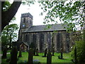
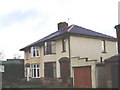
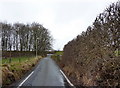
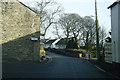
Photos of BB12 9EB
Area Information
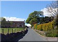
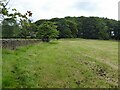
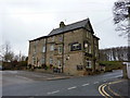
Living in BB12 9EB means inhabiting a compact, residential postcode area nestled in Old Laund Booth, Pendle, Lancashire. This small cluster spans 1.1 hectares and is home to 1,585 residents, creating a tightly knit community. The area’s proximity to Burnley, just 3 miles south, offers access to nearby services while maintaining a quieter, more localised character. Historically tied to the River Henburn and the Leeds and Liverpool Canal, the area reflects a blend of rural and small-town living. With a median age of 47 and a population skewed toward adults aged 30–64, BB12 9EB is a place where families and established residents coexist. The high rate of home ownership (82%) and prevalence of houses suggest a stable, long-term demographic. For those seeking a balance between tranquillity and connectivity, this area provides a base near rail links and local amenities, all within a small, defined footprint.
- Area Type
- Postcode
- Area Size
- 1.1 hectares
- Population
- 1585
- Population Density
- 396 people/km²
The property market in BB12 9EB is dominated by owner-occupied homes, with 82% of residents living in properties they own. The accommodation type is predominantly houses, which suggests a focus on family-friendly, standalone dwellings rather than flats or apartments. Given the area’s small size (1.1 hectares) and limited number of properties, the housing stock is likely to be tightly held, with limited new developments. This dynamic may make the market competitive for buyers, particularly those seeking a home in a stable, low-density environment. The high rate of home ownership indicates a community where residents have long-term investment in their properties, which can influence pricing and availability. For prospective buyers, the immediate surroundings may offer similar housing profiles, though the small area size means the selection is confined to a specific cluster of homes.
House Prices in BB12 9EB
Showing 32 properties
| Address | Type | Beds | Baths | Last Sale Price | Last Sale Date | |
|---|---|---|---|---|---|---|
| 499 Wheatley Lane Road, Fence, BB12 9EB | house | - | - | £208,000 | Oct 2025 | |
| 479 Wheatley Lane Road, Fence, BB12 9EB | Terraced | 4 | 1 | £200,000 | Jul 2025 | |
| 473 Wheatley Lane Road, Fence, BB12 9EB | Terraced | 3 | 2 | £241,500 | Jan 2025 | |
| 481 Wheatley Lane Road, Fence, BB12 9EB | Terraced | 3 | 2 | £205,000 | Aug 2024 | |
| 501 Wheatley Lane Road, Fence, BB12 9EB | house | - | - | £400,000 | Aug 2024 | |
| 475 Wheatley Lane Road, Fence, BB12 9EB | Terraced | 3 | 1 | £222,500 | Apr 2023 | |
| 485 Wheatley Lane Road, Fence, BB12 9EB | Semi-detached | 3 | 1 | £259,950 | Feb 2023 | |
| 503 Wheatley Lane Road, Fence, BB12 9EB | Semi-detached | 3 | 2 | £257,500 | Mar 2022 | |
| 489 Wheatley Lane Road, Fence, BB12 9EB | house | - | - | £248,000 | Oct 2021 | |
| 497 Wheatley Lane Road, Fence, BB12 9EB | Semi-detached | 3 | 2 | £235,000 | May 2021 |
Energy Efficiency in BB12 9EB
The lifestyle in BB12 9EB is shaped by its small size and proximity to essential amenities. Within walking or short driving distance are five retail outlets, including Morrisons Daily, Asda Hollin, and Spar Nelson, offering grocery and convenience shopping. The area’s rail network, with stations such as Brierfield and Burnley Central, provides easy access to urban centres, enhancing both social and economic opportunities. While the data does not specify parks or leisure facilities, the historical context of the area near the Leeds and Liverpool Canal hints at potential recreational spaces. The presence of two primary schools and a mature community suggests a focus on family life, with amenities tailored to local needs. The compact nature of BB12 9EB means residents can access daily essentials without lengthy commutes, contributing to a convenient, self-contained lifestyle.
Amenities
Schools
Residents of BB12 9EB have access to two primary schools: Wheatley Lane Methodist Voluntary Aided Primary School and Wheatley Lane Methodist Primary School. Both institutions cater to younger children, providing essential early education within the area. While no Ofsted ratings are specified, the presence of two primary schools suggests a focus on localised education, reducing the need for long commutes. For families, this proximity to schools is a practical advantage, allowing children to attend nearby institutions without relying on transport links. The dual availability of primary schools may also indicate a capacity to accommodate local demand, though the absence of secondary schools or further education facilities means residents may need to travel for higher-level education. This mix of school types supports a community where primary education is prioritised, aligning with the area’s demographic profile of adults and families.
| Rank | School | Type | Entry gender | Ages |
|---|
Explore more schools in this area
Go to Schools tabDemographics
The community in BB12 9EB is predominantly composed of adults aged 30–64, with a median age of 47. This suggests a mature population, likely with established careers and family ties. Home ownership is high at 82%, indicating a strong presence of long-term residents rather than transient renters. The area is characterised by houses, which are the primary accommodation type, reflecting a traditional, suburban layout. The predominant ethnic group is White, which aligns with broader trends in the region. The population density of 396 people per square kilometre is moderate, balancing space and proximity. While no specific data on deprivation is provided, the high home ownership and stable age profile imply a community with relatively consistent access to resources and services. This demographic structure supports a steady local economy and infrastructure tailored to the needs of families and older adults.
Household Size
Accommodation Type
Tenure
Ethnic Group
Religion
Household Composition
Age
Household Deprivation
NS-SEC
Explore more demographic insights in this area
Go to Demographics tabPlanning
Planning Constraints
- Flood RiskPremium
- Ramsar Wetland SitesPremium
- Area of Outstanding Natural BeautyPremium
- Protected Nature ReservePremium
- Protected WoodlandPremium