Area Overview for BB12 9DS
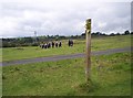
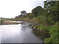
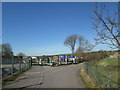
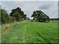
Photos of BB12 9DS
Area Information
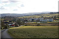
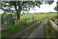
Living in BB12 9DS means being part of a small, tightly knit residential cluster in Lancashire’s Pendle district. The area spans 17.4 hectares and is home to 1,534 people, with a population density of 367 people per square kilometre. Historically tied to the cotton industry and canal networks, it sits near Burnley, 2 miles south of Reedley Hallows, a civil parish marked by 19th-century detached homes and terraced housing. The median age of 47 suggests a mature, stable community, with a strong presence of adults aged 30–64. Residents benefit from proximity to Burnley’s amenities, including railway stations and retail outlets, while the area retains a quiet, residential character. The local economy has evolved from textile mills to mixed-use developments, such as the regeneration of Brierfield Mill. With no major planning constraints or environmental risks, BB12 9DS offers a blend of historical charm and practical modern living, ideal for those seeking a balance between small-town tranquillity and accessible urban connectivity.
- Area Type
- Postcode
- Area Size
- 17.4 hectares
- Population
- 1534
- Population Density
- 367 people/km²
The property market in BB12 9DS is dominated by owner-occupied homes, with 79% of residents living in detached houses. This contrasts with nearby Brierfield, where higher-density terraced housing is more common. The area’s housing stock reflects its historical roots in the cotton industry, with large 19th-century properties built for professionals and industrialists. These homes, such as Reedley Hall and The Oaks, suggest a market skewed towards established buyers seeking spacious, characterful residences. The limited area size means the housing stock is relatively small, with few new developments. However, regeneration projects like Brierfield Mill’s transformation into mixed-use spaces offer potential for future growth. For buyers, this means a focus on existing properties rather than speculative investment, with prices likely influenced by the area’s historical appeal and proximity to Burnley’s amenities.
House Prices in BB12 9DS
Showing 6 properties
| Address | Type | Beds | Baths | Last Sale Price | Last Sale Date | |
|---|---|---|---|---|---|---|
| Wood End Barn Farm, Woodend Road, Reedley, Burnley, BB12 9DS | Semi-detached | 9 | 3 | - | - | |
| Wood End Barn, 2 Woodend Road, Reedley, Burnley, BB12 9DS | Semi-detached | - | - | - | - | |
| Wood End Barn, 1 Woodend Road, Reedley, Burnley, BB12 9DS | Semi-detached | - | - | - | - | |
| Wood End Farm, Woodend Road, Reedley, Burnley, BB12 9DS | house | - | - | - | - | |
| Wood End Cottage, Woodend Road, Reedley, Burnley, BB12 9DS | house | - | - | - | - | |
| Caravan 1 Adjacent Woodend Farm, Woodend Road, Reedley, Burnley, BB12 9DS | Mobile Home | - | - | - | - |
Energy Efficiency in BB12 9DS
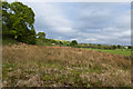
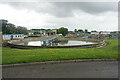
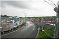
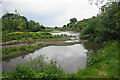
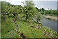
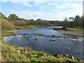
Daily life in BB12 9DS is shaped by its proximity to practical amenities. Within walking distance are retail outlets like Morrisons Daily, Lidl Browhead, and Iceland Burnley, offering essential shopping. The area’s railway stations, including Brierfield and Burnley Central, provide easy access to public transport. For leisure, the Leeds and Liverpool Canal and Pendle Water offer scenic routes for walking, cycling, and boating. Historic sites such as Grade II-listed Brierfield Mill and Reedley Hall add cultural depth, while nearby Brierfield hosts community hubs and shops. The blend of small-town convenience and historical charm creates a lifestyle that balances practicality with a touch of heritage. Residents benefit from a quiet, residential environment without sacrificing access to urban amenities, making it appealing for families and professionals alike.
Amenities
Schools
| Rank | School | Type | Entry gender | Ages |
|---|
Explore more schools in this area
Go to Schools tabDemographics
The community in BB12 9DS is predominantly composed of adults aged 30–64, with a median age of 47. Home ownership is high, at 79%, reflecting a stable, long-term resident base. The area is characterised by detached houses, a type of accommodation that aligns with the presence of large 19th-century properties built for industrialists and professionals. The predominant ethnic group is Asian_total, contributing to a culturally diverse yet cohesive neighbourhood. The population density of 367 people per square kilometre suggests a compact, residential layout without the pressures of overcrowding. While no specific deprivation data is provided, the high home ownership rate and mature age profile indicate a community with established economic stability. This demographic profile shapes a lifestyle centred on family-oriented living, with a focus on long-term residency and community continuity.
Household Size
Accommodation Type
Tenure
Ethnic Group
Religion
Household Composition
Age
Household Deprivation
NS-SEC
Explore more demographic insights in this area
Go to Demographics tabPlanning
Planning Constraints
- Flood RiskPremium
- Ramsar Wetland SitesPremium
- Area of Outstanding Natural BeautyPremium
- Protected Nature ReservePremium
- Protected WoodlandPremium