Area Overview for BB12 8UH
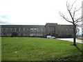
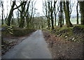
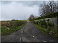
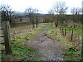
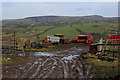
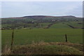
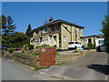
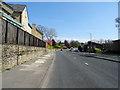
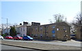
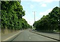
Photos of BB12 8UH
Area Information
Living in BB12 8UH means being part of a small, tightly knit residential cluster in the heart of Burnley, Lancashire. With a population of 1,345 spread over 6,687 square metres, the area has a population density of 484 people per square kilometre, reflecting a compact, community-focused environment. Historically, Ightenhill — the civil parish encompassing this postcode — has roots in medieval land grants and 12th-century manorial estates, though today it is defined by its modern residential character. The area’s proximity to Burnley’s urban core offers easy access to services, while its smaller footprint ensures a quieter, more intimate living experience. Daily life here balances convenience with a sense of place, with local amenities and transport links serving a population largely composed of middle-aged homeowners. The absence of major environmental constraints or planning restrictions makes BB12 8UH an attractive option for those seeking a stable, low-risk residential area without sacrificing proximity to essential services.
- Area Type
- Postcode
- Area Size
- 6687 m²
- Population
- 1345
- Population Density
- 484 people/km²
The property market in BB12 8UH is overwhelmingly owner-occupied, with 94% of homes owned by their residents. This high rate of home ownership points to a stable, long-term demographic, with few properties available for rent. The accommodation type is predominantly houses, which are typically larger and more private than flats, catering to families or individuals seeking space. Given the area’s small size — just 6,687 square metres — the housing stock is limited, meaning buyers must consider the immediate surroundings for additional options. The focus on owner-occupied properties suggests a market where properties are likely to retain value, though the limited scale of the area may mean fewer choices for buyers. For those prioritising privacy and stability, BB12 8UH offers a clear advantage.
House Prices in BB12 8UH
Showing 7 properties
| Address | Type | Beds | Baths | Last Sale Price | Last Sale Date | |
|---|---|---|---|---|---|---|
| 2 Torver Close, Burnley, BB12 8UH | house | 4 | 3 | £400,000 | Jul 2022 | |
| 7 Torver Close, Burnley, BB12 8UH | house | 4 | - | £295,000 | Sep 2014 | |
| 4 Torver Close, Burnley, BB12 8UH | house | - | - | £310,000 | Jan 2011 | |
| 5 Torver Close, Burnley, BB12 8UH | Detached | - | - | £135,000 | Jun 2001 | |
| 1 Torver Close, Burnley, BB12 8UH | Detached | 3 | 2 | £100,000 | Dec 1997 | |
| 6 Torver Close, Burnley, BB12 8UH | Detached | 5 | 2 | - | - | |
| 3 Torver Close, Burnley, BB12 8UH | Detached | - | - | - | - |
Energy Efficiency in BB12 8UH
The lifestyle in BB12 8UH is shaped by its proximity to essential amenities, including five retail outlets such as Spar and Farmfoods Rosehill, which provide everyday shopping convenience. The area’s railway stations — Rose Grove, Burnley Barracks, and Burnley Central — offer easy access to urban centres, enhancing both commuting and leisure opportunities. While the data does not specify parks or leisure facilities, the historical Ightenhill Park, established in 1912, may offer recreational space nearby. The mix of retail and transport options ensures a practical, community-oriented lifestyle, where residents can meet daily needs without long journeys.
Amenities
Schools
The nearest school to BB12 8UH is St Joseph’s Park Hill School, an independent institution. Independent schools often provide tailored education with smaller class sizes and specialist facilities, though no Ofsted rating is provided in the data. The presence of a single independent school suggests that families in the area may prioritise private education, potentially reflecting the community’s demographic profile of established homeowners. While no state schools are listed, the proximity to Burnley’s urban centre may offer additional options within a short commute. For families seeking a specific educational environment, St Joseph’s Park Hill School is a key local resource.
| Rank | School | Type | Entry gender | Ages |
|---|
Explore more schools in this area
Go to Schools tabDemographics
The community in BB12 8UH is predominantly composed of adults aged 30–64, with a median age of 47. This suggests a mature, established population, likely with long-term ties to the area. Home ownership is exceptionally high at 94%, indicating a stable housing market with few rental properties. The accommodation type is primarily houses, reflecting a preference for standalone properties over flats or apartments. The predominant ethnic group is White, though no specific data on diversity or deprivation is provided. The population density of 484 people per square kilometre implies a moderately sized community, neither overly crowded nor sparse. For buyers, this profile suggests a neighbourhood with low turnover, where residents are likely to remain long-term, contributing to a consistent and familiar local environment.
Household Size
Accommodation Type
Tenure
Ethnic Group
Religion
Household Composition
Age
Household Deprivation
NS-SEC
Explore more demographic insights in this area
Go to Demographics tabPlanning
Planning Constraints
- Flood RiskPremium
- Ramsar Wetland SitesPremium
- Area of Outstanding Natural BeautyPremium
- Protected Nature ReservePremium
- Protected WoodlandPremium