Area Overview for BB12 8UE
Photos of BB12 8UE
Area Information
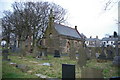
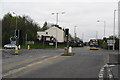
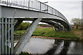
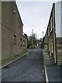
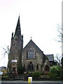
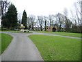
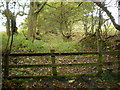
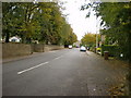
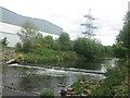
Living in BB12 8UE means being part of a compact, historic residential cluster in Lancashire’s Burnley Borough. This postcode covers 4.9 hectares, housing 1,266 people in a densely populated area with 722 residents per square kilometre. The area sits within Padiham, a small market town with Anglo-Saxon roots, now a conservation area preserving its 19th-century character. Residents benefit from proximity to the River Calder and Pendle Hill, blending rural tranquillity with accessible urban amenities. The town’s history as a market hub and industrial centre is evident in its listed buildings, including St Leonard’s Parish Church and Victoria Mill, now converted to flats. With a population skewed toward adults aged 30–64, BB12 8UE offers a stable, community-oriented environment. Its compact size means daily life is centred on local shops, rail links, and the town’s historic core, making it ideal for those seeking a balance between heritage and modern convenience.
- Area Type
- Postcode
- Area Size
- 4.9 hectares
- Population
- 1266
- Population Density
- 722 people/km²
The property market in BB12 8UE is characterised by a 64% home ownership rate, with houses being the primary accommodation type. This suggests a market skewed toward owner-occupied properties rather than rentals, reflecting the area’s historical development as a residential hub. The compact size of the postcode—just 4.9 hectares—means the housing stock is limited, with no indication of new builds or significant expansion. Buyers should consider the proximity to local amenities and transport networks when evaluating properties, as the area’s small footprint means homes are likely to be in close proximity to shops, schools, and rail stations. The lack of flats or commercial properties indicates a focus on traditional family homes, though the absence of data on property prices or recent sales means potential buyers must rely on local agents for up-to-date market insights.
House Prices in BB12 8UE
Showing 2 properties
| Address | Type | Beds | Baths | Last Sale Price | Last Sale Date | |
|---|---|---|---|---|---|---|
| 94 Blackburn Road, Padiham, BB12 8UE | Semi-detached | 4 | 1 | £240,000 | Aug 2017 | |
| 96 Blackburn Road, Padiham, BB12 8UE | Industrial | - | - | - | - |
Energy Efficiency in BB12 8UE
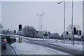
Residents of BB12 8UE have access to five retail venues within practical reach, including Lidl Padiham, Tesco Padiham, and Spar, ensuring everyday shopping needs are met locally. The area’s rail network, with five nearby stations, connects to broader transport routes, enhancing mobility for work, leisure, and travel. While the data does not specify parks or leisure facilities, Padiham’s historic conservation area and proximity to the River Calder suggest opportunities for outdoor activities. The presence of local shops and multiple rail stations contributes to a convenient, self-contained lifestyle, reducing the need for long commutes. The town’s heritage, including listed buildings and former industrial sites, adds cultural depth to daily life, blending practical amenities with historical character.
Amenities
Schools
The nearest school to BB12 8UE is Padiham St Leonard’s Voluntary Aided Church of England Primary School, a primary institution with an Ofsted rating of satisfactory. This school serves the local community, offering education for younger children, but no secondary schools are listed in the data. Families with children requiring secondary education would need to look beyond the immediate area, potentially commuting to nearby towns like Burnley or Clitheroe. The presence of a primary school with a satisfactory rating indicates a functional educational provision for younger students, though the lack of higher-level schooling may be a consideration for those planning long-term residency. Parents should verify the school’s performance against current Ofsted reports and assess the practicality of accessing secondary education elsewhere.
| Rank | School | Type | Entry gender | Ages |
|---|
Explore more schools in this area
Go to Schools tabDemographics
The community in BB12 8UE is predominantly middle-aged, with a median age of 47 and 64% of residents owning their homes. The majority of households are adults aged 30–64, reflecting a mature, established population. Accommodation is largely houses, with no data indicating flats or other formats. The predominant ethnic group is White, though specific diversity metrics are not provided. The high population density of 722 people per square kilometre suggests a close-knit community, though the area’s small size means limited space for expansion. This demographic profile indicates a stable, long-term resident base, with homeownership rates suggesting a focus on family homes rather than transient rental properties. The absence of detailed deprivation data means quality of life factors like access to services and infrastructure must be inferred from the available amenities and transport links.
Household Size
Accommodation Type
Tenure
Ethnic Group
Religion
Household Composition
Age
Household Deprivation
NS-SEC
Explore more demographic insights in this area
Go to Demographics tabPlanning
Planning Constraints
- Flood RiskPremium
- Ramsar Wetland SitesPremium
- Area of Outstanding Natural BeautyPremium
- Protected Nature ReservePremium
- Protected WoodlandPremium