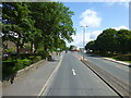
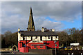
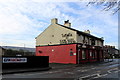
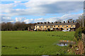
Area Overview for BB12 8SJ
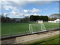
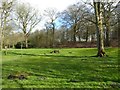
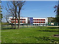
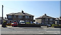
Photos of BB12 8SJ
Area Information
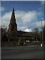
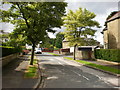
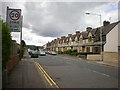
Living in BB12 8SJ means residing in a compact, densely populated area of 10.1 hectares in the Borough of Burnley, Lancashire. This postcode covers a small residential cluster with a population of 1,660 people, translating to a density of 16,507 people per square kilometre. The area’s history as a market town dates back to Anglo-Saxon times, with its centre designated a conservation area. Today, it retains a quiet, community-focused character, with homes predominantly occupied by owners (67%). The median age of 47 suggests a mature population, with adults aged 30–64 forming the largest demographic. Residents benefit from proximity to Padiham’s historic sites, including St Leonard’s Parish Church and the preserved Victoria Mill, now converted into flats. The area’s compact size means amenities are within practical reach, from local shops to rail stations. While the population has declined since its industrial peak, the town’s heritage and infrastructure remain intact, offering a blend of historical significance and modern convenience for those seeking a settled, low-density lifestyle.
- Area Type
- Postcode
- Area Size
- 10.1 hectares
- Population
- 1660
- Population Density
- 3132 people/km²
The property market in BB12 8SJ is characterised by high home ownership (67%) and a predominance of houses. This suggests a community where long-term residency is common, with fewer rental properties available. The compact size of the area (10.1 hectares) means housing stock is limited, potentially leading to competition for available homes. The conversion of historic sites like Victoria Mill into flats indicates a mix of traditional and modern housing types, though the data specifies only houses as the predominant accommodation. For buyers, this small area offers a blend of historical charm and practicality, with properties likely to be well-maintained given the conservation area status. However, the limited size may mean limited scope for new developments, making the market more static. Prospective buyers should consider the area’s density and the potential for limited expansion when evaluating long-term value.
House Prices in BB12 8SJ
Showing 38 properties
| Address | Type | Beds | Baths | Last Sale Price | Last Sale Date | |
|---|---|---|---|---|---|---|
| 184 Burnley Road, Padiham, BB12 8SJ | Terraced | 2 | 1 | £142,500 | Jul 2025 | |
| 150 Burnley Road, Padiham, BB12 8SJ | Terraced | 3 | 1 | £52,500 | May 2025 | |
| 168 Burnley Road, Padiham, BB12 8SJ | Terraced | 3 | 1 | £98,000 | Oct 2024 | |
| 192 Burnley Road, Padiham, BB12 8SJ | Terraced | 3 | 1 | £108,200 | Nov 2022 | |
| 126 Burnley Road, Padiham, BB12 8SJ | house | 5 | - | £60,000 | Mar 2022 | |
| 190 Burnley Road, Padiham, BB12 8SJ | Terraced | 3 | - | £77,000 | Oct 2021 | |
| 154 Burnley Road, Padiham, BB12 8SJ | Terraced | 3 | 1 | £79,950 | Oct 2020 | |
| 136 Burnley Road, Padiham, BB12 8SJ | Terraced | 3 | 1 | £88,000 | Jun 2020 | |
| 134 Burnley Road, Padiham, BB12 8SJ | Terraced | 2 | 1 | £92,500 | May 2019 | |
| 142 Burnley Road, Padiham, BB12 8SJ | Terraced | 2 | 1 | £73,000 | May 2018 |
Energy Efficiency in BB12 8SJ
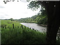
Daily life in BB12 8SJ is shaped by its compact size and proximity to essential amenities. The area’s retail offerings include five local shops, such as Tesco Padiham, Lidl Padiham, and Spar, providing convenience for grocery shopping. Rail stations like Rose Grove and Hapton offer access to broader transport networks, while the nearby Leeds and Liverpool Canal adds a recreational element. The town’s historic character is complemented by leisure opportunities, including visits to nearby Gawthorpe Hall, a National Trust site, and the conservation area’s listed buildings. The mix of retail, transport, and cultural sites creates a self-contained lifestyle, ideal for those valuing accessibility and historical context. While the area lacks large-scale commercial centres, its small-scale amenities foster a close-knit community feel, with services tailored to local needs.
Amenities
Schools
Residents of BB12 8SJ have access to a range of educational institutions, from nursery to secondary education. Whitegate Nursery School provides early years education, while Padiham Primary School (rated ‘good’ by Ofsted) serves younger children. Padiham Gawthorpe High School, also a primary school, and Shuttleworth College, which operates as both a primary school and an academy, offer broader educational pathways. The presence of multiple schools within the area ensures families have options for their children’s education, with a mix of traditional and academy-led institutions. This diversity may appeal to parents seeking different teaching approaches or curricula. The proximity of these schools to residential areas reduces commuting time, enhancing the area’s appeal for families. The ‘good’ rating at Padiham Primary School indicates a reliable standard of education, though no data is provided on secondary school performance.
| Rank | School | Type | Entry gender | Ages |
|---|
Explore more schools in this area
Go to Schools tabDemographics
The population of BB12 8SJ is 1,660, with a median age of 47. The most common age group is adults aged 30–64, reflecting a mature, stable community. Home ownership is high at 67%, indicating a strong presence of long-term residents. The area is predominantly occupied by houses, with no mention of flats or other accommodation types. The predominant ethnic group is White, though no further breakdown of diversity is provided. This demographic profile suggests a community focused on family living and stability, with fewer transient residents. The high home ownership rate implies lower rental activity, which may influence local property values and community cohesion. The absence of specific data on deprivation means the area’s quality of life is inferred from its infrastructure and amenities, which appear to meet basic needs. The age distribution and ownership figures suggest a population less reliant on public services and more invested in local continuity.
Household Size
Accommodation Type
Tenure
Ethnic Group
Religion
Household Composition
Age
Household Deprivation
NS-SEC
Explore more demographic insights in this area
Go to Demographics tabPlanning
Planning Constraints
- Flood RiskPremium
- Ramsar Wetland SitesPremium
- Area of Outstanding Natural BeautyPremium
- Protected Nature ReservePremium
- Protected WoodlandPremium