Area Overview for BB12 8SG
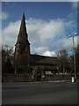
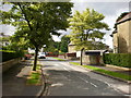
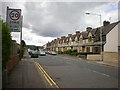
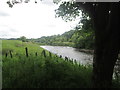
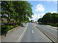
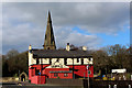
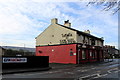
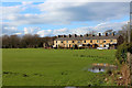
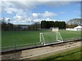
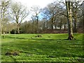
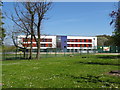
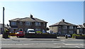
Photos of BB12 8SG
Area Information
BB12 8SG is a compact residential postcode nestled in the small market town of Padiham, Lancashire. This area covers just 6,455 square metres, yet it accommodates 1,660 residents, resulting in a remarkably high population density of 257,151 people per square kilometre. Padiham itself has a history stretching back to the Anglo-Saxon era, with its name derived from the homestead of Padda. Today, the town’s historic conservation area and proximity to the River Calder define its character. Daily life here is shaped by its small-town charm, with local amenities and a tight-knit community feel. The area is served by multiple railway stations, including Rose Grove and Hapton, linking residents to nearby Burnley and beyond. While the population is relatively modest, the density suggests a mix of long-standing residents and those drawn to the town’s historical and practical appeal. Living in BB12 8SG means navigating a compact, high-density environment with a focus on local infrastructure and community-centric living.
- Area Type
- Postcode
- Area Size
- 6455 m²
- Population
- 1660
- Population Density
- 3132 people/km²
The property market in BB12 8SG is characterised by a high rate of home ownership (67%) and a predominance of houses over flats. This suggests a community where long-term residency is common, with properties likely to be family homes rather than short-term rentals. Given the small area size and high population density, the housing stock is likely to be tightly packed, with limited scope for expansion. The presence of historic buildings, such as the Grade II-listed Padiham Town Hall and the converted Victoria Mill, adds to the area’s distinct architectural identity. For buyers, this means a market focused on existing properties rather than new developments. The compact nature of the area may limit availability, making it essential for buyers to consider nearby regions for alternative options. The mix of owner-occupied homes and the absence of significant rental demand indicates a stable, mature market with limited turnover.
House Prices in BB12 8SG
Showing 11 properties
| Address | Type | Beds | Baths | Last Sale Price | Last Sale Date | |
|---|---|---|---|---|---|---|
| 13 Kenilworth Close, Padiham, BB12 8SG | house | 3 | - | £163,000 | Mar 2012 | |
| 2 Kenilworth Close, Padiham, BB12 8SG | Detached | - | - | £63,000 | Aug 1998 | |
| 11 Kenilworth Close, Padiham, BB12 8SG | Detached | 4 | 2 | - | - | |
| 3 Kenilworth Close, Padiham, BB12 8SG | Detached | - | - | - | - | |
| 1 Kenilworth Close, Padiham, BB12 8SG | house | - | - | - | - | |
| 5 Kenilworth Close, Padiham, BB12 8SG | Detached | - | - | - | - | |
| 7 Kenilworth Close, Padiham, BB12 8SG | Detached | - | - | - | - | |
| 9 Kenilworth Close, Padiham, BB12 8SG | Detached | - | - | - | - | |
| 4 Kenilworth Close, Padiham, BB12 8SG | Detached | - | - | - | - | |
| 6 Kenilworth Close, Padiham, BB12 8SG | Detached | - | - | - | - |
Energy Efficiency in BB12 8SG
The lifestyle in BB12 8SG is shaped by its proximity to local amenities, including five retail outlets such as Tesco Padiham, Lidl Padiham, and Spar, which cater to everyday shopping needs. The presence of multiple railway stations within practical reach enhances mobility, connecting residents to broader networks. While the data does not specify dining or leisure venues, the town’s historical character suggests a blend of traditional and modern facilities. The area’s compact size means residents can access essential services without long commutes. The nearby River Calder and surrounding green spaces, though not explicitly detailed, may contribute to a balance between urban living and natural environments. The mix of retail, transport, and historical sites creates a lifestyle that prioritises convenience and community engagement, with a focus on local resources over distant attractions.
Amenities
Schools
Residents of BB12 8SG have access to a range of educational institutions, including Whitegate Nursery School, which provides early-years education. For primary education, Padiham Primary School holds an Ofsted rating of ‘good,’ indicating a reliable foundation for younger students. Padiham Gawthorpe High School and Shuttleworth College also serve the area, though the latter is listed as both a primary and academy school, suggesting a layered educational structure. The presence of multiple schools within a short distance offers families flexibility, with options spanning nursery to secondary education. The mix of school types ensures that parents can choose between traditional state schools and academies, which may offer specialised curricula or resources. This variety supports a comprehensive educational environment, though the specific quality of secondary education at Shuttleworth College remains unquantified by the data.
| Rank | School | Type | Entry gender | Ages |
|---|
Explore more schools in this area
Go to Schools tabDemographics
The population of BB12 8SG skews towards adults aged 30–64, with a median age of 47. This suggests a community rooted in established households rather than younger families or retirees. Home ownership is strong, with 67% of residents owning their homes, indicating a stable, long-term demographic. The area is predominantly composed of houses, not flats, which aligns with the higher proportion of owner-occupied properties. The predominant ethnic group is White, reflecting the broader demographic trends in the region. The high population density, combined with the age profile, implies a mix of working-age individuals and families. However, the absence of specific data on deprivation or income levels means the quality of life implications of this density remain unquantified. The demographic makeup supports a community focused on local amenities, with limited reliance on external services.
Household Size
Accommodation Type
Tenure
Ethnic Group
Religion
Household Composition
Age
Household Deprivation
NS-SEC
Explore more demographic insights in this area
Go to Demographics tabPlanning
Planning Constraints
- Flood RiskPremium
- Ramsar Wetland SitesPremium
- Area of Outstanding Natural BeautyPremium
- Protected Nature ReservePremium
- Protected WoodlandPremium