Area Overview for BB12 8RJ
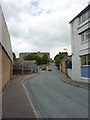
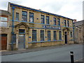
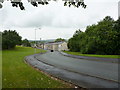
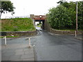
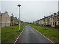
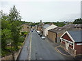
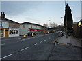
Photos of BB12 8RJ

Area Information
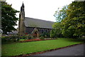
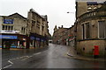
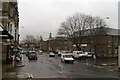
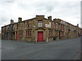
BB12 8RJ is a small, densely populated postcode area in Lancashire, nestled within the Borough of Burnley. With a population of 1,660 spread across 5,103 square metres, it is a compact residential cluster characterised by a high population density of 325,320 people per square kilometre. The area has historical roots as an Anglo-Saxon settlement, evolving into a market town centred around the River Calder. Today, it retains a conservation area status, reflecting its heritage as a place where tradition meets modern living. Residents here are predominantly adults aged 30–64, with a median age of 47. The community is largely home-owning, with 67% of properties in private hands. Daily life is shaped by proximity to local amenities, rail links, and a mix of historical and contemporary architecture, including Grade II-listed buildings and repurposed industrial sites like Victoria Mill. The area’s small size means it is tightly knit, with a focus on local connectivity and a balance between residential tranquillity and access to nearby services.
- Area Type
- Postcode
- Area Size
- 5103 m²
- Population
- 1660
- Population Density
- 3132 people/km²
The property market in BB12 8RJ is dominated by owner-occupied homes, with 67% of properties in private hands. The area’s housing stock is primarily composed of houses, reflecting a preference for detached or semi-detached residences over flats. Given the small area size of 5,103 square metres and a population of 1,660, the density is exceptionally high, which may limit availability and drive competition among buyers. The prevalence of houses suggests a market tailored to families and individuals seeking spacious, long-term homes. However, the compact nature of the area means that property choices are limited to the immediate vicinity, with little scope for expansion. Buyers should consider the potential for price volatility in such a constrained market, as well as the historical character of the area, which may influence property values and desirability.
House Prices in BB12 8RJ
Showing 42 properties
| Address | Type | Beds | Baths | Last Sale Price | Last Sale Date | |
|---|---|---|---|---|---|---|
| 49 Milton Street, Padiham, BB12 8RJ | house | 3 | 1 | £82,000 | Aug 2024 | |
| 53 Milton Street, Padiham, BB12 8RJ | house | 3 | 1 | £96,500 | Jul 2024 | |
| 39 Milton Street, Padiham, BB12 8RJ | Terraced | 2 | 2 | £107,000 | Jan 2023 | |
| 77 Milton Street, Padiham, BB12 8RJ | house | 3 | 1 | £115,000 | Sep 2022 | |
| 66 Milton Street, Padiham, BB12 8RJ | Terraced | 2 | 1 | £73,000 | Sep 2022 | |
| 70 Milton Street, Padiham, BB12 8RJ | house | - | - | £129,500 | Jan 2022 | |
| 52 Milton Street, Padiham, BB12 8RJ | house | - | - | £136,000 | Dec 2021 | |
| 63 Milton Street, Padiham, BB12 8RJ | Terraced | 3 | 1 | £105,000 | Nov 2021 | |
| 50 Milton Street, Padiham, BB12 8RJ | Terraced | 3 | 1 | £69,000 | Apr 2021 | |
| 75 Milton Street, Padiham, BB12 8RJ | house | - | - | £100,000 | Jan 2021 |
Energy Efficiency in BB12 8RJ
The lifestyle in BB12 8RJ is shaped by its small-town character and proximity to local amenities. Within practical reach are five retail venues, including Tesco Padiham, Lidl Padiham, and Spar, ensuring everyday shopping needs are met. Rail stations such as Hapton and Burnley Barracks provide access to regional transport networks, enhancing connectivity. The area’s historical and cultural assets, including St Leonard’s Parish Church and Padiham Town Hall, add to its charm, while nearby sites like Gawthorpe Hall offer leisure opportunities. The mix of retail, rail, and heritage sites creates a convenient, community-focused environment. Though compact, the area balances practicality with a sense of place, making it suitable for those who value accessibility without sacrificing a connection to local history and amenities.
Amenities
Schools
Residents of BB12 8RJ have access to a range of educational institutions, including Whitegate Nursery School, which provides early years education. For primary schooling, Padiham Primary School is rated ‘good’ by Ofsted, offering a solid foundation for younger children. Padiham Gawthorpe High School and Shuttleworth College cater to primary and secondary education, with the latter operating as both a primary school and an academy. This mix of nursery, primary, and academy schools ensures families have options from early education through to secondary levels. The presence of multiple schools within proximity supports a well-rounded educational environment, though parents may need to consider commuting distances for secondary schooling. The variety of school types reflects the area’s commitment to providing diverse learning opportunities for its residents.
| Rank | School | Type | Entry gender | Ages |
|---|
Explore more schools in this area
Go to Schools tabDemographics
The population of BB12 8RJ is predominantly adults aged 30–64, with a median age of 47. This suggests a mature, stable community with a strong presence of working-age residents. Home ownership is high, at 67%, indicating a preference for long-term residency over rental properties. The area is characterised by houses rather than flats, reflecting a more traditional housing stock. The predominant ethnic group is White, though specific diversity statistics are not provided. The high proportion of owner-occupied homes and the age profile suggest a community that values stability and established living. With a population density over 300,000 per square kilometre, the area is intensely populated, which may influence local dynamics and the availability of shared spaces. The demographic profile aligns with a town that has transitioned from industrial roots to a residential hub with a focus on local amenities and community cohesion.
Household Size
Accommodation Type
Tenure
Ethnic Group
Religion
Household Composition
Age
Household Deprivation
NS-SEC
Explore more demographic insights in this area
Go to Demographics tabPlanning
Planning Constraints
- Flood RiskPremium
- Ramsar Wetland SitesPremium
- Area of Outstanding Natural BeautyPremium
- Protected Nature ReservePremium
- Protected WoodlandPremium