Area Overview for BB12 8EY
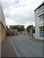
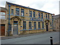
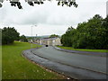
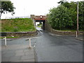
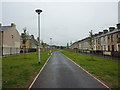
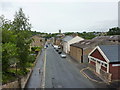
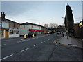
Photos of BB12 8EY

Area Information
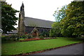
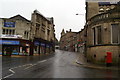
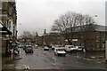
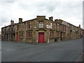
Living in BB12 8EY, part of the small market town of Padiham in Lancashire, offers a compact, tightly knit residential experience. With a population of 1,266 spread across a densely populated area of 722 people per square kilometre, the postcode reflects a small cluster of homes rather than a sprawling suburb. Padiham itself, the area’s historical heart, is a conservation area with roots in Anglo-Saxon settlements and 19th-century industrial growth. The town’s proximity to Burnley and Pendle Hill provides a blend of rural charm and accessible town amenities. Daily life here is shaped by its heritage: a functioning conservation area, historic churches, and remnants of cotton mills. The community, predominantly middle-aged and home-owning, benefits from strong rail links and proximity to the Leeds and Liverpool Canal. While the area lacks large commercial hubs, its small-scale character means neighbours are likely to be familiar faces, and local landmarks like St Leonard’s Parish Church and Victoria Mill add a sense of continuity.
- Area Type
- Postcode
- Area Size
- Not available
- Population
- 1266
- Population Density
- 722 people/km²
The property market in BB12 8EY is characterised by a high rate of home ownership (64%) and a focus on houses rather than flats or apartments. This suggests a market skewed towards owner-occupied properties, likely catering to families or individuals seeking long-term residency. The small size of the postcode area means the housing stock is limited, with homes concentrated in a tight cluster around Padiham’s conservation area. The prevalence of houses indicates a preference for single-family dwellings, which may appeal to buyers seeking more space or privacy. However, the limited number of properties in the area could make the market competitive for buyers, particularly for those seeking specific features like proximity to amenities or historical architecture. The area’s conservation status may also influence property values and planning restrictions, requiring buyers to consider potential limitations on modifications or extensions.
House Prices in BB12 8EY
No properties found in this postcode.
Energy Efficiency in BB12 8EY
Residents of BB12 8EY have access to a range of nearby amenities that support daily life. The retail sector includes notable stores such as Lidl Padiham, Tesco Padiham, and Spar, providing essential shopping options within walking or short driving distance. The rail network, with stations like Hapton and Huncoat, offers convenient links to surrounding areas, facilitating both commuting and leisure travel. While the data does not specify parks or recreational facilities, the area’s conservation status and proximity to historical sites like St Leonard’s Parish Church and Victoria Mill suggest a blend of cultural and natural attractions. The small-scale nature of the postcode means amenities are closely clustered, enhancing convenience for residents. However, those seeking larger leisure options may need to travel to nearby towns, balancing the area’s charm with practical considerations.
Amenities
Schools
The only school explicitly listed near BB12 8EY is Padiham St Leonard’s Voluntary Aided Church of England Primary School, which serves the local community with primary education. The school has an Ofsted rating of satisfactory, indicating it meets acceptable standards but may have areas for improvement. As the sole educational institution mentioned in the data, it suggests a limited range of school options for families, particularly for secondary education. Parents seeking a broader selection of schools may need to look beyond the immediate area, though the proximity to Padiham’s town centre could provide access to other local facilities. The presence of a primary school within the postcode highlights the area’s suitability for families with young children, though the lack of secondary school data means further research would be necessary for comprehensive planning.
| Rank | School | Type | Entry gender | Ages |
|---|
Explore more schools in this area
Go to Schools tabDemographics
The population of BB12 8EY has a median age of 47, with the majority of residents falling within the 30–64 age range. This suggests a mature, stable community with a focus on family life and long-term residency. Home ownership is high at 64%, indicating a strong presence of owner-occupied properties. The area is predominantly composed of houses rather than flats or apartments, which aligns with the residential cluster’s small-scale nature. The predominant ethnic group is White, though the data does not provide further breakdowns of diversity. The population density of 722 people per square kilometre implies a compact, closely packed settlement, which may influence the availability of private outdoor space. The demographic profile suggests a community that values stability, with fewer young families or transient populations compared to larger urban areas.
Household Size
Accommodation Type
Tenure
Ethnic Group
Religion
Household Composition
Age
Household Deprivation
NS-SEC
Explore more demographic insights in this area
Go to Demographics tabPlanning
Planning Constraints
- Flood RiskPremium
- Ramsar Wetland SitesPremium
- Area of Outstanding Natural BeautyPremium
- Protected Nature ReservePremium
- Protected WoodlandPremium