Area Overview for BB12 7SL
Photos of BB12 7SL

Area Information
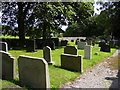
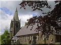
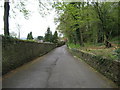
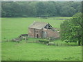
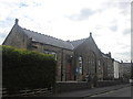
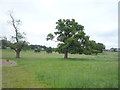
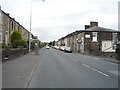
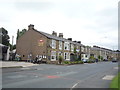
BB12 7SL is a small, residential postcode area in Simonstone, a civil parish in Ribble Valley, Lancashire. With a population of 1,417 and a density of 250 people per square kilometre, it is a compact village with a distinct character. The area is steeped in history, including ties to the Cockshutt family, who owned land here as early as 1562, and features 22 listed buildings, reflecting its heritage. Daily life here is defined by its rural setting and proximity to nearby towns. Residents benefit from a quiet, low-density environment, with easy access to local amenities and transport links. The area’s small size means a tight-knit community feel, where familiarity with neighbours is common. For those seeking a peaceful, historically rich location without sacrificing convenience, BB12 7SL offers a blend of tradition and practicality. Its position in North West England ensures it is part of a broader network of villages and towns, yet it retains its individuality. The presence of two well-regarded primary schools and a range of nearby shops and rail stations further enhances its appeal as a self-contained yet connected place to live.
- Area Type
- Postcode
- Area Size
- Not available
- Population
- 1417
- Population Density
- 250 people/km²
The property market in BB12 7SL is characterised by a high rate of home ownership (78%) and a predominance of houses as the primary accommodation type. This suggests a market where owner-occupation is the norm, rather than a rental-focused environment. The small size of the area means that housing stock is limited, which could create competition among buyers. The presence of houses rather than flats or apartments aligns with the rural nature of Simonstone, where larger properties are more common. For prospective buyers, this implies a focus on purchasing rather than renting, with properties likely to be family homes or long-term investments. The limited scale of the area also means that buyers should consider the surrounding regions for additional options. The high home ownership rate indicates a stable market, with properties likely to hold value due to their scarcity. However, the lack of commercial or mixed-use developments may restrict opportunities for alternative property types.
House Prices in BB12 7SL
No properties found in this postcode.
Energy Efficiency in BB12 7SL
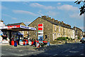
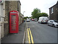
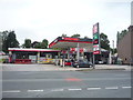
The lifestyle in BB12 7SL is shaped by its proximity to practical amenities, including five retail venues such as Spar, Lidl Padiham, and Tesco Padiham. These shops provide everyday essentials, reducing the need for long trips to larger centres. The area’s rail stations—Hapton, Huncoat, and Whalley—offer easy access to nearby towns, enhancing connectivity for shopping, leisure, and work. While the village itself is small, its surrounding areas provide a range of facilities, from local markets to cultural events in nearby towns. The presence of two primary schools and a low crime risk contributes to a family-friendly environment. The rural setting allows for outdoor activities, though specific parks or recreational spaces are not detailed in the data. Overall, BB12 7SL offers a balance of convenience and tranquillity, with amenities that support both daily needs and occasional excursions.
Amenities
Schools
Residents of BB12 7SL have access to two primary schools, both rated 'good' by Ofsted. These are Read St John’s CofE Primary School and Simonstone St Peter’s Church of England Primary School. Both institutions serve the local community, offering education for younger children in a setting that combines academic standards with a focus on spiritual and social development. The presence of two primary schools within the area ensures that families have options, though the small population of the postcode means that each school may have a relatively small pupil base. The 'good' Ofsted ratings suggest that both schools meet or exceed national standards in teaching quality and student outcomes. For families prioritising early education, the availability of two schools reduces the need to travel to nearby towns. The schools’ church affiliations may also appeal to those seeking an educational environment aligned with religious values.
| Rank | School | Type | Entry gender | Ages |
|---|
Explore more schools in this area
Go to Schools tabDemographics
The population of BB12 7SL has a median age of 47, with the majority of residents falling in the 30-64 age range. This suggests a mature, stable community with a focus on family life and long-term residency. Home ownership is high, at 78%, indicating a strong preference for property investment over renting. The accommodation type is predominantly houses, which aligns with the area’s rural character and the prevalence of single-family homes. The predominant ethnic group is White, reflecting the broader demographic trends in the region. While specific data on deprivation is not provided, the high home ownership rate and low crime risk suggest a relatively affluent and secure environment. The age profile implies a community with established careers and families, contributing to a steady local economy. The absence of significant demographic diversity may appeal to those seeking a homogeneous, familiar social landscape. Overall, BB12 7SL is a place where long-term residents form the majority, with a focus on stability and continuity.
Household Size
Accommodation Type
Tenure
Ethnic Group
Religion
Household Composition
Age
Household Deprivation
NS-SEC
Explore more demographic insights in this area
Go to Demographics tabPlanning
Planning Constraints
- Flood RiskPremium
- Ramsar Wetland SitesPremium
- Area of Outstanding Natural BeautyPremium
- Protected Nature ReservePremium
- Protected WoodlandPremium