Area Overview for BB12 7RT
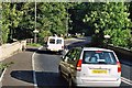
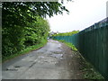
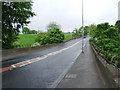
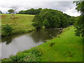
Photos of BB12 7RT
Area Information
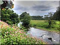
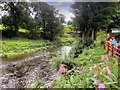
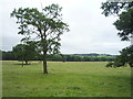
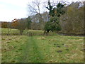
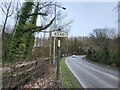
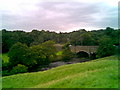
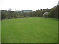
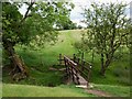
Living in BB12 7RT means being part of a small, tightly knit residential cluster in Lancashire’s Ribble Valley district. The area covers 39.3 hectares and is home to 1,237 residents, creating a quiet, low-density environment. Historically, this civil parish developed along the A671 road, a route that connected medieval Whalley and Padiham. Today, it retains a rural charm with stone-built homes, small businesses, and a focus on local heritage. The village is surrounded by natural beauty, including Pendle Hill and the Trough of Bowland, offering walking opportunities. Nearby, attractions like Clitheroe’s Norman castle and Gawthorpe Hall provide cultural and historical interest. With a population skewed toward adults aged 30–64 and a high rate of home ownership, BB12 7RT suits those seeking a stable, community-oriented lifestyle with easy access to nature and regional amenities.
- Area Type
- Postcode
- Area Size
- 39.3 hectares
- Population
- 1237
- Population Density
- 249 people/km²
The property market in BB12 7RT is dominated by owner-occupied homes, with 93% of properties owned outright. This high rate of home ownership points to a community that values long-term investment and stability. The accommodation type is exclusively houses, which is unusual for a small postcode area but reflects the village’s traditional, low-density development. The limited size of the area—just 39.3 hectares—means property options are constrained, though the surrounding region offers more choices. Buyers should expect a focus on single-family homes, often with historical or architectural character. The high home ownership rate also implies a competitive market, where properties may retain value due to limited supply. For those seeking a quiet, family-oriented environment, BB12 7RT’s housing stock offers a blend of practicality and heritage.
House Prices in BB12 7RT
Showing 3 properties
| Address | Type | Beds | Baths | Last Sale Price | Last Sale Date | |
|---|---|---|---|---|---|---|
| The Nurseries, Old Coal Staithe, Read, BB12 7RT | house | 3 | 1 | £379,950 | Aug 2022 | |
| Old Coal Staithe House, Old Coal Staithe, Read, BB12 7RT | house | 4 | 2 | £340,000 | Nov 2019 | |
| Cock Bridge Garage, Old Coal Staithe, Read, BB12 7RT | Industrial | - | - | - | - |
Energy Efficiency in BB12 7RT
Life in BB12 7RT is defined by proximity to small businesses, local shops, and natural spaces. Within practical reach are five retail outlets, including Spar, Tesco Blackburn, and Aldi Great, ensuring everyday needs are met without long journeys. The village’s historic character is complemented by nearby attractions such as Read Hall, St John Evangelist church, and the Trough of Bowland’s walking trails. Residents can enjoy picnics in Spring Wood or explore Whalley Abbey, a 13th-century monastic site. The area’s low density and small businesses foster a community feel, with stone-built homes and shops contributing to its distinct identity. While the village lacks large-scale entertainment, its location near Clitheroe and Pendle Hill offers broader cultural and recreational opportunities. The balance of local convenience and natural beauty makes BB12 7RT appealing to those seeking a relaxed, self-sufficient lifestyle.
Amenities
Schools
| Rank | School | Type | Entry gender | Ages |
|---|
Explore more schools in this area
Go to Schools tabDemographics
The community in BB12 7RT is predominantly composed of adults aged 30–64, with a median age of 47. This suggests a mature, established population, likely with long-term ties to the area. Home ownership is exceptionally high at 93%, indicating a strong sense of permanence and investment in property. The accommodation type is primarily houses, reflecting a traditional, residential character. The predominant ethnic group is White, though no specific data on diversity is provided. With a population density of 249 people per square kilometre, the area balances residential comfort with a sense of space. The high home ownership rate and age profile suggest a community focused on stability, with fewer transient residents. This demographic profile aligns with the area’s historical roots and its appeal to those prioritising a settled, low-traffic lifestyle.
Household Size
Accommodation Type
Tenure
Ethnic Group
Religion
Household Composition
Age
Household Deprivation
NS-SEC
Explore more demographic insights in this area
Go to Demographics tabPlanning
Planning Constraints
- Flood RiskPremium
- Ramsar Wetland SitesPremium
- Area of Outstanding Natural BeautyPremium
- Protected Nature ReservePremium
- Protected WoodlandPremium