Area Overview for BB12 7NF
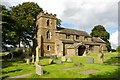
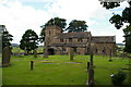
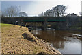
Photos of BB12 7NF
Area Information
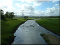
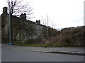
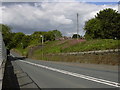
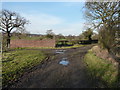
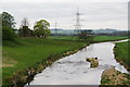
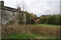
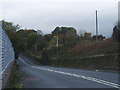
Living in BB12 7NF means settling in a small, residential cluster in the Ribble Valley, Lancashire, with a population of 1,417. The area’s compact size and low density of 250 people per square kilometre suggest a quiet, close-knit community. Historically tied to the Cockshutt family and local landowners, the village retains a rural character with 22 listed buildings and connections to Gawthorpe Hall. Daily life here is shaped by proximity to primary schools, rail stations, and nearby towns. The area’s appeal lies in its balance of historical heritage and practical amenities, making it suitable for those seeking a tranquil yet connected lifestyle. With a median age of 47 and a strong home ownership rate, BB12 7NF is a stable, family-oriented postcode where residents often prioritise local schools and community ties over urban conveniences. Its small size means neighbours are likely to know one another, and the absence of major environmental constraints ensures a straightforward living experience.
- Area Type
- Postcode
- Area Size
- Not available
- Population
- 1417
- Population Density
- 250 people/km²
The property market in BB12 7NF is characterised by a high home ownership rate of 78%, indicating a strong presence of owner-occupied homes. The accommodation type is predominantly houses, which is typical for small rural postcodes where larger properties are more common than flats or apartments. This suggests a market skewed towards families and individuals seeking spacious, private living. Given the area’s small size, the housing stock is likely limited, with limited scope for new developments. Buyers should consider the proximity to nearby towns and the reliance on rail connectivity, as the area itself offers few commercial or industrial properties. The lack of rental data means the market may be less active for tenants, though the high home ownership rate implies a steady demand for residential properties. For those considering purchase, the focus would be on long-term value and the appeal of a low-maintenance, rural lifestyle.
House Prices in BB12 7NF
No properties found in this postcode.
Energy Efficiency in BB12 7NF
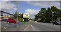
The lifestyle in BB12 7NF is shaped by its proximity to essential amenities within practical reach. Residents can access five retail venues, including Spar, Lidl Padiham, and Tesco Padiham, ensuring everyday shopping needs are met without long journeys. The rail network connects to five stations, offering links to nearby towns and enabling access to broader services. While the area lacks large parks or leisure facilities, its small size and historical character provide a quiet, low-stress environment. The presence of two primary schools and a strong community focus suggests a family-oriented lifestyle. The absence of major commercial or entertainment hubs means residents may need to travel for dining or nightlife, but the area’s charm lies in its simplicity and ease of access to nearby towns. This balance of practicality and tranquillity makes BB12 7NF appealing to those prioritising convenience over urban vibrancy.
Amenities
Schools
Residents of BB12 7NF have access to two primary schools: Read St John’s CofE Primary School and Simonstone St Peter’s Church of England Primary School. Both institutions hold a good Ofsted rating, reflecting a commitment to quality education. The presence of two primary schools within the area ensures that families with young children have multiple options for schooling, reducing the need for long commutes. The schools’ church-affiliated status may appeal to those seeking a specific educational ethos. Given the area’s median age and high home ownership rate, these schools are likely central to the community’s identity. The good ratings suggest reliable teaching standards and facilities, which are critical for families prioritising education when choosing a place to live. For prospective buyers, proximity to these schools is a key consideration, as it enhances the area’s appeal to households with children.
| Rank | School | Type | Entry gender | Ages |
|---|
Explore more schools in this area
Go to Schools tabDemographics
The community in BB12 7NF is predominantly composed of adults aged 30–64, with a median age of 47. Home ownership is high at 78%, reflecting a settled population that values long-term residency. The accommodation type is largely houses, indicating a mix of family homes and single-occupancy properties. The predominant ethnic group is White, though no specific data on diversity or deprivation is provided. The age profile suggests a mature demographic, which may influence local services and amenities. For instance, the presence of two primary schools with good Ofsted ratings aligns with the needs of families with school-age children. The low population density and high home ownership rate imply a stable, low-turnover community where residents are likely to have established roots. This demographic profile supports a quiet, family-friendly environment with limited pressure on local infrastructure.
Household Size
Accommodation Type
Tenure
Ethnic Group
Religion
Household Composition
Age
Household Deprivation
NS-SEC
Explore more demographic insights in this area
Go to Demographics tabPlanning
Planning Constraints
- Flood RiskPremium
- Ramsar Wetland SitesPremium
- Area of Outstanding Natural BeautyPremium
- Protected Nature ReservePremium
- Protected WoodlandPremium