Area Overview for BB12 7EB
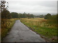
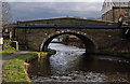
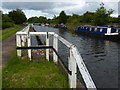
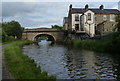
Photos of BB12 7EB
Area Information
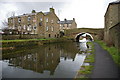
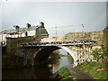
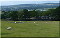
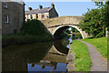
Living in BB12 7EB means being part of a tightly knit, historically rich community in Padiham, a small market town in Lancashire. The postcode covers 8,520 square metres, housing 1,679 residents in a dense, residential cluster. Padiham itself is a civil parish with Anglo-Saxon roots, once a thriving hub for trade and industry. Its conservation area preserves historic architecture, including St Leonard’s Parish Church and the Grade II-listed Padiham Town Hall. The area’s compact size fosters a close-knit atmosphere, with daily life shaped by local amenities and proximity to Burnley. With a median age of 47 and a population density of 197,073 people per square kilometre, the community is predominantly middle-aged, with a strong presence of homeowners. The mix of historical and modern elements, from 19th-century cotton mills to contemporary retail, creates a unique character for those seeking a blend of tradition and convenience.
- Area Type
- Postcode
- Area Size
- 8520 m²
- Population
- 1679
- Population Density
- 2925 people/km²
The property market in BB12 7EB is characterised by a 47% home ownership rate, with houses forming the majority of accommodation types. This suggests a mix of owner-occupied and rental properties, though the data does not specify the proportion of rentals. The small area’s limited size means housing stock is concentrated, with limited scope for expansion. Historic buildings, such as the converted Victoria Mill flats, add architectural diversity. For buyers, the area’s compact nature may mean competition for properties, particularly given its proximity to Burnley and the presence of conservation areas. The high population density also implies that properties are likely to be smaller or part of multi-unit developments. Those seeking homes here should consider the balance between historical charm and practicality, as well as the potential for limited availability in a constrained geographical footprint.
House Prices in BB12 7EB
Showing 28 properties
| Address | Type | Beds | Baths | Last Sale Price | Last Sale Date | |
|---|---|---|---|---|---|---|
| 3 Bedford Place, Padiham, BB12 7EB | house | - | - | £71,200 | Jun 2021 | |
| 2 Bedford Place, Padiham, BB12 7EB | Semi-detached | 3 | 1 | £77,500 | Nov 2019 | |
| 13 Bedford Place, Padiham, BB12 7EB | Terraced | 3 | - | £60,000 | Oct 2019 | |
| 8 Bedford Place, Padiham, BB12 7EB | house | - | - | £70,000 | Aug 2007 | |
| 1 Bedford Place, Padiham, BB12 7EB | Terraced | 3 | - | - | - | |
| 16 Bedford Place, Padiham, BB12 7EB | house | - | - | - | - | |
| 4 Bedford Place, Padiham, BB12 7EB | house | - | - | - | - | |
| 24 Bedford Place, Padiham, BB12 7EB | house | - | - | - | - | |
| 12 Bedford Place, Padiham, BB12 7EB | house | - | - | - | - | |
| 5 Bedford Place, Padiham, BB12 7EB | house | - | - | - | - |
Energy Efficiency in BB12 7EB
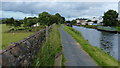
Residents of BB12 7EB enjoy a range of amenities within practical reach, including five retail outlets such as Tesco Padiham, Lidl Padiham, and Spar, ensuring everyday shopping needs are met. The area’s historical and cultural assets, like the conservation area and St Leonard’s Parish Church, contribute to a distinct local character. Nearby leisure opportunities include the River Calder and proximity to Gawthorpe Hall, a National Trust site. The compact size of the postcode means amenities are closely clustered, fostering convenience. However, the absence of detailed data on dining or parks means the full extent of recreational options remains unclear. The blend of retail, rail access, and historic sites creates a lifestyle that balances practicality with a sense of place, ideal for those valuing both modern comforts and heritage.
Amenities
Schools
Residents of BB12 7EB have access to two primary schools: Padiham Green Church of England Primary School, which holds an Ofsted rating of satisfactory, and St John the Baptist Roman Catholic Primary School, Padiham, rated good. Both institutions cater to younger children, providing a range of educational options for families. The presence of a Church of England and a Roman Catholic school reflects the area’s religious diversity and offers parents the choice between state and faith-based education. However, no secondary schools are listed in the data, meaning students may need to travel to nearby towns for further education. The quality of primary education, particularly the good rating at St John the Baptist, is a positive factor for families prioritising school standards.
| Rank | School | Type | Entry gender | Ages |
|---|
Explore more schools in this area
Go to Schools tabDemographics
The population of BB12 7EB is 1,679, with a median age of 47, indicating a mature demographic. The most common age range is adults aged 30–64, suggesting a stable, working-age population. Home ownership rates stand at 47%, with houses being the primary accommodation type. The predominant ethnic group is White, reflecting the area’s historical and cultural continuity. The high population density of 197,073 people per square kilometre means the area is intensely populated for its small size, which can influence local services and infrastructure. While no specific deprivation data is provided, the demographic profile suggests a community with established routines and a focus on residential stability. The absence of detailed diversity metrics means the area’s social composition remains largely homogenous, with no explicit data on minority populations or socioeconomic variation.
Household Size
Accommodation Type
Tenure
Ethnic Group
Religion
Household Composition
Age
Household Deprivation
NS-SEC
Explore more demographic insights in this area
Go to Demographics tabPlanning
Planning Constraints
- Flood RiskPremium
- Ramsar Wetland SitesPremium
- Area of Outstanding Natural BeautyPremium
- Protected Nature ReservePremium
- Protected WoodlandPremium