Area Overview for BB12 7AB
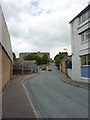
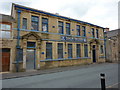
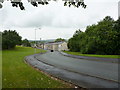
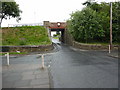
Photos of BB12 7AB

Area Information
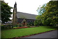
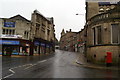
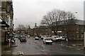
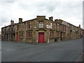
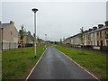
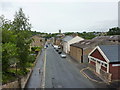
BB12 7AB is a small, densely populated postcode area in Lancashire, part of the historic market town of Padiham. Nestled near the River Calder and within reach of Pendle Hill, it occupies just 453 m² yet hosts 1,623 residents, making it one of the most densely populated areas in England. The area’s character is shaped by its Anglo-Saxon origins and 19th-century industrial legacy, with remnants like Victoria Mill—now converted to flats—and St Leonard’s Parish Church, a Grade II listed building. Daily life here is rooted in the town’s compact layout, with proximity to Burnley and nearby transport links. While the population is predominantly White and skewed toward adults aged 30–64, the area’s small size means residents often know their neighbours. The high population density, however, reflects a mix of long-standing communities and newer developments, creating a dynamic but tightly knit environment. For buyers, BB12 7AB offers a blend of historic charm and practical living, though its size means every home is part of a closely connected cluster.
- Area Type
- Postcode
- Area Size
- 453 m²
- Population
- 1623
- Population Density
- 4332 people/km²
BB12 7AB’s property market is defined by its small size and high population density. With 43% of homes owner-occupied, the area is not dominated by rental properties, though the exact rental market share is unclear. The accommodation type is predominantly houses, which is unusual for a densely populated postcode but may reflect a mix of older, larger homes and newer developments. Given the area’s compact nature, properties are likely to be closely spaced, with limited scope for expansion. For buyers, this means a focus on existing homes rather than new builds, with potential for character properties given Padiham’s conservation area status. The high density also means competition for available properties, particularly for those seeking family homes. Proximity to rail stations like Hapton and Huncoat may appeal to commuters, while the historic character of the town could attract buyers seeking a blend of tradition and practicality. However, the small area size means buyers must consider the immediate surroundings for additional housing options.
House Prices in BB12 7AB
Showing 2 properties
| Address | Type | Beds | Baths | Last Sale Price | Last Sale Date | |
|---|---|---|---|---|---|---|
| 1 Livesey Street, Padiham, BB12 7AB | Retail | - | - | - | - | |
| Riverside Gym, 5 Livesey Street, Padiham, BB12 7AB | assembly_leisure | - | - | - | - |
Energy Efficiency in BB12 7AB
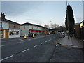
Living in BB12 7AB means access to essential retail and transport hubs within practical reach. The area’s five retail outlets include major names like Tesco Padiham, Lidl Padiham, and Spar, providing everyday shopping convenience. For transport, five railway stations—Hapton, Rose Grove, Huncoat, and others—offer regular services to Burnley and surrounding areas, making commuting straightforward. While the area lacks detailed data on dining or leisure options, its historic market town roots suggest a mix of local amenities. Padiham’s conservation area status implies preserved green spaces and architectural heritage, though specific parks or recreational facilities are not named in the data. The compact layout ensures amenities are within walking or short driving distance, supporting a convenient, community-focused lifestyle. For residents, the blend of retail, rail access, and historic character creates a practical yet rooted environment, ideal for those valuing proximity to services and a small-town atmosphere.
Amenities
Schools
| Rank | School | Type | Entry gender | Ages |
|---|
Explore more schools in this area
Go to Schools tabDemographics
The population of BB12 7AB is 1,623, with a median age of 47 and a majority of residents aged 30–64. This suggests a community skewed toward middle-aged adults, likely including professionals, retirees, and families. Home ownership stands at 43%, indicating a mix of owner-occupied properties and rental stock, though the exact proportion of renters is not specified. The area’s accommodation is predominantly houses, which may reflect a preference for single-family homes in a small town setting. The predominant ethnic group is White, with no data on other demographics provided. The high population density—3.58 million people per km²—suggests a compact, possibly multi-generational living pattern. While this density can foster community interaction, it also raises questions about housing availability and pressure on local infrastructure. The age profile implies a stable, experienced population, but the lack of younger residents may impact long-term demographic trends.
Household Size
Accommodation Type
Tenure
Ethnic Group
Religion
Household Composition
Age
Household Deprivation
NS-SEC
Explore more demographic insights in this area
Go to Demographics tabPlanning
Planning Constraints
- Flood RiskPremium
- Ramsar Wetland SitesPremium
- Area of Outstanding Natural BeautyPremium
- Protected Nature ReservePremium
- Protected WoodlandPremium