Area Overview for BB12 6WY
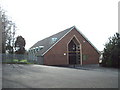
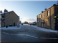
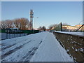
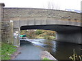
Photos of BB12 6WY
Area Information
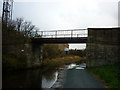
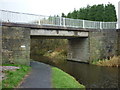
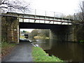
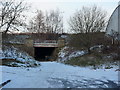
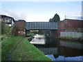
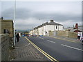
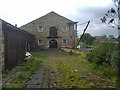
Living in BB12 6WY means being part of a compact, residential cluster within the Borough of Burnley, Lancashire. With a population of 1,729, this area blends historical character with practical modernity. The ward includes parts of Rosegrove with Lowerhouse, a district rooted in the manor of Ightenhill. Notable landmarks like Empire Mill and Imperial Mill on Liverpool Road reflect the area’s industrial past, now repurposed for retail, offices, and housing. Daily life here is shaped by proximity to rail networks and local amenities. The community is defined by its mature demographic, with a median age of 47, suggesting a stable, established population. While small in size, BB12 6WY offers a quiet, low-traffic environment with easy access to Burnley’s broader infrastructure. Homeownership is high at 78%, indicating long-term residency and a sense of permanence. For buyers, this area appeals to those seeking a balance between historical charm and contemporary convenience, with minimal environmental constraints and a reputation for safety.
- Area Type
- Postcode
- Area Size
- Not available
- Population
- 1729
- Population Density
- Not available
The property market in BB12 6WY is dominated by owner-occupied homes, with 78% of properties owned by residents rather than rented. This high homeownership rate suggests a stable, long-term community with limited turnover. The accommodation type is primarily houses, which is uncommon in urban areas but typical of smaller, semi-rural postcode clusters. This housing stock may appeal to buyers seeking larger living spaces or those prioritising property value retention. The small size of the area means the market is tightly focused, with limited scope for new developments. For buyers, this presents both opportunities and challenges: while the existing stock is likely well-maintained, the lack of rental properties may limit investment options. The prevalence of houses also means properties are likely to be family-friendly, with gardens and private outdoor space.
House Prices in BB12 6WY
No properties found in this postcode.
Energy Efficiency in BB12 6WY
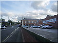
Daily life in BB12 6WY is shaped by its proximity to retail and transport hubs. Local shops include Spar and Farmfoods Rosehill, providing essential groceries and convenience. The Rawtenstall metro station adds regional connectivity, while rail links to Rose Grove and Hapton stations offer regular services to Burnley. Historically, the area is linked to industrial sites like Empire Mill and Imperial Mill, now repurposed as retail and office spaces. These sites contribute to a mix of modern and heritage character. While the area lacks large parks or leisure facilities, its small size means residents can access Burnley’s amenities within short distances. The retail options and transport links create a practical, low-maintenance lifestyle, ideal for those prioritising convenience over sprawling leisure options.
Amenities
Schools
| Rank | School | Type | Entry gender | Ages |
|---|
Explore more schools in this area
Go to Schools tabDemographics
The population of BB12 6WY is 1,729, with a median age of 47, placing it firmly in the adult demographic (30–64 years). This suggests a community of middle-aged residents, likely with established careers and family ties. Homeownership is high at 78%, reflecting a preference for long-term residency over rental properties. The predominant accommodation type is houses, which aligns with the area’s residential character and may cater to families or those seeking more space. The predominant ethnic group is White, though no specific diversity statistics are provided. The age profile indicates a mature population, which may influence local services and amenities. With no data on deprivation levels, the focus remains on the area’s stability and low turnover. This demographic profile suggests a community that values continuity, with residents likely invested in local institutions and infrastructure.
Household Size
Accommodation Type
Tenure
Ethnic Group
Religion
Household Composition
Age
Household Deprivation
NS-SEC
Explore more demographic insights in this area
Go to Demographics tabPlanning
Planning Constraints
- Flood RiskPremium
- Ramsar Wetland SitesPremium
- Area of Outstanding Natural BeautyPremium
- Protected Nature ReservePremium
- Protected WoodlandPremium