Area Overview for BB12 6RG
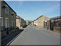
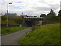
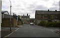
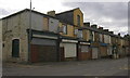
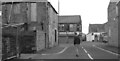
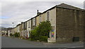
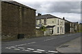
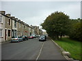
Photos of BB12 6RG
Area Information
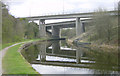
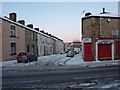
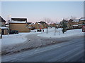
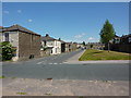
Living in BB12 6RG means residing in a compact residential cluster within the Borough of Burnley, Lancashire. The area covers 7,409 square metres and is home to 1,435 people, making it a densely populated postcode with a population density of 193,684 people per square kilometre. This small area is part of the Gannow Ward, historically shaped by the Leeds and Liverpool Canal, which once served as a key transport route for industrial activity. Today, the area is characterised by its proximity to Burnley town centre and the M65 motorway, which separates it from northern districts. BB12 6RG is a quiet, residential neighbourhood with a focus on local amenities and community hubs like the Gannow Community Centre. Its compact size means residents are close to essential services, while the surrounding areas offer a mix of industrial legacy and modern housing developments. The area’s population, predominantly adults aged 30–64, reflects a mature community with a strong sense of local identity.
- Area Type
- Postcode
- Area Size
- 7409 m²
- Population
- 1435
- Population Density
- 5688 people/km²
The property market in BB12 6RG is characterised by a 46% home ownership rate, indicating a balance between owner-occupied and rental properties. The area is predominantly composed of houses, which suggests a focus on family homes and semi-detached or terraced housing typical of smaller towns in Lancashire. Given the small size of the postcode and the high population density, the housing stock is likely to be tightly packed, with limited scope for new developments. The presence of Gannow Business Park, which repurposes Victorian cotton mills, hints at a mix of residential and commercial land use. For buyers, this means a market skewed towards existing properties rather than new builds. The compact nature of the area means that proximity to transport links, such as the M65 motorway and nearby railway stations, is a key selling point. However, the limited space also means that property choices are constrained, with potential buyers needing to consider the immediate surroundings for additional options.
House Prices in BB12 6RG
Showing 39 properties
| Address | Type | Beds | Baths | Last Sale Price | Last Sale Date | |
|---|---|---|---|---|---|---|
| 29 Oak Street, Burnley, BB12 6RG | Terraced | 2 | 1 | £63,000 | Sep 2025 | |
| 4 Oak Street, Burnley, BB12 6RG | Terraced | 2 | 1 | £57,000 | Jun 2025 | |
| 1 Oak Street, Burnley, BB12 6RG | Terraced | 2 | 1 | £68,000 | Jan 2025 | |
| 8 Oak Street, Burnley, BB12 6RG | Terraced | 2 | 1 | £64,950 | Jun 2024 | |
| 21 Oak Street, Burnley, BB12 6RG | Terraced | 2 | 1 | £60,000 | Mar 2023 | |
| 2 Oak Street, Burnley, BB12 6RG | Terraced | 2 | 1 | £74,000 | Jun 2022 | |
| 9 Oak Street, Burnley, BB12 6RG | Terraced | 2 | 1 | £55,000 | May 2022 | |
| 36 Oak Street, Burnley, BB12 6RG | Terraced | 2 | 1 | £50,000 | May 2022 | |
| 6 Oak Street, Burnley, BB12 6RG | Terraced | 2 | 1 | £60,000 | Apr 2022 | |
| 25 Oak Street, Burnley, BB12 6RG | Terraced | 2 | 1 | £73,000 | Feb 2022 |
Energy Efficiency in BB12 6RG
The lifestyle in BB12 6RG is shaped by its proximity to essential amenities and community hubs. Residents have access to five retail outlets, including Farmfoods Rosehill and Spar, offering everyday shopping and convenience. The area’s rail network, with five nearby stations, facilitates easy travel to Burnley and surrounding areas. While parks and green spaces are not explicitly mentioned in the data, the historical presence of the Leeds and Liverpool Canal suggests potential for recreational walks or water-based activities. The Gannow Community Centre, acquired in 2017, serves as a local focal point for social and cultural activities. The compact nature of the area means that daily life is centred around local interactions, with amenities within walking distance. This blend of retail, transport, and community facilities creates a self-contained environment that supports both practical needs and a sense of local identity.
Amenities
Schools
Residents of BB12 6RG have access to two primary educational institutions within practical reach. The Ightenhill Nursery School provides early years education, while Burnley Ightenhill Primary School offers primary-level education and holds a Good Ofsted rating. These schools cater to the needs of young families in the area, with the primary school’s rating indicating a satisfactory standard of education. The absence of secondary schools in the immediate vicinity suggests that students may need to travel to nearby towns for further education. The mix of nursery and primary schools reflects a community-focused approach to education, with local provision for younger children. However, the lack of secondary schooling within the postcode means that families should consider the availability of transport links or nearby towns when planning for long-term educational needs.
| Rank | School | Type | Entry gender | Ages |
|---|
Explore more schools in this area
Go to Schools tabDemographics
The demographic profile of BB12 6RG is defined by a median age of 47, with the majority of residents falling within the 30–64 age range. Home ownership stands at 46%, indicating a mix of owner-occupied and rented properties. The predominant accommodation type is houses, reflecting a traditional residential layout. The area’s population is predominantly White, with no specific data provided on other ethnic groups. The high population density of 193,684 people per square kilometre suggests a compact, closely knit community. While no explicit data on deprivation is provided, the high population density and age profile suggest a stable, long-term resident base. The absence of significant planning constraints or protected natural areas implies that the area prioritises residential living over conservation. This demographic structure supports a community-oriented lifestyle, with local amenities and transport links catering to the needs of a mature, established population.
Household Size
Accommodation Type
Tenure
Ethnic Group
Religion
Household Composition
Age
Household Deprivation
NS-SEC
Explore more demographic insights in this area
Go to Demographics tabPlanning
Planning Constraints
- Flood RiskPremium
- Ramsar Wetland SitesPremium
- Area of Outstanding Natural BeautyPremium
- Protected Nature ReservePremium
- Protected WoodlandPremium