Area Overview for BB12 0QZ
Photos of BB12 0QZ
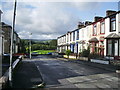
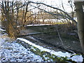
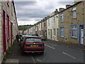
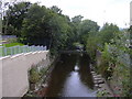
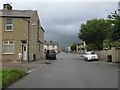
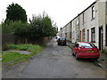
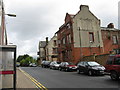
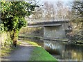
92 photos from this area
Area Information
Key information about the BB12 0QZ including its size, population, and administrative classification.
- Area Type
- Postcode
- Area Size
- 9.7 hectares
- Population
- 1690
- Population Density
- 2298 people/km²
House Prices in BB12 0QZ
24
Properties
£69,507
Average Sold Price
£15,000
Lowest Price
£118,000
Highest Price
Showing 24 properties
| Address | Type | Beds | Baths | Last Sale Price | Last Sale Date | |
|---|---|---|---|---|---|---|
| 24 Clifton Street, Burnley, BB12 0QZ | Semi-detached | 2 | 1 | £110,000 | May 2025 | |
| 14 Clifton Street, Burnley, BB12 0QZ | Terraced | 2 | 1 | £115,000 | Feb 2025 | |
| 32 Clifton Street, Burnley, BB12 0QZ | Terraced | 3 | 1 | £58,000 | Mar 2024 | |
| 49 Clifton Street, Burnley, BB12 0QZ | house | - | - | £45,000 | Jul 2023 | |
| 30 Clifton Street, Burnley, BB12 0QZ | house | - | - | £38,500 | Nov 2022 | |
| 53 Clifton Street, Burnley, BB12 0QZ | house | - | - | £55,000 | Feb 2022 | |
| 20 Clifton Street, Burnley, BB12 0QZ | house | 3 | - | £118,000 | Dec 2021 | |
| 18 Clifton Street, Burnley, BB12 0QZ | Land | - | - | £116,000 | Jun 2021 | |
| 37 Clifton Street, Burnley, BB12 0QZ | Terraced | 3 | 1 | £80,000 | May 2021 | |
| 51 Clifton Street, Burnley, BB12 0QZ | Terraced | 2 | 1 | £55,750 | May 2021 |
Page 1 of 3
Energy Efficiency in BB12 0QZ
Amenities
Schools
| Rank | School | Type | Entry gender | Ages |
|---|
Explore more schools in this area
Go to Schools tabDemographics
Household Size
One person
most common
Accommodation Type
Houses
most common
Tenure
40
majority
Ethnic Group
White
most common
Religion
N/A
most common
Household Composition
N/A
most common
Age
47
median
Adults (30-64 years)
most common
Household Deprivation
N/A
with no deprivation
NS-SEC
19
in Lower managerial occupations
Explore more demographic insights in this area
Go to Demographics tabPlanning
Planning Constraints
- Flood RiskPremium
- Ramsar Wetland SitesPremium
- Area of Outstanding Natural BeautyPremium
- Protected Nature ReservePremium
- Protected WoodlandPremium