Area Overview for BB12 0NL
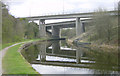
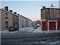
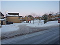
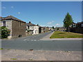
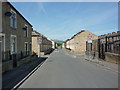
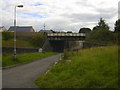
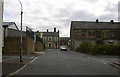
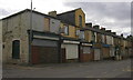
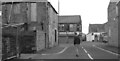
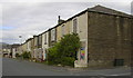
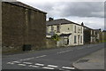
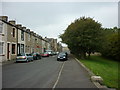
Photos of BB12 0NL
Area Information
You are looking at postcode BB12 0NL, a small residential cluster situated within the Whittlefield with Ightenhill Ward of Burnley, Lancashire. This specific area covers exactly 2601 m² and holds a resident population of 1841 people. Despite its modest footprint, the location connects to the historic significance of Ightenhill, a place first mentioned in a 1238 charter. The modern boundaries incorporate parts of the former extra-parochial Ightenhill Park and extend into Burnley's urban fringe near coordinates 53.797681, -2.257596. Daily life here involves navigating a space defined by Gawthorpe Hall and the River Calder, areas that once supported quarrying activities. While the civil parish originated as Ightenhill Park in 1866, the current landscape reflects developments across several centuries of ownership by families such as the Towneleys and Shuttleworths. Living in BB12 0NL means residing in a neighbourhood that bridges historic estates with suburban expansion, offering a distinct blend of established character and modern housing constraints.
- Area Type
- Postcode
- Area Size
- 2601 m²
- Population
- 1841
- Population Density
- 4564 people/km²
The property market in BB12 0NL is characterised by a strong foundation of owner-occupied housing. With 59% of residents owning their homes, the area functions primarily as an established residential zone rather than a centre for private renting. The predominant accommodation type is houses, which aligns with the survey data showing houses as the main housing style. This means you are likely to encounter a stock of larger properties suited to the demographic of adults aged 30 to 64 years. The small size of the area, at just 2601 m², indicates that this postcode represents a micro-market where specific clusters of houses define local demand. Buyers looking at homes in BB12 0NL should anticipate a landscape where property values may be stable due to the high rate of owner occupancy. The market reflects a lack of rental density, focusing instead on permanent residents investing in properties that suit their need for space and stability in a historic ward of Burnley.
House Prices in BB12 0NL
Showing 21 properties
| Address | Type | Beds | Baths | Last Sale Price | Last Sale Date | |
|---|---|---|---|---|---|---|
| 19 Cairo Street, Burnley, BB12 0NL | Terraced | 2 | 1 | £60,000 | Apr 2025 | |
| 5 Cairo Street, Burnley, BB12 0NL | house | 2 | 1 | £56,500 | Nov 2022 | |
| 6 Cairo Street, Burnley, BB12 0NL | Terraced | 2 | 1 | £50,750 | Nov 2021 | |
| 24 Cairo Street, Burnley, BB12 0NL | Terraced | 2 | 1 | £50,000 | Aug 2021 | |
| 20 Cairo Street, Burnley, BB12 0NL | Terraced | 2 | 1 | £49,995 | Aug 2019 | |
| 12 Cairo Street, Burnley, BB12 0NL | house | - | - | £40,000 | May 2019 | |
| 14 Cairo Street, Burnley, BB12 0NL | Terraced | - | - | £20,000 | Feb 2018 | |
| 10 Cairo Street, Burnley, BB12 0NL | Terraced | 2 | 1 | £38,500 | Nov 2017 | |
| 13 Cairo Street, Burnley, BB12 0NL | house | - | - | £32,000 | May 2016 | |
| 17 Cairo Street, Burnley, BB12 0NL | house | - | - | £42,000 | Sep 2014 |
Energy Efficiency in BB12 0NL
Your daily routine in BB12 0NL benefits from proximity to practical amenities within practical reach of residents. You have five railway stations nearby, including Burnley Barracks Railway Station, Burnley Central Railway Station, and Burnley Manchester Road Railway Station, placing you close to regional transport links. Retail options are equally accessible, with four shops located nearby including Farmfoods Rosehill, Spar, and Aldi Burnley. Living in BB12 0NL provides convenient access to these essential services without requiring extensive travel to town centres. The area is part of the Whittlefield with Ightenhill Ward, which historically included parts of Ightenhill Park and extends near Gawthorpe Hall. While natural beauty sites like AONBs are not present here, the character of the ward includes features like the River Calder and listed buildings in the local ward. The combination of rail access and immediate retail establishments creates a functional suburb where you can manage household needs efficiently while enjoying the quiet atmosphere of a residential cluster.
Amenities
Schools
| Rank | School | Type | Entry gender | Ages |
|---|
Explore more schools in this area
Go to Schools tabDemographics
The community in BB12 0NL is defined by older residents and significant stability. The median age stands at 47 years, confirming that Adults between 30 and 64 years constitute the most common age range. You will find that 59% of the population own their homes, indicating a settled cohort rather than a transient rental market. The area is populated largely by people of White ethnicity, reflecting the broader demographics of Lancashire. Houses dominate the accommodation type within this zone, suggesting a preference for detached or semi-detached properties over flats. You can expect a neighbourhood where long-term ownership is the norm, with a relatively narrow age spread centred on middle age. This demographic profile suggests a community less focused on young families seeking starter flats and more concerned with established households managing larger houses. The high home ownership figure aligns with the specific architecture found here, where houses form the primary housing stock rather than multi-unit blocks.
Household Size
Accommodation Type
Tenure
Ethnic Group
Religion
Household Composition
Age
Household Deprivation
NS-SEC
Explore more demographic insights in this area
Go to Demographics tabPlanning
Planning Constraints
- Flood RiskPremium
- Ramsar Wetland SitesPremium
- Area of Outstanding Natural BeautyPremium
- Protected Nature ReservePremium
- Protected WoodlandPremium