Area Overview for BB12 0HZ
Photos of BB12 0HZ
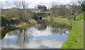
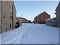
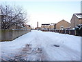
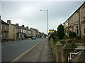
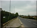
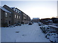
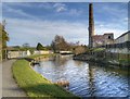
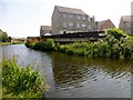
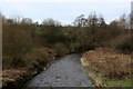
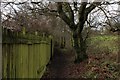
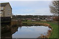
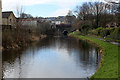
38 photos from this area
Area Information
Key information about the BB12 0HZ including its size, population, and administrative classification.
- Area Type
- Postcode
- Area Size
- 9366 m²
- Population
- 1392
- Population Density
- 765 people/km²
House Prices in BB12 0HZ
21
Properties
£133,071
Average Sold Price
£400
Lowest Price
£215,000
Highest Price
Showing 21 properties
| Address | Type | Beds | Baths | Last Sale Price | Last Sale Date | |
|---|---|---|---|---|---|---|
| 76 Wellfield Drive, Burnley, BB12 0HZ | Detached | 5 | 1 | £185,000 | Jan 2025 | |
| 66 Wellfield Drive, Burnley, BB12 0HZ | Detached | 3 | 1 | £215,000 | Jul 2023 | |
| 35 Wellfield Drive, Burnley, BB12 0HZ | Semi-detached | - | - | £400 | Jun 2023 | |
| 33 Wellfield Drive, Burnley, BB12 0HZ | Bungalow | 2 | 1 | £137,500 | Oct 2019 | |
| 49 Wellfield Drive, Burnley, BB12 0HZ | Bungalow | 2 | 1 | £150,000 | Aug 2018 | |
| 45 Wellfield Drive, Burnley, BB12 0HZ | Bungalow | 3 | - | £130,000 | Oct 2015 | |
| 80 Wellfield Drive, Burnley, BB12 0HZ | Detached | 4 | - | £175,000 | Jun 2015 | |
| 78 Wellfield Drive, Burnley, BB12 0HZ | Detached | 4 | - | £156,500 | Jan 2014 | |
| 82 Wellfield Drive, Burnley, BB12 0HZ | Detached | 4 | 1 | £172,500 | Apr 2008 | |
| 74 Wellfield Drive, Burnley, BB12 0HZ | Detached | - | - | £120,000 | Oct 2004 |
Page 1 of 3
Energy Efficiency in BB12 0HZ
Amenities
Schools
| Rank | School | Type | Entry gender | Ages |
|---|
Explore more schools in this area
Go to Schools tabDemographics
Household Size
Two person
most common
Accommodation Type
Houses
most common
Tenure
92
majority
Ethnic Group
White
most common
Religion
N/A
most common
Household Composition
N/A
most common
Age
47
median
Adults (30-64 years)
most common
Household Deprivation
N/A
with no deprivation
NS-SEC
38
in Lower managerial occupations
Explore more demographic insights in this area
Go to Demographics tabPlanning
Planning Constraints
- Flood RiskPremium
- Ramsar Wetland SitesPremium
- Area of Outstanding Natural BeautyPremium
- Protected Nature ReservePremium
- Protected WoodlandPremium