Area Overview for BB12 0EH
Photos of BB12 0EH
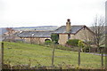
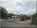
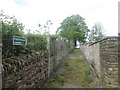

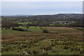
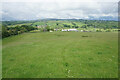
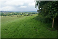
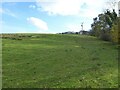
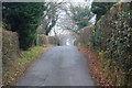
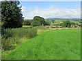
10 photos from this area
Area Information
Key information about the BB12 0EH including its size, population, and administrative classification.
- Area Type
- Postcode
- Area Size
- 8.1 hectares
- Population
- 1392
- Population Density
- 765 people/km²
House Prices in BB12 0EH
52
Properties
£130,234
Average Sold Price
£39,950
Lowest Price
£277,000
Highest Price
Showing 52 properties
| Address | Type | Beds | Baths | Last Sale Price | Last Sale Date | |
|---|---|---|---|---|---|---|
| 12 Foxcroft, Burnley, BB12 0EH | Detached | 3 | 2 | £220,500 | Oct 2025 | |
| 41 Foxcroft, Burnley, BB12 0EH | Bungalow | 2 | 1 | £249,000 | Aug 2025 | |
| 48 Foxcroft, Burnley, BB12 0EH | Terraced | 3 | 1 | £175,000 | Jun 2025 | |
| 56 Foxcroft, Burnley, BB12 0EH | Semi-detached | 2 | 1 | £168,000 | Mar 2025 | |
| 17 Foxcroft, Burnley, BB12 0EH | Detached | 4 | 2 | £277,000 | May 2024 | |
| 58 Foxcroft, Burnley, BB12 0EH | Semi-detached | 2 | 1 | £154,000 | May 2024 | |
| 9 Foxcroft, Burnley, BB12 0EH | Detached | 3 | 1 | £198,000 | Mar 2024 | |
| 54 Foxcroft, Burnley, BB12 0EH | Semi-detached | 2 | 1 | £160,000 | Nov 2023 | |
| 28 Foxcroft, Burnley, BB12 0EH | Retail | 3 | 1 | £190,000 | Dec 2022 | |
| 33 Foxcroft, Burnley, BB12 0EH | Terraced | 2 | 2 | £130,000 | Feb 2022 |
Page 1 of 6
Energy Efficiency in BB12 0EH
Amenities
Schools
| Rank | School | Type | Entry gender | Ages |
|---|
Explore more schools in this area
Go to Schools tabDemographics
Household Size
Two person
most common
Accommodation Type
Houses
most common
Tenure
92
majority
Ethnic Group
White
most common
Religion
N/A
most common
Household Composition
N/A
most common
Age
47
median
Adults (30-64 years)
most common
Household Deprivation
N/A
with no deprivation
NS-SEC
38
in Lower managerial occupations
Explore more demographic insights in this area
Go to Demographics tabPlanning
Planning Constraints
- Flood RiskPremium
- Ramsar Wetland SitesPremium
- Area of Outstanding Natural BeautyPremium
- Protected Nature ReservePremium
- Protected WoodlandPremium