Area Overview for BB12 0AN
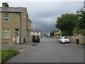
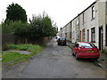
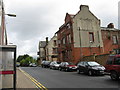
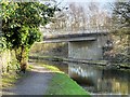
Photos of BB12 0AN
Area Information
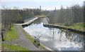
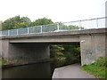
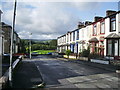
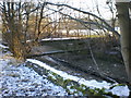
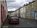
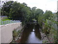
BB12 0AN is a small residential postcode cluster in Burnley, Lancashire, home to 2,054 people. Nestled north of Burnley town centre, it is defined by pre-1919 terraced housing, former factories, and mills, shaped by 19th-century industrial expansion. The area is bounded by the M65 motorway to the west and the Leeds and Liverpool Canal to the east, with nearby rail stations offering connections to Manchester and beyond. Daily life here is shaped by its compact urban layout and proximity to Burnley’s core. The community is predominantly Asian British, with 90.85% identifying as Asian, and 80% Muslim according to 2021 census data. This demographic influence is evident in local amenities and cultural landmarks, such as the under-construction Shah Jalal Mosque. While the area’s history as a working-class district persists, its modern character blends historical architecture with contemporary needs. Residents benefit from nearby retail, transport, and educational facilities, though challenges like high deprivation rates and crime risk remain. BB12 0AN is a place where industrial heritage meets present-day practicality, offering a distinct, tightly knit environment for those seeking affordability and proximity to Burnley’s amenities.
- Area Type
- Postcode
- Area Size
- Not available
- Population
- 2054
- Population Density
- 2800 people/km²
The property market in BB12 0AN is characterised by low home ownership, with only 27% of residents owning their homes. This suggests a rental market dominates, likely driven by the area’s affordability and proximity to Burnley’s job opportunities. The accommodation type is predominantly houses, though the exact mix of terraced, semi-detached, or detached properties is not specified. Given the area’s history of pre-1919 terraced housing, it is probable that many properties are older, multi-unit homes. For buyers, this means limited availability of owner-occupied properties, with a focus on rental investments. The small size of the postcode area and its immediate surroundings may restrict property choice, though proximity to Burnley’s transport links and amenities could offset this. Potential buyers should consider the area’s high deprivation and crime risk, which may affect property values and long-term investment appeal. The market reflects a balance between historical housing stock and modern demand, but its constraints require careful evaluation.
House Prices in BB12 0AN
No properties found in this postcode.
Energy Efficiency in BB12 0AN
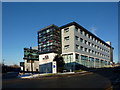
Residents of BB12 0AN have access to essential retail and transport hubs within walking or short driving distance. Nearby stores include Aldi Burnley, Iceland Burnley, and Asda Burnley, providing everyday shopping convenience. The area’s proximity to Burnley’s town centre and surrounding districts ensures a range of dining, leisure, and service options. While specific parks or green spaces are not listed in the data, the historical presence of the River Calder in Stoneyholme and the Leeds and Liverpool Canal may offer informal recreational opportunities. The local football club, Daneshouse FC, adds to the community’s social fabric. The mix of retail, transport, and cultural amenities supports a practical lifestyle, though the area’s compact nature means residents must travel slightly further for specialist services. The presence of multiple railway stations and major roads enhances mobility, making it easier to access Burnley’s broader offerings.
Amenities
Schools
Residents of BB12 0AN have access to two key educational institutions. Burnley St Peter’s Church of England Primary School, rated ‘good’ by Ofsted, provides primary education for young children, ensuring a solid foundation in early learning. For secondary and sixth-form education, Burnley College is nearby, offering advanced studies and vocational training. The combination of a primary school and a sixth-form college creates a comprehensive educational pathway for families, reducing the need for long commutes. However, the absence of secondary schools in the immediate vicinity may require students to travel to Burnley’s town centre or surrounding areas for secondary education. The ‘good’ rating at the primary school indicates a reliable start to education, but the lack of data on secondary school performance means families must consider broader regional options. Overall, the availability of these institutions supports family needs, though the educational landscape is not fully self-contained within the postcode.
| Rank | School | Type | Entry gender | Ages |
|---|
Explore more schools in this area
Go to Schools tabDemographics
The population of BB12 0AN has a median age of 22, but the most common age range is adults aged 30–64, indicating a working-age demographic. Only 27% of residents own their homes, suggesting a rental-heavy market. The area is predominantly composed of houses, though the exact number of households or family structures is not specified. The predominant ethnic group is Asian_total, with 90.85% of the population identifying as such, reflecting a deeply rooted South Asian community. This demographic also correlates with high deprivation levels, placing the area among the UK’s 5% most deprived wards. Child poverty is particularly pronounced, with two-thirds of children living in households below the poverty line. These factors influence local services and infrastructure, with limited public investment in amenities. The high proportion of Asian British residents, many of whom are Muslim, shapes the cultural and religious landscape, evident in places like the Burnley Islamic Cultural Centre. The combination of high deprivation and concentrated demographics creates a community with both resilience and significant socioeconomic challenges.
Household Size
Accommodation Type
Tenure
Ethnic Group
Religion
Household Composition
Age
Household Deprivation
NS-SEC
Explore more demographic insights in this area
Go to Demographics tabPlanning
Planning Constraints
- Flood RiskPremium
- Ramsar Wetland SitesPremium
- Area of Outstanding Natural BeautyPremium
- Protected Nature ReservePremium
- Protected WoodlandPremium