Area Overview for BB11 5UG
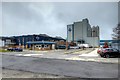
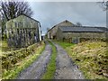
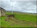
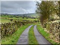
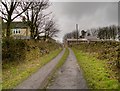
Photos of BB11 5UG
Area Information
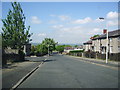
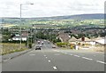
Living in BB11 5UG means being part of a small, tightly knit residential cluster in the Burnley district of Lancashire. With a population of 1,028 and a low density of 104 people per square kilometre, the area feels quiet and unassuming, yet it sits on the edge of Burnley, a town with a rich industrial history. Historically linked to cotton mills and coal mining, the area’s character is shaped by its suburban proximity to Burnley, with roots tracing back to the 15th century. Today, BB11 5UG is a place where older homes sit alongside modern amenities, offering a balance between tradition and practicality. The community is predominantly middle-aged, with a median age of 47, and most residents own their homes. Daily life here is defined by proximity to local shops, rail links, and the broader Burnley infrastructure. While the area lacks the density of a city, its small size ensures that essential services are within walking or cycling distance, making it a viable choice for those seeking a quieter lifestyle without complete isolation from urban conveniences.
- Area Type
- Postcode
- Area Size
- Not available
- Population
- 1028
- Population Density
- 104 people/km²
The property market in BB11 5UG is characterised by high home ownership (88%) and a predominance of houses. This suggests a market skewed towards owner-occupied homes rather than rental properties, which is typical of suburban areas with established communities. The focus on houses rather than flats or apartments indicates a preference for larger, private living spaces, likely catering to families or individuals seeking space and privacy. Given the small size of the postcode area, the housing stock is likely limited, meaning buyers may need to consider nearby suburbs or Burnley itself for more options. The high ownership rate also implies a stable market with little turnover, which can be both a benefit for long-term residents and a challenge for newcomers seeking to move quickly. For buyers, the area’s compact nature means proximity to amenities and transport links is a key selling point, though the limited property supply may require flexibility in location.
House Prices in BB11 5UG
No properties found in this postcode.
Energy Efficiency in BB11 5UG
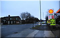
The lifestyle in BB11 5UG is shaped by its proximity to essential amenities. Local shops such as Farmfoods Rosehill and Spar provide convenience for daily errands, while the rail network offers access to broader retail and dining options in Burnley. The area’s small size means that amenities are within practical reach, reducing the need for long commutes. Though the data does not mention parks or leisure facilities, the historical presence of a golf club and the area’s suburban setting suggest opportunities for outdoor activities. The nearby rail stations also connect residents to cultural and recreational hubs in Burnley, such as museums, theatres, and sports facilities. Overall, BB11 5UG offers a balance of local convenience and regional access, making it suitable for those who value both independence and connectivity.
Amenities
Schools
The schools near BB11 5UG include Moorlands View School and Spring Vale School, both of which are special schools. Moorlands View has an Ofsted rating of ‘good’, while Spring Vale’s rating is not specified. The presence of two special schools indicates that the area is well-served for families with children requiring tailored education, such as those with additional needs or specific learning challenges. This makes BB11 5UG an attractive option for parents prioritising accessibility to specialist education. However, the absence of mainstream schools in the data means families may need to look further afield for primary or secondary education. The availability of special schools reflects the area’s commitment to inclusive education, though it also highlights the need to consider broader educational options for those seeking a more traditional school environment.
| Rank | School | Type | Entry gender | Ages |
|---|
Explore more schools in this area
Go to Schools tabDemographics
The community in BB11 5UG is predominantly middle-aged, with a median age of 47 and the majority of residents falling within the 30-64 age range. This suggests a stable, established population with strong ties to the area. Home ownership is high, with 88% of properties occupied by their owners, indicating a sense of long-term investment in the community. The accommodation type is primarily houses, reflecting a suburban rather than urban layout. The predominant ethnic group is White, though no specific data on diversity or deprivation is provided. This demographic profile suggests a low turnover of residents and a focus on family-oriented living. The age range implies that many residents are in their prime working years, potentially supporting local businesses and services. However, the lack of data on younger or older demographics means the area’s appeal to different life stages remains unclear.
Household Size
Accommodation Type
Tenure
Ethnic Group
Religion
Household Composition
Age
Household Deprivation
NS-SEC
Explore more demographic insights in this area
Go to Demographics tabPlanning
Planning Constraints
- Flood RiskPremium
- Ramsar Wetland SitesPremium
- Area of Outstanding Natural BeautyPremium
- Protected Nature ReservePremium
- Protected WoodlandPremium