Area Overview for BB11 5NB
Photos of BB11 5NB
Area Information
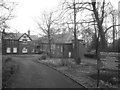
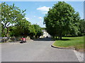
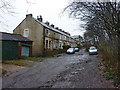
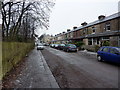
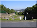
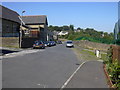
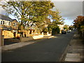
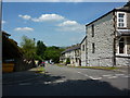
BB11 5NB is a small residential postcode in the Burnley area of Lancashire, home to around 1,286 people. This compact area reflects a community shaped by its historical ties to the Burnley Coalfield, where coal mining once defined the local economy. The ward’s name, Coal Clough with Deerplay, hints at its past, with Deerplay Colliery operating from the late 19th century until the mid-20th century. Today, the area’s character is defined by its modest housing stock and proximity to Burnley’s urban core. Residents here are predominantly adults aged 30–64, with a median age of 47, suggesting a stable, mature community. The area’s small size means it is tightly knit, with residents likely to know their neighbours. While the coal industry has long since declined, the legacy of mining remains in the landscape and local identity. Living here offers a quiet, residential environment with easy access to Burnley’s amenities, rail links, and nearby countryside. It is a place where history and modern living coexist, with no major environmental or planning constraints to complicate daily life.
- Area Type
- Postcode
- Area Size
- Not available
- Population
- 1286
- Population Density
- 3193 people/km²
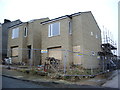
BB11 5NB is a predominantly owner-occupied area, with 84% of homes owned by residents rather than rented. The housing stock consists almost entirely of houses, not flats, which is typical of smaller, rural or semi-rural postcode areas. This suggests a community where property ownership is the norm, and the market is likely to cater to buyers seeking single-family homes. Given the area’s small size and limited housing stock, the market is unlikely to be highly competitive, but buyers should be aware of the limited availability of new builds or larger properties. The proximity to Burnley’s urban amenities, combined with the lack of planning constraints, makes this area appealing for those prioritising stability and a quieter lifestyle. However, the small size of the postcode means that buyers must consider the broader Burnley area for more options.
House Prices in BB11 5NB
No properties found in this postcode.
Energy Efficiency in BB11 5NB
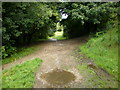
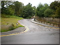
Residents of BB11 5NB have access to a range of local amenities within practical reach. Retail options include Spar, Farmfoods Rosehill, and M&S Burnley, offering everyday shopping needs. The area’s rail stations provide easy access to Burnley’s urban centres, where additional shops, dining, and services are available. While the data does not mention parks or leisure facilities directly, the absence of environmental constraints like AONBs or protected woodlands suggests open spaces may be accessible nearby. The proximity to Burnley’s transport network and retail hubs means daily life is convenient, with minimal need to travel far for essentials. The small size of the postcode means the character of the area is defined by its residential clusters and local shops, offering a quiet but connected lifestyle.
Amenities
Schools
Residents of BB11 5NB have access to two primary schools: Christ The King Roman Catholic Primary School, Burnley, and Christ The King Roman Catholic Primary School, a Voluntary Academy. Both are primary schools, though no Ofsted ratings are provided in the data. The presence of two schools of the same name suggests they may serve different areas or have distinct administrative structures. For families, this offers some choice in primary education, though the lack of secondary schools in the immediate vicinity means students will need to travel to Burnley or nearby towns for secondary education. The absence of detailed performance data means potential buyers should conduct further research into school quality if this is a priority.
| Rank | School | Type | Entry gender | Ages |
|---|
Explore more schools in this area
Go to Schools tabDemographics
The population of BB11 5NB is 1,286, with a median age of 47. The most common age group is adults aged 30–64, indicating a community that is neither dominated by young families nor retirees. Home ownership is high at 84%, suggesting a stable, long-term resident base. The area is predominantly occupied by houses, not flats, which aligns with the higher proportion of owner-occupied properties. The predominant ethnic group is White, though no specific diversity statistics are provided. This age profile and ownership rate suggest a community with established roots, where many residents have lived for decades. The absence of significant deprivation data means the area likely avoids the challenges faced by more economically disadvantaged regions. However, the lack of detailed diversity metrics means the full demographic picture remains incomplete.
Household Size
Accommodation Type
Tenure
Ethnic Group
Religion
Household Composition
Age
Household Deprivation
NS-SEC
Explore more demographic insights in this area
Go to Demographics tabPlanning
Planning Constraints
- Flood RiskPremium
- Ramsar Wetland SitesPremium
- Area of Outstanding Natural BeautyPremium
- Protected Nature ReservePremium
- Protected WoodlandPremium