Area Overview for BB11 5HJ
Photos of BB11 5HJ
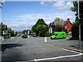
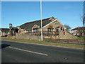
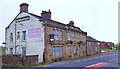
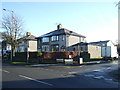
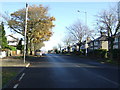
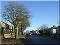
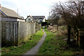
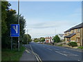
35 photos from this area
Area Information
Key information about the BB11 5HJ including its size, population, and administrative classification.
- Area Type
- Postcode
- Area Size
- 6314 m²
- Population
- 1286
- Population Density
- 3193 people/km²
House Prices in BB11 5HJ
18
Properties
£109,228
Average Sold Price
£32,950
Lowest Price
£168,000
Highest Price
Showing 18 properties
| Address | Type | Beds | Baths | Last Sale Price | Last Sale Date | |
|---|---|---|---|---|---|---|
| 429 Rossendale Road, Burnley, BB11 5HJ | Terraced | 3 | 1 | £168,000 | May 2024 | |
| 421 Rossendale Road, Burnley, BB11 5HJ | Semi-detached | 3 | 1 | £136,000 | Aug 2020 | |
| 447 Rossendale Road, Burnley, BB11 5HJ | Semi-detached | 2 | 1 | £150,000 | Jun 2020 | |
| 445 Rossendale Road, Burnley, BB11 5HJ | Semi-detached | 2 | 1 | £139,600 | Nov 2016 | |
| 417 Rossendale Road, Burnley, BB11 5HJ | Semi-detached | - | - | £124,000 | Sep 2016 | |
| 431 Rossendale Road, Burnley, BB11 5HJ | house | - | - | £115,000 | Dec 2014 | |
| 423 Rossendale Road, Burnley, BB11 5HJ | Semi-detached | - | - | £70,500 | Jul 2006 | |
| 413 Rossendale Road, Burnley, BB11 5HJ | house | - | - | £47,000 | Apr 2002 | |
| 427 Rossendale Road, Burnley, BB11 5HJ | Terraced | - | - | £32,950 | May 2001 | |
| 415 Rossendale Road, Burnley, BB11 5HJ | Semi-detached | 3 | 1 | - | - |
Page 1 of 2
Energy Efficiency in BB11 5HJ
Amenities
Schools
| Rank | School | Type | Entry gender | Ages |
|---|
Explore more schools in this area
Go to Schools tabDemographics
Household Size
Family (3-5 people)
most common
Accommodation Type
Houses
most common
Tenure
84
majority
Ethnic Group
White
most common
Religion
N/A
most common
Household Composition
N/A
most common
Age
47
median
Adults (30-64 years)
most common
Household Deprivation
N/A
with no deprivation
NS-SEC
35
in Lower managerial occupations
Explore more demographic insights in this area
Go to Demographics tabPlanning
Planning Constraints
- Flood RiskPremium
- Ramsar Wetland SitesPremium
- Area of Outstanding Natural BeautyPremium
- Protected Nature ReservePremium
- Protected WoodlandPremium