Area Overview for BB11 4NY
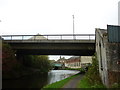
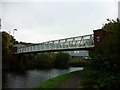
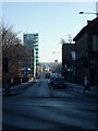
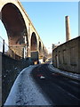
Photos of BB11 4NY
Area Information
Living in BB11 4NY means settling into a compact residential cluster defined by its specific postcode boundaries. This area spans just 2235 square metres and holds a population of 1382 residents. The density here is significant, reaching 618232 people per square kilometre across this small footprint. You are looking at a small, tightly packed community rather than a sprawling neighbourhood. This postcode covers a specific residential cluster where daily life revolves around immediate close neighbours. The character of this spot is derived from its size and the concentration of households within its limits. Prospective buyers find that life here offers the convenience of proximity while maintaining a distinct residential identity. The area's small scale means that services and amenities are likely within short walking distances. You enter a space where the population is fixed and the environment is managed within clearly defined borders. Understanding the scale of BB11 4NY is essential before considering a purchase, as it represents a microcosm of housing within a larger municipal context. This location serves as a focused hub for local living needs.
- Area Type
- Postcode
- Area Size
- 2235 m²
- Population
- 1382
- Population Density
- 4518 people/km²
Homes in BB11 4NY are predominantly houses rather than flats or other urban dwellings. This preference for detached or semi-detached housing shapes the market significantly for homebuyers targeting this location. With a home ownership rate of 45 per cent, the area presents a moderate ownership landscape compared to high-density urban centres. This statistic indicates that nearly half of the households own their residences, suggesting a stable property market with established owners staying put. The remaining portion of the market comprises rental properties, offering flexibility for those not ready to commit to ownership. For you as a buyer, the focus remains on traditional house types suited for families or those seeking private gardens. The small size of the postcode area means the total number of listings is limited, requiring careful selection from available stock. This configuration supports residents who value ground-level access and typical domestic surroundings over high-rise living. The accommodation type dictates the neighbourhood feel, ensuring a consistent residential experience throughout BB11 4NY.
House Prices in BB11 4NY
Showing 20 properties
| Address | Type | Beds | Baths | Last Sale Price | Last Sale Date | |
|---|---|---|---|---|---|---|
| 12 Prince Street, Burnley, BB11 4NY | Terraced | 2 | 1 | £57,000 | Feb 2025 | |
| 5 Prince Street, Burnley, BB11 4NY | Terraced | 3 | 1 | £95,000 | Feb 2023 | |
| 3 Prince Street, Burnley, BB11 4NY | Terraced | 2 | 1 | £72,000 | Nov 2022 | |
| 1 Prince Street, Burnley, BB11 4NY | Retail | 3 | 1 | £100,000 | Jun 2022 | |
| 13 Prince Street, Burnley, BB11 4NY | house | 1 | 1 | £49,995 | May 2021 | |
| 11 Prince Street, Burnley, BB11 4NY | Terraced | 2 | 1 | £53,000 | Feb 2021 | |
| 10 Prince Street, Burnley, BB11 4NY | Terraced | 2 | 1 | £56,000 | Apr 2019 | |
| 14 Prince Street, Burnley, BB11 4NY | Terraced | 3 | 1 | £72,000 | Nov 2016 | |
| 2 Prince Street, Burnley, BB11 4NY | Terraced | 2 | 1 | £34,000 | Nov 2016 | |
| 20 Prince Street, Burnley, BB11 4NY | Terraced | 2 | 1 | £28,500 | Sep 2013 |
Energy Efficiency in BB11 4NY
Retail and travel convenience define the lifestyle for those living in BB11 4NY. You have access to five listed retail options, including Spar, Farmfoods Rosehill, and M&S Burnley. These venues provide essential shopping needs without requiring a long commute. Rail connectivity is also within practical reach, with five railway stations nearby including Burnley Manchester Road Railway Station, Burnley Barracks Railway Station, and Burnley Central Railway Station. Additionally, one metro station in Rawtenstall serves the broader network needs of the area. This combination of local supermarkets and major train networks ensures that daily errands and longer journeys are manageable. You can run errands at Farmfoods or M&S and catch a train at Burnley Central for wider travel. The presence of these specific named amenities means you do not need to travel far for groceries or commuting. This accessibility supports the daily rhythm of family life in this small residential zone.
Amenities
Schools
Families considering schools near BB11 4NY have access to Burnley Holy Trinity Church of England Primary School. This institution serves young children within the local cluster. The school holds a good Ofsted rating, providing reassurance regarding educational standards. This primary option is the only school listed in the data for the immediate vicinity. The mix of school types available is currently limited to this single primary provider. You will need to consider transport arrangements for secondary education, as no secondary schools appear in the local data. The presence of a rated primary school supports the area's suitability for young families seeking foundational education close to home. Living in this postcode gives you direct access to a primary institution with a verified quality rating. This specific educational facility forms the core of the local schooling option for children in the 30 to 64 year old demographic cluster. Prospective parents can verify the school's name and rating directly with the establishment.
| Rank | School | Type | Entry gender | Ages |
|---|
Explore more schools in this area
Go to Schools tabDemographics
The community in BB11 4NY is characterised by a mature demographic profile with a median age of 47 years. Most residents fall into the adult age range of 30 to 64 years. This data indicates a population likely settled into long-term homes rather than transient housing. Home ownership stands at 45 per cent of the total household structure. This figure suggests a balanced mix of owner-occupied properties and rented accommodation within the cluster. Houses constitute the primary form of accommodation in this postcode area. The predominant ethnic group identified as White reflects the broader local composition of the region. You are looking at a society with a clear age skew towards middle-aged adults who typically manage their own properties. The stability implied by the age range and ownership rate points to a neighbourhood where families and households have established roots. This demographic makeup influences the local pace and the types of community interactions that occur daily within the 2235 square metre zone.
Household Size
Accommodation Type
Tenure
Ethnic Group
Religion
Household Composition
Age
Household Deprivation
NS-SEC
Explore more demographic insights in this area
Go to Demographics tabPlanning
Planning Constraints
- Flood RiskPremium
- Ramsar Wetland SitesPremium
- Area of Outstanding Natural BeautyPremium
- Protected Nature ReservePremium
- Protected WoodlandPremium