Area Overview for BB11 4HE
Photos of BB11 4HE
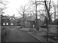
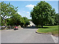
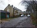
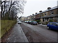
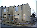
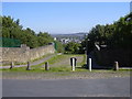
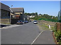
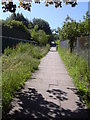
70 photos from this area
Area Information
Key information about the BB11 4HE including its size, population, and administrative classification.
- Area Type
- Postcode
- Area Size
- 1.1 hectares
- Population
- 1286
- Population Density
- 3193 people/km²
House Prices in BB11 4HE
32
Properties
£125,966
Average Sold Price
£718
Lowest Price
£235,000
Highest Price
Showing 32 properties
| Address | Type | Beds | Baths | Last Sale Price | Last Sale Date | |
|---|---|---|---|---|---|---|
| 407 Manchester Road, Burnley, BB11 4HE | Terraced | 4 | 2 | £192,500 | Apr 2025 | |
| 393 Manchester Road, Burnley, BB11 4HE | Terraced | 3 | 1 | £172,000 | Mar 2025 | |
| 373 Manchester Road, Burnley, BB11 4HE | Terraced | 4 | 1 | £180,000 | Jan 2025 | |
| 401 Manchester Road, Burnley, BB11 4HE | Terraced | 5 | 1 | £190,000 | Feb 2024 | |
| 403 Manchester Road, Burnley, BB11 4HE | house | 4 | 1 | £198,000 | Jul 2023 | |
| 405 Manchester Road, Burnley, BB11 4HE | Terraced | 4 | 1 | £235,000 | Mar 2023 | |
| 361 Manchester Road, Burnley, BB11 4HE | house | - | - | £126,500 | Aug 2022 | |
| 413 Manchester Road, Burnley, BB11 4HE | house | - | - | £718 | Jul 2022 | |
| 395 Manchester Road, Burnley, BB11 4HE | Retail | 3 | 1 | £142,500 | Mar 2022 | |
| 359 Manchester Road, Burnley, BB11 4HE | Terraced | 3 | 1 | £145,500 | Aug 2021 |
Page 1 of 4
Energy Efficiency in BB11 4HE
Amenities
Schools
| Rank | School | Type | Entry gender | Ages |
|---|
Explore more schools in this area
Go to Schools tabDemographics
Household Size
Family (3-5 people)
most common
Accommodation Type
Houses
most common
Tenure
84
majority
Ethnic Group
White
most common
Religion
N/A
most common
Household Composition
N/A
most common
Age
47
median
Adults (30-64 years)
most common
Household Deprivation
N/A
with no deprivation
NS-SEC
35
in Lower managerial occupations
Explore more demographic insights in this area
Go to Demographics tabPlanning
Planning Constraints
- Flood RiskPremium
- Ramsar Wetland SitesPremium
- Area of Outstanding Natural BeautyPremium
- Protected Nature ReservePremium
- Protected WoodlandPremium