Area Overview for BB11 3LT
Photos of BB11 3LT

Area Information
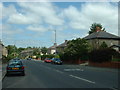
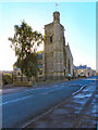
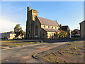
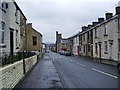
Living in BB11 3LT means settling into a small residential cluster known locally as Rosehill with Burnley Wood. This specific postcode covers just 1086 square metres of land but houses a distinct population of 2261 people. You are accessing a location that sits between Parliament Street in the north and Hufling Lane in the south. The boundaries stretch from the railway line in the west to Todmorden Road in the east. Historically, this ward was separated from the main Burnley township by the River Calder until its incorporation into the County Borough of Burnley in 1894. The physical layout is a high-density grid of terraced housing that developed alongside former cotton mills. You will find some larger properties that originally belonged to mill owners alongside the typical terraced streets. The area endured significant challenges, including housing market failure in the mid-1990s and the unrest of the 2001 Burnley riots. Since then, regeneration efforts under the East Lancashire Elevate scheme have reshaped the landscape. Today, the neighbourhood features listed buildings and offers access to Healey Heights, a public woodland and informal open space. When you consider homes in this postcode, you are buying a property with deep historical roots and a clear sense of place within the Borough of Burnley.
- Area Type
- Postcode
- Area Size
- 1086 m²
- Population
- 2261
- Population Density
- 5086 people/km²
The housing stock in BB11 3LT is dominated by houses, which forms the majority of the available accommodation. With a home ownership rate of only 39 per cent, this area leans heavily towards the rental market. This statistic indicates that most residents are tenants rather than owners of their dwellings. The primary structures are houses situated in a grid-iron pattern, reflecting the 19th-century industrial expansion. You will encounter high-density terraced housing rather than modern detached homes or purpose-built flats. This configuration defines the typical streetscape you will see when viewing properties near BB11 3LT. The historical context of cotton mills and subsequent regeneration adds a layer of character to the building stock. Buyers looking at this small area should expect homes to range from 19th-century terraces to later regeneration properties. The location adjoins the River Calder and canal, adding potential value for those who appreciate industrial heritage. Because ownership is lower than the national average, competition for sales might be frequent or pricing dynamics could reflect higher turnover. If you seek a rental property, the prevalence of tenants means strong tenant networks and established letting agencies likely operate here. For buyers, the offer of houses specifically caters to families requiring gardens or internal stairs, as flats are excluded from this postcode's main profile. The mix of mill-owner residences and back-to-back cottages offers variety even within this compact footprint.
House Prices in BB11 3LT
Showing 5 properties
| Address | Type | Beds | Baths | Last Sale Price | Last Sale Date | |
|---|---|---|---|---|---|---|
| 84 Brunswick Street, Burnley, BB11 3LT | house | 2 | - | £31,500 | Apr 2017 | |
| 82 Brunswick Street, Burnley, BB11 3LT | house | - | - | £20,000 | Mar 2016 | |
| 83 Brunswick Street, Burnley, BB11 3LT | Terraced | 3 | 1 | £55,200 | Dec 2009 | |
| 86 Brunswick Street, Burnley, BB11 3LT | house | - | - | - | - | |
| 85 Brunswick Street, Burnley, BB11 3LT | house | - | - | - | - |
Energy Efficiency in BB11 3LT
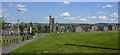
Your daily life in BB11 3LT benefits from a well-distributed network of local amenities within practical reach. Retail options include five distinct shops where you can purchase groceries and essentials. Notable venues include Spar, Aldi Brunshaw, and Tesco Burnley, ensuring you have access to major and budget supermarkets. For a comprehensive overview of local shopping, you should also consider the retail offerings along Parliament Street and Oxford Road. Transport links are extensive, with five railway stations nearby, including Burnley Manchester Road and Burnley Central. This variety gives you flexibility when travelling to work or leisure destinations. For weekender trips, the Metro service to Rawtenstall provides an additional rail link outside the immediate borough. Beyond essential services, you have access to Healey Heights, a public woodland that serves as an informal open space. This natural area offers a green escape from the density of the terraced housing. The historical presence of Parliament Street and Oxford Road adds character to the local high street scene. When considering lifestyle factors for living in BB11 3LT, the combination of strong retail provision and accessible green space creates a balanced environment. You can manage household shopping at Tesco or Aldi while enjoying walks in the local woodland.
Amenities
Schools
Families considering living in BB11 3LT have two primary school options immediately accessible within the ward. The first is Burnley, Burnley Wood Primary School, which serves as a local foundation for younger children. This institution provides early education within the immediate vicinity of homes in the postcode. The second option is Burnley Springfield Community Primary School, which currently holds an Ofsted rating of good. This positive rating is a significant factor for parents prioritising academic standards and school quality. Both schools are of the primary type, meaning there are no secondary schools listed directly within the immediate data for this specific cluster. You must rely on these primary institutions for early years education before families move to larger secondary colleges nearby. The presence of a school with a good rating provides a solid baseline for local education quality. Without data on secondary schools or travel times to larger institutions like Burnley High School, your focus remains on these two named entities. The proximity of schools like Burnley Springfield Community Primary School makes this area practical for young families with children in infant or junior years. When searching for schools near BB11 3LT, these two names appear as the definitive local choices provided by current records.
| Rank | School | Type | Entry gender | Ages |
|---|
Explore more schools in this area
Go to Schools tabDemographics
The community within BB11 3LT is defined by a mature population where the median age is 47 years. Most residents fall into the adult bracket between 30 and 64 years of age. This age profile suggests a neighbourhood suited to established families, retired professionals, or carers rather than young students or transient workers. Ownership of the properties is relatively low, with only 39 per cent of households owning their homes outright or with a mortgage. Consequently, a substantial portion of the population likely rents, creating a rented-heavy market compared to other British suburbs. The predominant ethnic group is white, mirroring the broader demographic profile of the surrounding Lancashire region. The accommodation stock consists almost entirely of houses, meaning you will not find flats or purpose-built apartment blocks within this specific cluster. These houses are set in dense terraced rows rather than detached estates. Deprivation data is not included in the available statistics, so you cannot assess income levels specifically for this exact code from these figures. However, the age and ownership rates provide clear indicators of the local economic structure. If you are looking for a quiet, stable community with a clear residential character, the age range here supports a slower pace of life compared to university towns. The high density of 2081856 people per square kilometre indicates tight spacing between properties.
Household Size
Accommodation Type
Tenure
Ethnic Group
Religion
Household Composition
Age
Household Deprivation
NS-SEC
Explore more demographic insights in this area
Go to Demographics tabPlanning
Planning Constraints
- Flood RiskPremium
- Ramsar Wetland SitesPremium
- Area of Outstanding Natural BeautyPremium
- Protected Nature ReservePremium
- Protected WoodlandPremium