Area Overview for BB11 3LB
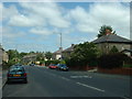
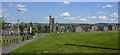
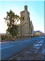
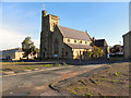
Photos of BB11 3LB
Area Information
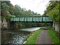
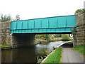
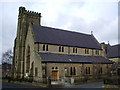
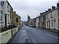
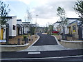
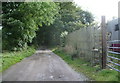
Living in BB11 3LB means residing within the BB11 3LB postcode cluster, a residential zone in the Borough of Burnley that defines a specific cluster of homes. This area covers 6,589 square metres and supports a population of 2,261 residents. The location spans from Parliament Street in the north to Hufling Lane in the south, creating a defined community footprint. Historically, this was rough moorland and woodland until the Leeds and Liverpool Canal opened in 1801, which spurred rapid expansion with mills and coal mining from 1825. You are situated in Rosehill with Burnley Wood, an electoral ward that incorporates this area at coordinates 53.782485, -2.239049. The neighbourhood features high-density terraced housing arranged in a grid-iron pattern, a legacy of 19th-century development alongside former cotton mills. Some larger properties remain where mill owners once lived, contrasting with the typical terraced stock. The area suffered market failure in the mid-1990s and subsequent riots, leading to regeneration under the East Lancashire Elevate scheme. Today, the mix of historic stone cottages and regenerated housing offers a distinct character. You are walking distance from Healey Heights, a public woodland offering informal open space nearby. The River Calder and canal flow close to the area, passing beneath Lane Bridge. This dense, historically industrial setting is now a primarily residential hub. While it retains its industrial roots, daily life focuses on the immediate street scene and local connections. The area is bounded by Todmorden Road to the east and the railway line to the west, separating the homes from the main transport arteries. This postcode covers a small footprint, meaning neighbours are often close by, fostering a tight-knit but historically complex community environment.
- Area Type
- Postcode
- Area Size
- 6589 m²
- Population
- 2261
- Population Density
- 5086 people/km²
The property market in BB11 3LB is defined by its housing stock and the specific composition of BB11 3LB, which consists mainly of Houses. With 39% of households owning their own homes, the market operates as a hybrid of owner-occupied and rented sectors. This lower-than-50% ownership rate suggests a significant portion of the population rents, likely due to the high density of 343,143 people per square kilometre. The predominant accommodation type of Houses reflects the historical expansion of the area after 1801, when mills and back-to-back cottages replaced the earlier rough moorland. You are looking at a postcode that covers a small residential cluster of just 6,589 square metres. This limited area size means properties are situated very close together. The grid-iron pattern of 19th-century development ensures that streets are narrow and properties are arranged in dense rows. Some larger houses for mill owners exist alongside the typical terraced stock. The area experienced housing market failure in the mid-1990s, yet it has since undergone regeneration. The East Lancashire Elevate scheme shaped the current housing landscape, improving safety and usability without erasing the area's character. Buyers seeking homes in BB11 3LB should expect a mix of Victorian and early 20th-century stone buildings. The high density means land premiums are high for any private garden space. The 39% ownership rate indicates you will compete with other buyers for the limited stock of houses available. Rental values may remain strong due to the concentration of tenure types. The area is not a vast estate but a dense urban enclave. Its price reflects the historical significance and the regeneration efforts that have improved living standards. If you require space, the small size of the postcode area is a constraint. The local market is driven by demand from the working population employed in nearby sectors.
House Prices in BB11 3LB
Showing 75 properties
| Address | Type | Beds | Baths | Last Sale Price | Last Sale Date | |
|---|---|---|---|---|---|---|
| 19 Dall Street, Burnley, BB11 3LB | Terraced | 2 | 1 | £67,000 | Jan 2025 | |
| 24 Dall Street, Burnley, BB11 3LB | house | - | - | £95,999 | Sep 2024 | |
| 27 Dall Street, Burnley, BB11 3LB | Terraced | 2 | 1 | £15,000 | Sep 2024 | |
| 20 Dall Street, Burnley, BB11 3LB | house | - | - | £61,500 | Jun 2024 | |
| 49 Dall Street, Burnley, BB11 3LB | Terraced | 2 | 1 | £68,000 | Apr 2024 | |
| 60 Dall Street, Burnley, BB11 3LB | house | - | - | £40,000 | Mar 2024 | |
| 72 Dall Street, Burnley, BB11 3LB | house | - | - | £55,000 | Feb 2023 | |
| 71 Dall Street, Burnley, BB11 3LB | house | 2 | 1 | £61,000 | Jan 2023 | |
| 33 Dall Street, Burnley, BB11 3LB | Terraced | 2 | 1 | £60,000 | Dec 2022 | |
| 56 Dall Street, Burnley, BB11 3LB | house | - | - | £30,000 | Oct 2022 |
Energy Efficiency in BB11 3LB
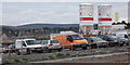
Daily life in BB11 3LB is anchored by nearby amenities that cover shopping and transport needs. Five retail outlets serve the local community, including Tesco Burnley, Aldi Brunshaw, and Spar. These three named supermarkets are the most notable locations for your grocery shopping. You can rely on Tesco Burnley for a wide range of food products. Aldi Brunshaw offers a cost-effective alternative for weekly shopping. Spare provides convenience locally. Having access to three major chains ensures you do not need to travel far for essentials. Beyond retail, five railway stations provide transport options within a short distance. Burnley Manchester Road Railway Station, Burnley Central Railway Station, and Burnley Barracks Railway Station are the key transport hubs. These stations facilitate travel to Manchester and other cities. The area also features entertainment options nearby. While not listed as primary amenities, the cultural backdrop includes Taunton Street, Robinson Road, and Junior Street, which are known for iconic markets and independent shopping. The proximity to these hubs allows residents to access a range of shops and cafes that define the city's retail scene. Healey Heights serves as a public woodland and informal open space nearby. This green area connects to Rose Grove and provides a peaceful refuge for residents. The River Calder and the canal at Lane Bridge add further leisure value, offering scenic walks alongside the water. The historical breadth of the area, with railways opening in 1849 and canals in 1801, creates a setting rich in physical heritage. For families with 2,261 people living in the ward, these amenities provide balanced access to nature and urban facilities. The density of services means convenience is a defining feature of living in BB11 3LB.
Amenities
Schools
Families living in BB11 3LB have access to two primary schools within the immediate vicinity. The local options for young learners include Burnley, Burnley Wood Primary School and Burnley Springfield Community Primary School. The latter holds an Ofsted rating of good, providing reassurance regarding educational standards for those sending children to local institutions. Burnley, Burnley Wood Primary School is also available, completing the picture of local educational provision. This mix of state primary schools serves the community of 2,261 residents. The demographic peak for Adults aged 30-64 years aligns with an age group where children are often attending primary-level education. These schools are situated to serve the Rosehill with Burnley Wood ward directly. Parents do not need to travel far to secure education for their children within the ward boundaries. The presence of two named schools suggests the local authority has accounted for the population size when planning provision. Schools near BB11 3LB are firmly rooted in the local community. You can expect feeder relationships with these specific institutions for the residential cluster. The good Ofsted rating for Burnley Springfield Community Primary School highlights a standard of performance that meets regulatory expectations. Burnley, Burnley Wood Primary School complements this option, providing an alternative for families within the postcode. Neither school is described as comprehensive, indicating they focus on the early stages of a child's academic life. This educational environment supports the family demographic profile of the area. If you are moving to BB11 3LB, school catchment areas around these institutions are relevant to your decision-making process.
| Rank | School | Type | Entry gender | Ages |
|---|
Explore more schools in this area
Go to Schools tabDemographics
Community statistics within BB11 3LB reveal a mature and established population. The median age is 47 years, indicating that Adults aged 30-64 years represent the most common age range. This profile suggests the area appeals to individuals established in their careers or families with older children rather than young professionals seeking entry-level housing. Home ownership stands at 39% of households within the postcode cluster. This figure places the area in a mixed market where neither owners nor renters completely dominate the social fabric. The accommodation types primarily consist of Houses, reflecting the legacy of the local mill workers and their families who built their homes in the 19th century. This housing stock supports the high population density of 343,143 people per square kilometre. Such density creates a lived-in feel, though you should expect a crowded residential atmosphere rather than private expansion. The predominant ethnic group is White, which aligns with the historical demographic trends of the Borough of Burnley. For those considering buying a home here, the 39% ownership rate signals a competitive private market. Rental demand remains significant as the proportion of owned homes is less than half. The concentration of adults between 30 and 64 years old means schools are filled with older children while retirees may also command local properties. The area functions as a self-contained residential unit where the majority of residents have been established for years. This stability comes with the benefit of known neighbours but also means less rapid demographic turnover. The high population density ensures that streets are active throughout the day and evening.
Household Size
Accommodation Type
Tenure
Ethnic Group
Religion
Household Composition
Age
Household Deprivation
NS-SEC
Explore more demographic insights in this area
Go to Demographics tabPlanning
Planning Constraints
- Flood RiskPremium
- Ramsar Wetland SitesPremium
- Area of Outstanding Natural BeautyPremium
- Protected Nature ReservePremium
- Protected WoodlandPremium