Area Overview for BB11 3HB
Photos of BB11 3HB
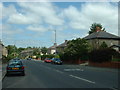
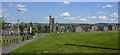
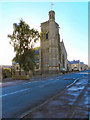
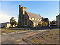
100 photos from this area
Area Information
Key information about the BB11 3HB including its size, population, and administrative classification.
- Area Type
- Postcode
- Area Size
- 2995 m²
- Population
- 2261
- Population Density
- 5086 people/km²
House Prices in BB11 3HB
23
Properties
£48,250
Average Sold Price
£15,000
Lowest Price
£95,000
Highest Price
Showing 23 properties
| Address | Type | Beds | Baths | Last Sale Price | Last Sale Date | |
|---|---|---|---|---|---|---|
| 193 Oxford Road, Burnley, BB11 3HB | house | - | - | £95,000 | Aug 2025 | |
| 180 Oxford Road, Burnley, BB11 3HB | house | - | - | £83,999 | Mar 2024 | |
| 172 Oxford Road, Burnley, BB11 3HB | house | - | - | £65,000 | Mar 2024 | |
| 191 Oxford Road, Burnley, BB11 3HB | house | - | - | £65,000 | Sep 2021 | |
| 195 Oxford Road, Burnley, BB11 3HB | house | - | - | £52,000 | Aug 2020 | |
| 197 Oxford Road, Burnley, BB11 3HB | Flat | - | - | £68,000 | Feb 2020 | |
| 176 Oxford Road, Burnley, BB11 3HB | house | - | - | £25,000 | Feb 2017 | |
| 182 Oxford Road, Burnley, BB11 3HB | house | - | - | £15,000 | Sep 2014 | |
| 187 Oxford Road, Burnley, BB11 3HB | house | - | - | £40,000 | Jun 2011 | |
| 189 Oxford Road, Burnley, BB11 3HB | house | - | - | £40,000 | Aug 2010 |
Page 1 of 3
Energy Efficiency in BB11 3HB
Amenities
Schools
| Rank | School | Type | Entry gender | Ages |
|---|
Explore more schools in this area
Go to Schools tabDemographics
Household Size
One person
most common
Accommodation Type
Houses
most common
Tenure
39
majority
Ethnic Group
White
most common
Religion
N/A
most common
Household Composition
N/A
most common
Age
47
median
Adults (30-64 years)
most common
Household Deprivation
N/A
with no deprivation
NS-SEC
15
in Lower managerial occupations
Explore more demographic insights in this area
Go to Demographics tabPlanning
Planning Constraints
- Flood RiskPremium
- Ramsar Wetland SitesPremium
- Area of Outstanding Natural BeautyPremium
- Protected Nature ReservePremium
- Protected WoodlandPremium