Area Overview for BB11 2LZ
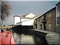
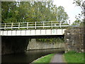
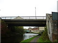
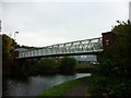
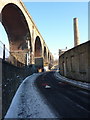
Photos of BB11 2LZ
Area Information
** The BB11 2LZ postcode defines a compact residential cluster covering 6,306 square metres. You are looking at a population of 2,261 people concentrated in a location historically significant to Lancashire. This ward, known as Rosehill with Burnley Wood, sits between Parliament Street and Hufling Lane, bounded by the railway to the west and Todmorden Road to the east. Historically part of the parish of Habergham Eaves prior to 1894, the area developed rapidly after the Leeds and Liverpool Canal opened in 1801. Rapid expansion followed, introducing cotton mills and coal mining which shaped the local grid. The area suffered market failures in the mid-1990s, compounded by the 2001 Burnley riots, before regeneration commenced under the East Lancashire Elevate scheme. When considering living in BB11 2LZ, you are accessing a neighbourhood defined by its industrial past and subsequent urban planning interventions. The current character is a high-density environment that many residents find practical, though the history of regeneration is visible in the streetscape. Understanding this context is essential for anyone House-hunting here. **** Most residents in BB11 2LZ fit into the adult demographic, with 76% of the population aged between 30 and 64 years. The median age for those living here is 47 years, indicating a community rather focused on mature homebuyers and established families. Thirty-nine per cent of households in this postcode own their property outright or with a mortgage, while the remaining majority likely rent. Houses dominate the accommodation mix in this specific small area, reflecting the inventory created during the 19th-century industrial boom. The predominant ethnic group is White, which aligns with the broader demographic profile of Burnley and the surrounding borough. When you evaluate homes in BB11 2LZ, you find a stable population where families and professionals have settled. While some regeneration occurred previously, the current social composition remains solid. The concentration of adults suggests you will live amongst neighbours with similar life stages. This age distribution also influences local demand, as schools and family-oriented services remain relevant for a large portion of the ward. **** Housing stock in BB11 2LZ consists primarily of houses, a direct result of the late Victorian and Edwardian development cycles that followed the opening of the Leeds and Liverpool Canal. You will find high-density terraced housing arranged in a grid-iron pattern, typical of the former cotton mill towns. Currently, 39% of residents own their homes, which suggests a mixed market where purchases happen alongside long-term tenancies. The remaining 61% of residents do not own their property, indicating a significant rental sector alongside owned homes. When looking at homes in BB11 2LZ, you are examining properties that have undergone regeneration efforts aimed at reviving the East Lancashire area. The grid layout means streets are canals of uniform housing blocks, often built for mill workers and now occupied by various demographics. This structure influences both pricing and availability, as there is less variety in architectural styles compared to newer estates. Buyers should expect to navigate a market defined by the legacy of industrial housing, where prices reflect both the historical character and the modern needs of a 47-year-old median age resident. **** Families living in BB11 2LZ have access to two primary schools located nearby. The Burnley Wood Primary School serves the younger generation in this area. You also have the option of Burnley Springfield Community Primary School, which holds a good Ofsted rating. This specific rating indicates the school meets expected standards of quality and instruction. Both institutions are primary schools, meaning you will find elementary education options within a short distance of the BB11 2LZ postcode. For families with children nearing schooling age, these named schools are the main options available in the immediate vicinity. Two of the schools mentioned include special designations, such as Burnley Springfield Community Primary School being community-led. When planning living in BB11 2LZ, the presence of two primary institutions provides essential educational support without requiring long commutes to larger secondary complexes. The good rating of Springfield is a positive factor for any parent assessing education quality in this specific ward. **** Digital connectivity for residents of BB11 2LZ is strong and suitable for remote work or heavy internet usage. Broadband quality scores 100 out of 100, meaning fixed lines are excellent. Mobile coverage scores 85 out of 100, indicating a robust network for most users. For people working from home or streaming, this level of connectivity removes common barriers found in rural locations. You can expect reliable high-speed internet to support video conferencing and large file downloads. Historical transport links also serve the area, with the nearby Towneley railway station opening in 1849 and connecting to the East Lancashire line. Today, residents have access to five rail stations, including Burnley Manchester Road Railway Station, Burnley Central Railway Station, and Burnley Barracks Railway Station. Retail options like Tesco Burnley and Iceland Burnley are within practical reach. The proximity to Rawtenstall is another advantage for daily travel. This combination of modern broadband and established rail links ensures you can stay connected whether working remotely or commuting to larger employment hubs in the north west. **** Daily life in BB11 2LZ benefits from nearby amenities that are within practical reach. You can visit Burnley Manchester Road Railway Station, Burnley Central Railway Station, or Burnley Barracks Railway Station if you need local transport links. Additionally, Rawtenstall metro services are accessible, providing an extra layer of connectivity. For shopping, the area offers five notable retail options. You can shop at Tesco Burnley, Iceland Burnley, and M&S Burnley, ensuring your weekly food and household needs are met without driving far. The ward also features Healey Heights, a public woodland and informal open space in Rosehill. This area provides a space for walking and enjoying nature close to your home. Historically, Parliament Street and Oxford Road included corner shops and sub-post offices, though the current retail landscape is dominated by larger superstores. The lifestyle here is practical and community-focused, with essential services clustered near transport hubs. You will find that living in BB11 2LZ offers convenient access to both industrial heritage sites and modern retail networks, supporting a balanced daily routine. **** Safety assessments for BB11 2LZ show a mixed picture that you must weigh carefully. Environmental constraints are minimal, with passes on flood risk, Ramsar wetland sites, areas of outstanding natural beauty, protected nature reserves, and protected woodland. This means regulatory hurdles regarding construction and environmental impact are low. However, the crime risk assessment is critical, with a score of 0 out of 100. This indicates a high crime risk where rates exceed the average. Enhanced security measures are recommended for residents or anyone visiting. You must acknowledge this elevated crime risk when evaluating homes in BB11 2LZ, as it stands in contrast to the environmental safety of the location. The area has a long history of urban challenges, including the 2001 Burnley riots, which contextually informs the current crime statistics. While there are no flood risks or protected site conflicts, the high crime score requires vigilance. When assessing safety, consider that the low scores on environmental constraints are positive for planning, but the critical crime rating is a significant factor for your personal security and insurance requirements. **** What is the residential character of BB11 2LZ?The area consists of high-density terraced housing in a grid-iron pattern developed during the 19th century. The median age is 47 years, and houses are the predominant accommodation type in this specific postcode cluster of 6,306 square metres. Which schools serve families living near BB11 2LZ?Families have access to Burnley Wood Primary School and Burnley Springfield Community Primary School. The latter holds a good Ofsted rating, providing elementary education options for children residing in Rosehill with Burnley Wood. How are transport and connectivity for residents of BB11 2LZ?Residents enjoy excellent fixed broadband scoring 100 out of 100 and mobile coverage of 85 out of 100. Five rail stations are nearby, including Burnley Central Railway Station, and major retailers like Tesco and Iceland are within practical reach. Should I be concerned about safety in BB11 2LZ?While environmental risks like flooding are non-existent, the crime risk assessment is critical. Crime rates are above average with a safety score of 0 out of 100, suggesting enhanced security measures are recommended for anyone living in or visiting the area.
- Area Type
- Postcode
- Area Size
- 6306 m²
- Population
- 2261
- Population Density
- 5086 people/km²
** Housing stock in BB11 2LZ consists primarily of houses, a direct result of the late Victorian and Edwardian development cycles that followed the opening of the Leeds and Liverpool Canal. You will find high-density terraced housing arranged in a grid-iron pattern, typical of the former cotton mill towns. Currently, 39% of residents own their homes, which suggests a mixed market where purchases happen alongside long-term tenancies. The remaining 61% of residents do not own their property, indicating a significant rental sector alongside owned homes. When looking at homes in BB11 2LZ, you are examining properties that have undergone regeneration efforts aimed at reviving the East Lancashire area. The grid layout means streets are canals of uniform housing blocks, often built for mill workers and now occupied by various demographics. This structure influences both pricing and availability, as there is less variety in architectural styles compared to newer estates. Buyers should expect to navigate a market defined by the legacy of industrial housing, where prices reflect both the historical character and the modern needs of a 47-year-old median age resident. **** Families living in BB11 2LZ have access to two primary schools located nearby. The Burnley Wood Primary School serves the younger generation in this area. You also have the option of Burnley Springfield Community Primary School, which holds a good Ofsted rating. This specific rating indicates the school meets expected standards of quality and instruction. Both institutions are primary schools, meaning you will find elementary education options within a short distance of the BB11 2LZ postcode. For families with children nearing schooling age, these named schools are the main options available in the immediate vicinity. Two of the schools mentioned include special designations, such as Burnley Springfield Community Primary School being community-led. When planning living in BB11 2LZ, the presence of two primary institutions provides essential educational support without requiring long commutes to larger secondary complexes. The good rating of Springfield is a positive factor for any parent assessing education quality in this specific ward. **** Digital connectivity for residents of BB11 2LZ is strong and suitable for remote work or heavy internet usage. Broadband quality scores 100 out of 100, meaning fixed lines are excellent. Mobile coverage scores 85 out of 100, indicating a robust network for most users. For people working from home or streaming, this level of connectivity removes common barriers found in rural locations. You can expect reliable high-speed internet to support video conferencing and large file downloads. Historical transport links also serve the area, with the nearby Towneley railway station opening in 1849 and connecting to the East Lancashire line. Today, residents have access to five rail stations, including Burnley Manchester Road Railway Station, Burnley Central Railway Station, and Burnley Barracks Railway Station. Retail options like Tesco Burnley and Iceland Burnley are within practical reach. The proximity to Rawtenstall is another advantage for daily travel. This combination of modern broadband and established rail links ensures you can stay connected whether working remotely or commuting to larger employment hubs in the north west. **** Daily life in BB11 2LZ benefits from nearby amenities that are within practical reach. You can visit Burnley Manchester Road Railway Station, Burnley Central Railway Station, or Burnley Barracks Railway Station if you need local transport links. Additionally, Rawtenstall metro services are accessible, providing an extra layer of connectivity. For shopping, the area offers five notable retail options. You can shop at Tesco Burnley, Iceland Burnley, and M&S Burnley, ensuring your weekly food and household needs are met without driving far. The ward also features Healey Heights, a public woodland and informal open space in Rosehill. This area provides a space for walking and enjoying nature close to your home. Historically, Parliament Street and Oxford Road included corner shops and sub-post offices, though the current retail landscape is dominated by larger superstores. The lifestyle here is practical and community-focused, with essential services clustered near transport hubs. You will find that living in BB11 2LZ offers convenient access to both industrial heritage sites and modern retail networks, supporting a balanced daily routine. **** Safety assessments for BB11 2LZ show a mixed picture that you must weigh carefully. Environmental constraints are minimal, with passes on flood risk, Ramsar wetland sites, areas of outstanding natural beauty, protected nature reserves, and protected woodland. This means regulatory hurdles regarding construction and environmental impact are low. However, the crime risk assessment is critical, with a score of 0 out of 100. This indicates a high crime risk where rates exceed the average. Enhanced security measures are recommended for residents or anyone visiting. You must acknowledge this elevated crime risk when evaluating homes in BB11 2LZ, as it stands in contrast to the environmental safety of the location. The area has a long history of urban challenges, including the 2001 Burnley riots, which contextually informs the current crime statistics. While there are no flood risks or protected site conflicts, the high crime score requires vigilance. When assessing safety, consider that the low scores on environmental constraints are positive for planning, but the critical crime rating is a significant factor for your personal security and insurance requirements. **** What is the residential character of BB11 2LZ?The area consists of high-density terraced housing in a grid-iron pattern developed during the 19th century. The median age is 47 years, and houses are the predominant accommodation type in this specific postcode cluster of 6,306 square metres. Which schools serve families living near BB11 2LZ?Families have access to Burnley Wood Primary School and Burnley Springfield Community Primary School. The latter holds a good Ofsted rating, providing elementary education options for children residing in Rosehill with Burnley Wood. How are transport and connectivity for residents of BB11 2LZ?Residents enjoy excellent fixed broadband scoring 100 out of 100 and mobile coverage of 85 out of 100. Five rail stations are nearby, including Burnley Central Railway Station, and major retailers like Tesco and Iceland are within practical reach. Should I be concerned about safety in BB11 2LZ?While environmental risks like flooding are non-existent, the crime risk assessment is critical. Crime rates are above average with a safety score of 0 out of 100, suggesting enhanced security measures are recommended for anyone living in or visiting the area.
House Prices in BB11 2LZ
No properties found in this postcode.
Energy Efficiency in BB11 2LZ
** Daily life in BB11 2LZ benefits from nearby amenities that are within practical reach. You can visit Burnley Manchester Road Railway Station, Burnley Central Railway Station, or Burnley Barracks Railway Station if you need local transport links. Additionally, Rawtenstall metro services are accessible, providing an extra layer of connectivity. For shopping, the area offers five notable retail options. You can shop at Tesco Burnley, Iceland Burnley, and M&S Burnley, ensuring your weekly food and household needs are met without driving far. The ward also features Healey Heights, a public woodland and informal open space in Rosehill. This area provides a space for walking and enjoying nature close to your home. Historically, Parliament Street and Oxford Road included corner shops and sub-post offices, though the current retail landscape is dominated by larger superstores. The lifestyle here is practical and community-focused, with essential services clustered near transport hubs. You will find that living in BB11 2LZ offers convenient access to both industrial heritage sites and modern retail networks, supporting a balanced daily routine. **** Safety assessments for BB11 2LZ show a mixed picture that you must weigh carefully. Environmental constraints are minimal, with passes on flood risk, Ramsar wetland sites, areas of outstanding natural beauty, protected nature reserves, and protected woodland. This means regulatory hurdles regarding construction and environmental impact are low. However, the crime risk assessment is critical, with a score of 0 out of 100. This indicates a high crime risk where rates exceed the average. Enhanced security measures are recommended for residents or anyone visiting. You must acknowledge this elevated crime risk when evaluating homes in BB11 2LZ, as it stands in contrast to the environmental safety of the location. The area has a long history of urban challenges, including the 2001 Burnley riots, which contextually informs the current crime statistics. While there are no flood risks or protected site conflicts, the high crime score requires vigilance. When assessing safety, consider that the low scores on environmental constraints are positive for planning, but the critical crime rating is a significant factor for your personal security and insurance requirements. **** What is the residential character of BB11 2LZ?The area consists of high-density terraced housing in a grid-iron pattern developed during the 19th century. The median age is 47 years, and houses are the predominant accommodation type in this specific postcode cluster of 6,306 square metres. Which schools serve families living near BB11 2LZ?Families have access to Burnley Wood Primary School and Burnley Springfield Community Primary School. The latter holds a good Ofsted rating, providing elementary education options for children residing in Rosehill with Burnley Wood. How are transport and connectivity for residents of BB11 2LZ?Residents enjoy excellent fixed broadband scoring 100 out of 100 and mobile coverage of 85 out of 100. Five rail stations are nearby, including Burnley Central Railway Station, and major retailers like Tesco and Iceland are within practical reach. Should I be concerned about safety in BB11 2LZ?While environmental risks like flooding are non-existent, the crime risk assessment is critical. Crime rates are above average with a safety score of 0 out of 100, suggesting enhanced security measures are recommended for anyone living in or visiting the area.
Amenities
Schools
** Families living in BB11 2LZ have access to two primary schools located nearby. The Burnley Wood Primary School serves the younger generation in this area. You also have the option of Burnley Springfield Community Primary School, which holds a good Ofsted rating. This specific rating indicates the school meets expected standards of quality and instruction. Both institutions are primary schools, meaning you will find elementary education options within a short distance of the BB11 2LZ postcode. For families with children nearing schooling age, these named schools are the main options available in the immediate vicinity. Two of the schools mentioned include special designations, such as Burnley Springfield Community Primary School being community-led. When planning living in BB11 2LZ, the presence of two primary institutions provides essential educational support without requiring long commutes to larger secondary complexes. The good rating of Springfield is a positive factor for any parent assessing education quality in this specific ward. **** Digital connectivity for residents of BB11 2LZ is strong and suitable for remote work or heavy internet usage. Broadband quality scores 100 out of 100, meaning fixed lines are excellent. Mobile coverage scores 85 out of 100, indicating a robust network for most users. For people working from home or streaming, this level of connectivity removes common barriers found in rural locations. You can expect reliable high-speed internet to support video conferencing and large file downloads. Historical transport links also serve the area, with the nearby Towneley railway station opening in 1849 and connecting to the East Lancashire line. Today, residents have access to five rail stations, including Burnley Manchester Road Railway Station, Burnley Central Railway Station, and Burnley Barracks Railway Station. Retail options like Tesco Burnley and Iceland Burnley are within practical reach. The proximity to Rawtenstall is another advantage for daily travel. This combination of modern broadband and established rail links ensures you can stay connected whether working remotely or commuting to larger employment hubs in the north west. **** Daily life in BB11 2LZ benefits from nearby amenities that are within practical reach. You can visit Burnley Manchester Road Railway Station, Burnley Central Railway Station, or Burnley Barracks Railway Station if you need local transport links. Additionally, Rawtenstall metro services are accessible, providing an extra layer of connectivity. For shopping, the area offers five notable retail options. You can shop at Tesco Burnley, Iceland Burnley, and M&S Burnley, ensuring your weekly food and household needs are met without driving far. The ward also features Healey Heights, a public woodland and informal open space in Rosehill. This area provides a space for walking and enjoying nature close to your home. Historically, Parliament Street and Oxford Road included corner shops and sub-post offices, though the current retail landscape is dominated by larger superstores. The lifestyle here is practical and community-focused, with essential services clustered near transport hubs. You will find that living in BB11 2LZ offers convenient access to both industrial heritage sites and modern retail networks, supporting a balanced daily routine. **** Safety assessments for BB11 2LZ show a mixed picture that you must weigh carefully. Environmental constraints are minimal, with passes on flood risk, Ramsar wetland sites, areas of outstanding natural beauty, protected nature reserves, and protected woodland. This means regulatory hurdles regarding construction and environmental impact are low. However, the crime risk assessment is critical, with a score of 0 out of 100. This indicates a high crime risk where rates exceed the average. Enhanced security measures are recommended for residents or anyone visiting. You must acknowledge this elevated crime risk when evaluating homes in BB11 2LZ, as it stands in contrast to the environmental safety of the location. The area has a long history of urban challenges, including the 2001 Burnley riots, which contextually informs the current crime statistics. While there are no flood risks or protected site conflicts, the high crime score requires vigilance. When assessing safety, consider that the low scores on environmental constraints are positive for planning, but the critical crime rating is a significant factor for your personal security and insurance requirements. **** What is the residential character of BB11 2LZ?The area consists of high-density terraced housing in a grid-iron pattern developed during the 19th century. The median age is 47 years, and houses are the predominant accommodation type in this specific postcode cluster of 6,306 square metres. Which schools serve families living near BB11 2LZ?Families have access to Burnley Wood Primary School and Burnley Springfield Community Primary School. The latter holds a good Ofsted rating, providing elementary education options for children residing in Rosehill with Burnley Wood. How are transport and connectivity for residents of BB11 2LZ?Residents enjoy excellent fixed broadband scoring 100 out of 100 and mobile coverage of 85 out of 100. Five rail stations are nearby, including Burnley Central Railway Station, and major retailers like Tesco and Iceland are within practical reach. Should I be concerned about safety in BB11 2LZ?While environmental risks like flooding are non-existent, the crime risk assessment is critical. Crime rates are above average with a safety score of 0 out of 100, suggesting enhanced security measures are recommended for anyone living in or visiting the area.
| Rank | School | Type | Entry gender | Ages |
|---|
Explore more schools in this area
Go to Schools tabDemographics
** Most residents in BB11 2LZ fit into the adult demographic, with 76% of the population aged between 30 and 64 years. The median age for those living here is 47 years, indicating a community rather focused on mature homebuyers and established families. Thirty-nine per cent of households in this postcode own their property outright or with a mortgage, while the remaining majority likely rent. Houses dominate the accommodation mix in this specific small area, reflecting the inventory created during the 19th-century industrial boom. The predominant ethnic group is White, which aligns with the broader demographic profile of Burnley and the surrounding borough. When you evaluate homes in BB11 2LZ, you find a stable population where families and professionals have settled. While some regeneration occurred previously, the current social composition remains solid. The concentration of adults suggests you will live amongst neighbours with similar life stages. This age distribution also influences local demand, as schools and family-oriented services remain relevant for a large portion of the ward. **** Housing stock in BB11 2LZ consists primarily of houses, a direct result of the late Victorian and Edwardian development cycles that followed the opening of the Leeds and Liverpool Canal. You will find high-density terraced housing arranged in a grid-iron pattern, typical of the former cotton mill towns. Currently, 39% of residents own their homes, which suggests a mixed market where purchases happen alongside long-term tenancies. The remaining 61% of residents do not own their property, indicating a significant rental sector alongside owned homes. When looking at homes in BB11 2LZ, you are examining properties that have undergone regeneration efforts aimed at reviving the East Lancashire area. The grid layout means streets are canals of uniform housing blocks, often built for mill workers and now occupied by various demographics. This structure influences both pricing and availability, as there is less variety in architectural styles compared to newer estates. Buyers should expect to navigate a market defined by the legacy of industrial housing, where prices reflect both the historical character and the modern needs of a 47-year-old median age resident. **** Families living in BB11 2LZ have access to two primary schools located nearby. The Burnley Wood Primary School serves the younger generation in this area. You also have the option of Burnley Springfield Community Primary School, which holds a good Ofsted rating. This specific rating indicates the school meets expected standards of quality and instruction. Both institutions are primary schools, meaning you will find elementary education options within a short distance of the BB11 2LZ postcode. For families with children nearing schooling age, these named schools are the main options available in the immediate vicinity. Two of the schools mentioned include special designations, such as Burnley Springfield Community Primary School being community-led. When planning living in BB11 2LZ, the presence of two primary institutions provides essential educational support without requiring long commutes to larger secondary complexes. The good rating of Springfield is a positive factor for any parent assessing education quality in this specific ward. **** Digital connectivity for residents of BB11 2LZ is strong and suitable for remote work or heavy internet usage. Broadband quality scores 100 out of 100, meaning fixed lines are excellent. Mobile coverage scores 85 out of 100, indicating a robust network for most users. For people working from home or streaming, this level of connectivity removes common barriers found in rural locations. You can expect reliable high-speed internet to support video conferencing and large file downloads. Historical transport links also serve the area, with the nearby Towneley railway station opening in 1849 and connecting to the East Lancashire line. Today, residents have access to five rail stations, including Burnley Manchester Road Railway Station, Burnley Central Railway Station, and Burnley Barracks Railway Station. Retail options like Tesco Burnley and Iceland Burnley are within practical reach. The proximity to Rawtenstall is another advantage for daily travel. This combination of modern broadband and established rail links ensures you can stay connected whether working remotely or commuting to larger employment hubs in the north west. **** Daily life in BB11 2LZ benefits from nearby amenities that are within practical reach. You can visit Burnley Manchester Road Railway Station, Burnley Central Railway Station, or Burnley Barracks Railway Station if you need local transport links. Additionally, Rawtenstall metro services are accessible, providing an extra layer of connectivity. For shopping, the area offers five notable retail options. You can shop at Tesco Burnley, Iceland Burnley, and M&S Burnley, ensuring your weekly food and household needs are met without driving far. The ward also features Healey Heights, a public woodland and informal open space in Rosehill. This area provides a space for walking and enjoying nature close to your home. Historically, Parliament Street and Oxford Road included corner shops and sub-post offices, though the current retail landscape is dominated by larger superstores. The lifestyle here is practical and community-focused, with essential services clustered near transport hubs. You will find that living in BB11 2LZ offers convenient access to both industrial heritage sites and modern retail networks, supporting a balanced daily routine. **** Safety assessments for BB11 2LZ show a mixed picture that you must weigh carefully. Environmental constraints are minimal, with passes on flood risk, Ramsar wetland sites, areas of outstanding natural beauty, protected nature reserves, and protected woodland. This means regulatory hurdles regarding construction and environmental impact are low. However, the crime risk assessment is critical, with a score of 0 out of 100. This indicates a high crime risk where rates exceed the average. Enhanced security measures are recommended for residents or anyone visiting. You must acknowledge this elevated crime risk when evaluating homes in BB11 2LZ, as it stands in contrast to the environmental safety of the location. The area has a long history of urban challenges, including the 2001 Burnley riots, which contextually informs the current crime statistics. While there are no flood risks or protected site conflicts, the high crime score requires vigilance. When assessing safety, consider that the low scores on environmental constraints are positive for planning, but the critical crime rating is a significant factor for your personal security and insurance requirements. **** What is the residential character of BB11 2LZ?The area consists of high-density terraced housing in a grid-iron pattern developed during the 19th century. The median age is 47 years, and houses are the predominant accommodation type in this specific postcode cluster of 6,306 square metres. Which schools serve families living near BB11 2LZ?Families have access to Burnley Wood Primary School and Burnley Springfield Community Primary School. The latter holds a good Ofsted rating, providing elementary education options for children residing in Rosehill with Burnley Wood. How are transport and connectivity for residents of BB11 2LZ?Residents enjoy excellent fixed broadband scoring 100 out of 100 and mobile coverage of 85 out of 100. Five rail stations are nearby, including Burnley Central Railway Station, and major retailers like Tesco and Iceland are within practical reach. Should I be concerned about safety in BB11 2LZ?While environmental risks like flooding are non-existent, the crime risk assessment is critical. Crime rates are above average with a safety score of 0 out of 100, suggesting enhanced security measures are recommended for anyone living in or visiting the area.
Household Size
Accommodation Type
Tenure
Ethnic Group
Religion
Household Composition
Age
Household Deprivation
NS-SEC
Explore more demographic insights in this area
Go to Demographics tabPlanning
Planning Constraints
- Flood RiskPremium
- Ramsar Wetland SitesPremium
- Area of Outstanding Natural BeautyPremium
- Protected Nature ReservePremium
- Protected WoodlandPremium