Area Overview for BB11 2JU
Photos of BB11 2JU
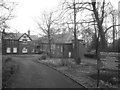
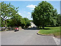
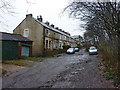
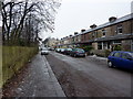
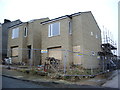
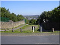
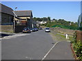
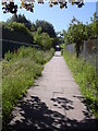
70 photos from this area
Area Information
Key information about the BB11 2JU including its size, population, and administrative classification.
- Area Type
- Postcode
- Area Size
- 6924 m²
- Population
- 1271
- Population Density
- 5741 people/km²
House Prices in BB11 2JU
20
Properties
£114,909
Average Sold Price
£49,000
Lowest Price
£163,000
Highest Price
Showing 20 properties
| Address | Type | Beds | Baths | Last Sale Price | Last Sale Date | |
|---|---|---|---|---|---|---|
| 2 Rosemount Avenue, Burnley, BB11 2JU | Semi-detached | 3 | 1 | £163,000 | Mar 2024 | |
| 6 Rosemount Avenue, Burnley, BB11 2JU | house | - | - | £155,000 | Jan 2022 | |
| 18 Rosemount Avenue, Burnley, BB11 2JU | house | - | - | £147,500 | Nov 2021 | |
| 24 Rosemount Avenue, Burnley, BB11 2JU | Semi-detached | 3 | 1 | £160,000 | Aug 2020 | |
| 5 Rosemount Avenue, Burnley, BB11 2JU | Semi-detached | 2 | 1 | £132,500 | Oct 2019 | |
| 22 Rosemount Avenue, Burnley, BB11 2JU | Semi-detached | 3 | 1 | £156,000 | Aug 2018 | |
| 10 Rosemount Avenue, Burnley, BB11 2JU | Semi-detached | 2 | 1 | £114,000 | Jan 2018 | |
| 11 Rosemount Avenue, Burnley, BB11 2JU | house | - | - | £100,950 | Jun 2014 | |
| 4 Rosemount Avenue, Burnley, BB11 2JU | Semi-detached | 3 | 1 | £134,000 | Jul 2010 | |
| 8 Rosemount Avenue, Burnley, BB11 2JU | Terraced | - | - | £93,500 | Feb 2008 |
Page 1 of 2
Energy Efficiency in BB11 2JU
Amenities
Schools
| Rank | School | Type | Entry gender | Ages |
|---|
Explore more schools in this area
Go to Schools tabDemographics
Household Size
Family (3-5 people)
most common
Accommodation Type
Houses
most common
Tenure
89
majority
Ethnic Group
White
most common
Religion
N/A
most common
Household Composition
N/A
most common
Age
47
median
Adults (30-64 years)
most common
Household Deprivation
N/A
with no deprivation
NS-SEC
35
in Lower managerial occupations
Explore more demographic insights in this area
Go to Demographics tabPlanning
Planning Constraints
- Flood RiskPremium
- Ramsar Wetland SitesPremium
- Area of Outstanding Natural BeautyPremium
- Protected Nature ReservePremium
- Protected WoodlandPremium