Area Overview for BB11 1TS
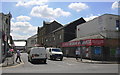
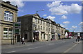
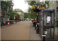
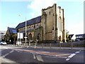
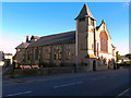
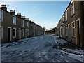
Photos of BB11 1TS
Area Information
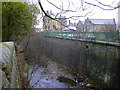
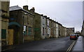
Living in BB11 1TS means residing in a specific residential cluster within the Daneshouse, Stoneyholme electoral ward of Burnley. This postcode covers approximately 1.0 hectare and serves a population of 2,054 people. The location sits immediately north of Burnley town centre, bounded by the M65 motorway to the west and the railway line to the east. The area is defined by predominantly pre-1919 terraced housing built between 1860 and 1930. These structures were constructed to house Burnley's expanding workforce during a period of significant industrial development influenced by the Leeds and Liverpool Canal and East Lancashire railway. The neighbourhood retains characteristics of its history as a close-knit urban district with former factories and mills interspersed with the terraced streets. You are stepping into a space where the layout of the streets reflects the rapid expansion of the late 19th and early 20th centuries. Daily life here is shaped by this dense urban fabric and the proximity to major transport links that define the ward's geography.
- Area Type
- Postcode
- Area Size
- 1.0 hectares
- Population
- 2054
- Population Density
- 200724 people/km²
The property market in BB11 1TS is strongly characterised by rental living rather than home ownership. With a housing stock composition where 27% of homes are owner-occupied, the area functions primarily as a rental market for residents seeking accommodation. The dominant accommodation type in this cluster is houses, including the extensive pre-1919 terraced housing that defines the visual character of the ward. This housing stock dates largely from the era between 1860 and 1930 when the area was developed to accommodate industrial workers. For you as a buyer or investor, this suggests a locale where security of tenure in the form of long-term ownership is less common than projected tenancy. The small area size of 1.0 hectare limits the volume of properties available within the BB11 1TS postcode itself, making each property significant to the local housing supply. Buyers looking here should expect a market driven by tenants requiring homes in this specific part of Burnley while the larger ward of Daneshouse, Stoneyholme and Duke Bar provides the broader housing context.
House Prices in BB11 1TS
Showing 19 properties
| Address | Type | Beds | Baths | Last Sale Price | Last Sale Date | |
|---|---|---|---|---|---|---|
| 54 Bank Parade, Burnley, BB11 1TS | house | 1 | 1 | £125,000 | Mar 2022 | |
| 62 Bank Parade, Burnley, BB11 1TS | Semi-detached | 4 | 2 | £110,000 | May 2016 | |
| Former, 62A Bank Parade, Burnley, BB11 1TS | undefined | - | - | - | - | |
| Aldo Due Italian Ristorante And Wine Bar, 58A Bank Parade, Burnley, BB11 1TS | restaurant_cafe | - | - | - | - | |
| Solace Foot Health And Reflexology Ltd, Churchill House, 60 Bank Parade, Burnley, BB11 1TS | retail_financial | - | - | - | - | |
| Flat 3, 66 Bank Parade, Burnley, BB11 1TS | Flat | - | - | - | - | |
| Flat 4, 68 Bank Parade, Burnley, BB11 1TS | Flat | - | - | - | - | |
| Flat 1, 68 Bank Parade, Burnley, BB11 1TS | Flat | - | - | - | - | |
| Flat 5, 68 Bank Parade, Burnley, BB11 1TS | Flat | - | - | - | - | |
| Flat 2, 68 Bank Parade, Burnley, BB11 1TS | Flat | - | - | - | - |
Energy Efficiency in BB11 1TS
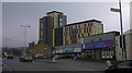
Your daily lifestyle in BB11 1TS benefits from a dense array of retail and transport amenities located within practical reach. For shopping needs, you are close to Iceland Burnley, Sainsburys Burnley, and Aldi Burnley, covering your weekly grocery requirements without needing a long drive. Retail infrastructure in the wider Daneshouse ward includes these major chains alongside independent shops found on the main roads. Transport connectivity is a key feature of your access to the rest of Lancashire. Five railway stations serve the area, with Burnley Central Railway Station and Burnley Manchester Road Railway Station being the primary hubs for journeys to Leeds, Manchester, and beyond. The Leeds and Liverpool Canal runs through the eastern side of the ward, adding a scenic element to your local landscape. You can combine errands in local supermarkets with easy train travel to work or leisure activities using these well-positioned transport nodes.
Amenities
Schools
Families living in BB11 1TS have access to educational institutions within the wider Daneshouse ward boundary. The nearest primary education option is Burnley St Peter's Church of England Primary School, which holds a 'good' Ofsted rating. This provides a designated local option for early years education within the catchment area of the surrounding wards. For older children, Burnley College is available as a sixth-form institution nearby. This creates a mixed educational landscape where primary schooling is represented by a specific church of England school, while further education relies on a college facility. The proximity of these institutions means you do not need to travel far for your children's schooling, although they are situated outside the tiny 1.0 hectare footprint of the BB11 1TS postcode itself. You must consider the travel distances between your home in this cluster and the main school buildings located in the adjacent Stoneyholme and Duke Bar districts.
| Rank | School | Type | Entry gender | Ages |
|---|
Explore more schools in this area
Go to Schools tabDemographics
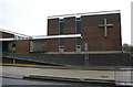
The community in BB11 1TS reflects a distinct demographic profile with a median age of 22 years. While the median age suggests a young population, the most common age group consists of adults aged 30 to 64 years. This indicates a neighbourhood populated largely by working-age adults rather than families with young children. Households in this postcode show a home ownership rate of just 27%, meaning the vast majority of residences are let. You will find that accommodation type is predominantly houses, though the high density of 200,724 people per square kilometre points to closely packed living arrangements typical of the ward's terraced streets. The area is ethnically diverse, with the Asian population being the predominant group. This demographic concentration aligns with wider census data for the Daneshouse ward, where the Asian or Asian British population reached nearly 91% in recent records. Cultural institutions such as the Burnley Islamic Cultural Centre serve this community, reflecting the strong community presence within this part of Burnley.
Household Size
Accommodation Type
Tenure
Ethnic Group
Religion
Household Composition
Age
Household Deprivation
NS-SEC
Explore more demographic insights in this area
Go to Demographics tabPlanning
Planning Constraints
- Flood RiskPremium
- Ramsar Wetland SitesPremium
- Area of Outstanding Natural BeautyPremium
- Protected Nature ReservePremium
- Protected WoodlandPremium