Area Overview for BB11 1BF
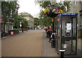
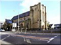
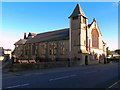
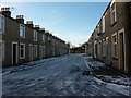
Photos of BB11 1BF
Area Information
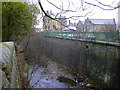
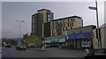
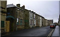
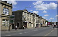
Living in BB11 1BF means inhabiting a small, tightly knit residential cluster in Burnley, Lancashire. With a population of 2,054, this area is defined by its proximity to Burnley town centre and its historical roots in 19th-century terraced housing. The landscape is shaped by the M65 motorway to the west and the Leeds and Liverpool Canal to the east, creating a compact urban environment. The area’s character stems from its industrial past, with former factories and mills giving way to densely packed homes. BB11 1BF sits at the northern edge of Burnley, blending residential life with remnants of its working-class heritage. The community is predominantly Asian British, with a strong Muslim presence, reflecting the area’s cultural identity. While the population is relatively small, the proximity to Burnley’s core amenities and transport links makes it a practical choice for those seeking affordability and connectivity. However, the area’s challenges—such as high deprivation and crime rates—mean residents must weigh convenience against these factors when considering a move.
- Area Type
- Postcode
- Area Size
- Not available
- Population
- 2054
- Population Density
- 2800 people/km²
The property market in BB11 1BF reflects its low home ownership rate of 27%, suggesting that most residents rent rather than own their homes. The accommodation type is primarily houses, which is notable in a small, densely populated area. This mix of housing stock may appeal to families seeking more space, but the limited number of properties means competition is fierce for buyers. The area’s compact size and proximity to Burnley’s town centre make it a niche market, with properties likely to be older terraced homes or converted industrial buildings. For those considering purchase, the low home ownership rate implies limited availability of owner-occupied properties, potentially driving up prices. Buyers should also factor in the area’s socioeconomic challenges, which may affect property values and long-term investment potential. The immediate surroundings offer few alternatives, so buyers must weigh affordability against the area’s practical advantages.
House Prices in BB11 1BF
No properties found in this postcode.
Energy Efficiency in BB11 1BF
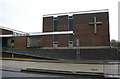
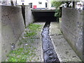
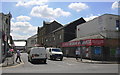
The lifestyle in BB11 1BF is shaped by its proximity to essential amenities. Retail options include Iceland Burnley and M&S Burnley, providing access to groceries and household goods. The area’s rail network is extensive, with stations like Burnley Central and Burnley Barracks offering links to regional and national routes. While parks and green spaces are not explicitly mentioned in the data, the presence of the River Calder in Stoneyholme and the historical Old Hall Farm suggest some natural elements. The community’s cultural identity is reflected in institutions like the Burnley Islamic Cultural Centre and Shah Jalal Mosque, which contribute to local life. However, the data does not detail leisure or dining options beyond the listed retail and transport hubs. The combination of practical amenities and cultural landmarks creates a functional, if modest, lifestyle for residents.
Amenities
Schools
Residents of BB11 1BF have access to two notable educational institutions. Burnley St Peter’s Church of England Primary School offers a good Ofsted rating, providing a solid foundation for young children. For older students, Burnley College serves as a sixth-form provider, catering to those pursuing further education or vocational training. The combination of a primary school with a strong rating and a sixth-form college ensures families can access education at multiple stages without leaving the area. However, the absence of secondary schools in the immediate vicinity may require students to commute to nearby towns for secondary education. The schools’ presence supports families with children, but the lack of a full range of educational stages highlights a potential gap for those requiring continuous schooling within the area.
| Rank | School | Type | Entry gender | Ages |
|---|
Explore more schools in this area
Go to Schools tabDemographics
The demographic profile of BB11 1BF is shaped by a median age of 22, though the most common age range is adults aged 30–64. This suggests a mix of young families and working-age residents. Home ownership is low, at 27%, indicating a rental-dominated market. The accommodation type is primarily houses, which is unusual for a densely populated area, though the data does not clarify whether these are detached or semi-detached. The predominant ethnic group is Asian_total, with 90.85% of the population identifying as Asian or Asian British. This aligns with the area’s reputation as one of the UK’s most deprived wards, where two-thirds of children live in poverty. The high deprivation score correlates with limited economic opportunities and higher crime rates, which impact quality of life. The 2021 census highlights that 80% of the Asian population is Muslim, further influencing the cultural and social fabric of the community.
Household Size
Accommodation Type
Tenure
Ethnic Group
Religion
Household Composition
Age
Household Deprivation
NS-SEC
Explore more demographic insights in this area
Go to Demographics tabPlanning
Planning Constraints
- Flood RiskPremium
- Ramsar Wetland SitesPremium
- Area of Outstanding Natural BeautyPremium
- Protected Nature ReservePremium
- Protected WoodlandPremium