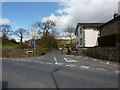
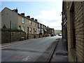
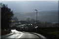
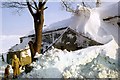
Area Overview for BB10 4RN
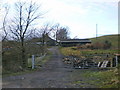
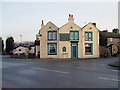
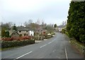
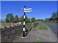
Photos of BB10 4RN
Area Information
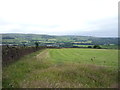
Cliviger, covered by the BB10 4RN postcode, is a civil parish and former township located within the Borough of Burnley in North West England. This residential cluster sits in the Cliviger Gorge along the River Calder, occupying a specific area of 12.1 hectares. With a population of 1,394, the community maintains a density of 214 people per square kilometre, creating an environment that feels distinctively local rather than part of a sprawling urban sprawl. The area has deep historical roots, first referenced around 1160 when land was granted to Kirkstall Abbey, and later evolved industrially with the construction of Lancashire's first blast furnace around 1700. Daily life here is shaped by its location within the Whalley parish. The postcode cluster reflects a settlement that has maintained its character through centuries of change, situated at coordinates 53.76812, -2.211811. For someone buying homes in BB10 4RN, the setting offers a connection to Lancashire's heritage while providing a tight-knit residential experience. The area's identity is firmly tied to its geography and its transition from agricultural and industrial origins to its current status as a small, conscious community. Understanding the specific context of this postcode helps you appreciate the quiet, established nature of living here away from immediate urban centres.
- Area Type
- Postcode
- Area Size
- 12.1 hectares
- Population
- 1394
- Population Density
- 214 people/km²
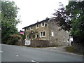
Homes in BB10 4RN represent a market dominated by existing stock rather than new developments. The accommodation type is exclusively houses, meaning you will not find flats or purpose-built apartments in this postcode cluster. The extremely high home ownership rate of 92% indicates that the vast majority of properties were purchased by their current occupants over time. This is not a transient rental market; it is a stable residential area where people buy to stay. The total area of 12.1 hectares contains 1,394 residents, which tightens the supply of available properties. For buyers considering this location, the market dynamics are influenced by the fact that 92% of households own their homes. New lots for sale must come from the existing housing stock being vacated by owners. The prevalence of houses over other property types limits the variety of home styles but ensures consistency in the residential character. The population density of 214 people per square kilometre suggests a spread-out neighbourhood where each house typically has more space than in a city centre. Consequently, access to large plots of land is a characteristic feature here. The historical context of the area, including its past industrial use, means the housing may range from older traditional builds adapted for modern living to maintained properties with local charm.
House Prices in BB10 4RN
Showing 2 properties
| Address | Type | Beds | Baths | Last Sale Price | Last Sale Date | |
|---|---|---|---|---|---|---|
| Braestones, The Long Causeway, Cliviger, BB10 4RN | house | - | - | £45,000 | Jul 2004 | |
| Braeside, The Long Causeway, Cliviger, BB10 4RN | Detached | - | - | - | - |
Energy Efficiency in BB10 4RN
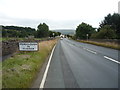
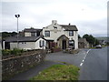
Living in BB10 4RN offers a lifestyle that balances proximity to town amenities with the quiet of a small parish. You have access to five retail outlets within practical reach, including stores like Spar and Tesco Burnley. These shops allow you to handle weekly grocery shopping and basic essentials without needing to travel far into Burnley town centre. For dining and socialising, the area boasts historic establishments such as the Ram Inn, which has been referenced since 1630, and Neno's Restaurant and Bar, located in the former Fighting Cocks pub. The Kettle Drum pub also sits nearby, offering local employment history linked to Colonel Charles Townley and the 1861 Epsom Derby. Cultural and historical interest is integrated into your daily environment through sites like Holme Chapel, a Grade II listed church built between 1788 and 1794. You can explore the simple classical style architecture and carved oak stalls inside this building. The history of the Cliviger Gorge, including the former weaving shed at Walk Mill which operated with 736 looms, adds depth to the local story. While specific data on parks or large leisure facilities is not provided in the source details, the presence of the River Calder and the historical landscape of the gorge defines the local scenery. The nearest rail stations, including Burnley Central, ensure you can reach broader cultural amenities when you wish to step out of the neighbourhood. The area caters to those who value local history and convenient access to towns.
Amenities
Schools
| Rank | School | Type | Entry gender | Ages |
|---|
Explore more schools in this area
Go to Schools tabDemographics
The community in BB10 4RN is defined by a mature demographic profile, with a median age of 47. Adults aged between 30 and 64 years constitute the most common age range within this cluster. This indicates a neighbourhood where families and established homeowners reside, rather than a hub for students or young professionals seeking entry-level rentals. Home ownership stands at 92%, which is a very high proportion for any area in the UK. This statistic confirms that the housing stock is primarily occupied by people who have purchased their properties, suggesting high stability and low short-term rental turnover. The predominant ethnic group is White, reflecting the traditional character of the region as part of Lancashire. The majority of dwellings are houses, consistent with the historical development of the Cliviger Gorge. The social fabric here is built on long-term residency, where 92% of residents own their homes. This figure implies that local neighbours are likely to remain in the area for decades. There is little data on deprivation in the provided information, so the focus remains on the high rate of ownership. High ownership rates generally correlate with invested communities where residents take a vested interest in local improvements. The age distribution strongly suggests an area suitable for those seeking a settled, owner-occupied lifestyle away from high-density urban life.
Household Size
Accommodation Type
Tenure
Ethnic Group
Religion
Household Composition
Age
Household Deprivation
NS-SEC
Explore more demographic insights in this area
Go to Demographics tabPlanning
Planning Constraints
- Flood RiskPremium
- Ramsar Wetland SitesPremium
- Area of Outstanding Natural BeautyPremium
- Protected Nature ReservePremium
- Protected WoodlandPremium