Area Overview for BB10 4JN
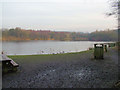
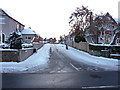
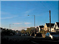
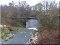
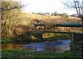
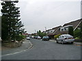
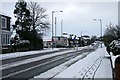
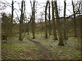
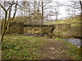
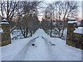
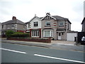
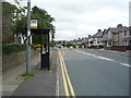
Photos of BB10 4JN
Area Information
BB10 4JN is a small, rural postcode area in Lancashire, England, encompassing the villages of Worsthorne and Hurstwood. With a population of 1,361, it retains a quiet, historic character shaped by centuries of settlement. The area is defined by its 16th- and 17th-century cottages, early Industrial Revolution millworkers’ housing, and conservation-area status, which preserves its architectural heritage. Residents benefit from proximity to Burnley’s urban amenities while enjoying rural tranquillity. The postcode falls within the Worsthorne Conservation Area, protecting its listed buildings, including Hurstwood Hall and St John the Evangelist’s Church. Daily life here balances historic charm with practical connectivity, including nearby railway stations and essential retail. The area’s low crime rate and flood risk make it appealing for those seeking a stable, community-oriented lifestyle. Its small size means residents know their neighbours, and the village atmosphere remains intact despite modern infrastructure. For buyers, BB10 4JN offers a rare blend of heritage and convenience, ideal for those valuing both history and accessibility.
- Area Type
- Postcode
- Area Size
- Not available
- Population
- 1361
- Population Density
- 1368 people/km²
The property market in BB10 4JN is dominated by owner-occupied homes, with 91% of properties in private hands. This high rate of home ownership indicates a stable, long-term resident base and limited rental activity. The accommodation type is predominantly houses, reflecting the rural, low-density character of the area. This contrasts with urban centres where flats or apartments dominate. For buyers, the market offers a mix of historic and traditional properties, including 16th- and 17th-century cottages and millworkers’ dwellings. The small size of the postcode means the housing stock is limited, but the conservation-area status ensures architectural quality. Buyers should expect a focus on family homes with garden space, catering to those seeking a quieter, heritage-rich lifestyle. The lack of high-rise or modern developments makes this area distinct, appealing to those valuing historical integrity over speculative investment.
House Prices in BB10 4JN
No properties found in this postcode.
Energy Efficiency in BB10 4JN
Living in BB10 4JN offers a mix of rural charm and practical amenities. Within practical reach are five retail outlets, including Spar and Tesco Burnley, ensuring access to daily essentials. The area’s historic character is complemented by its proximity to Burnley’s urban centres, though local life remains centred on the village’s conservation-area buildings and green spaces. The nearby railway stations, such as Burnley Barracks and Burnley Central, provide easy access to larger towns for shopping, dining, and leisure. While the area itself is rural, the surrounding region offers more extensive facilities. The presence of listed buildings, including Hurstwood Hall and 18th-century barns, adds cultural value. Residents benefit from a low-stress lifestyle, with the convenience of nearby transport and retail balancing the quiet, historic environment.
Amenities
Schools
| Rank | School | Type | Entry gender | Ages |
|---|
Explore more schools in this area
Go to Schools tabDemographics
The population of BB10 4JN is 1,361, with a median age of 47, indicating a mature community. The most common age range is adults aged 30–64, suggesting a stable, established demographic. Home ownership is exceptionally high at 91%, reflecting a long-term resident base with strong ties to the area. The predominant accommodation type is houses, aligning with the rural, low-density nature of the postcode. The predominant ethnic group is White, with no specific data provided on other groups. This demographic profile implies a community prioritising security, continuity, and family-oriented living. The absence of detailed diversity statistics means the area’s cultural composition remains largely unexplored in public data. However, the high home ownership rate and age profile suggest a population less likely to move frequently, fostering a cohesive local identity.
Household Size
Accommodation Type
Tenure
Ethnic Group
Religion
Household Composition
Age
Household Deprivation
NS-SEC
Explore more demographic insights in this area
Go to Demographics tabPlanning
Planning Constraints
- Flood RiskPremium
- Ramsar Wetland SitesPremium
- Area of Outstanding Natural BeautyPremium
- Protected Nature ReservePremium
- Protected WoodlandPremium