Area Overview for BB10 4HP
Photos of BB10 4HP
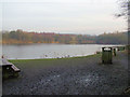
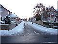
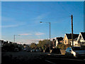
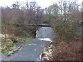
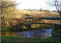
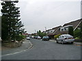
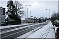
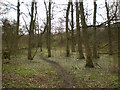
59 photos from this area
Area Information
Key information about the BB10 4HP including its size, population, and administrative classification.
- Area Type
- Postcode
- Area Size
- 2.7 hectares
- Population
- 1709
- Population Density
- 1768 people/km²
House Prices in BB10 4HP
49
Properties
£153,329
Average Sold Price
£12,000
Lowest Price
£285,000
Highest Price
Showing 49 properties
| Address | Type | Beds | Baths | Last Sale Price | Last Sale Date | |
|---|---|---|---|---|---|---|
| 531 Brunshaw Road, Burnley, BB10 4HP | house | 2 | 1 | £184,000 | Nov 2025 | |
| 530 Brunshaw Road, Burnley, BB10 4HP | Semi-detached | 3 | 1 | £270,000 | Aug 2024 | |
| 524 Brunshaw Road, Burnley, BB10 4HP | Terraced | 3 | 1 | £187,000 | May 2023 | |
| 551 Brunshaw Road, Burnley, BB10 4HP | Semi-detached | 3 | 1 | £263,500 | Dec 2022 | |
| 544 Brunshaw Road, Burnley, BB10 4HP | Retail | 4 | 2 | £285,000 | Oct 2022 | |
| 550 Brunshaw Road, Burnley, BB10 4HP | house | - | - | £130,000 | Aug 2022 | |
| 568 Brunshaw Road, Burnley, BB10 4HP | house | 3 | - | £240,000 | Jun 2022 | |
| 542 Brunshaw Road, Burnley, BB10 4HP | house | - | - | £245,000 | Feb 2022 | |
| 564 Brunshaw Road, Burnley, BB10 4HP | Bungalow | - | - | £200,000 | Aug 2021 | |
| 539 Brunshaw Road, Burnley, BB10 4HP | house | 3 | 1 | £193,050 | Jul 2021 |
Page 1 of 5
Energy Efficiency in BB10 4HP
Amenities
Schools
| Rank | School | Type | Entry gender | Ages |
|---|
Explore more schools in this area
Go to Schools tabDemographics
Household Size
One person
most common
Accommodation Type
Houses
most common
Tenure
55
majority
Ethnic Group
White
most common
Religion
N/A
most common
Household Composition
N/A
most common
Age
47
median
Adults (30-64 years)
most common
Household Deprivation
N/A
with no deprivation
NS-SEC
26
in Lower managerial occupations
Explore more demographic insights in this area
Go to Demographics tabPlanning
Planning Constraints
- Flood RiskPremium
- Ramsar Wetland SitesPremium
- Area of Outstanding Natural BeautyPremium
- Protected Nature ReservePremium
- Protected WoodlandPremium