Area Overview for BB10 4ES
Photos of BB10 4ES
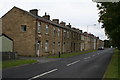
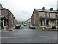
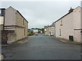
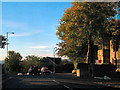
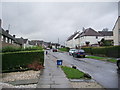
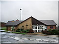
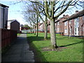
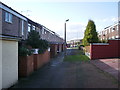
35 photos from this area
Area Information
Key information about the BB10 4ES including its size, population, and administrative classification.
- Area Type
- Postcode
- Area Size
- 3602 m²
- Population
- 1598
- Population Density
- 443631 people/km²
House Prices in BB10 4ES
28
Properties
£63,894
Average Sold Price
£26,000
Lowest Price
£110,000
Highest Price
Showing 28 properties
| Address | Type | Beds | Baths | Last Sale Price | Last Sale Date | |
|---|---|---|---|---|---|---|
| 85 Brockenhurst Street, Burnley, BB10 4ES | Terraced | 3 | 1 | £90,000 | May 2025 | |
| 98 Brockenhurst Street, Burnley, BB10 4ES | Terraced | 3 | 1 | £91,500 | Jul 2024 | |
| 86 Brockenhurst Street, Burnley, BB10 4ES | Terraced | 2 | 1 | £82,000 | Sep 2023 | |
| 75 Brockenhurst Street, Burnley, BB10 4ES | Terraced | 3 | 1 | £110,000 | Mar 2023 | |
| 84 Brockenhurst Street, Burnley, BB10 4ES | Terraced | 2 | 1 | £50,000 | Jan 2023 | |
| 71 Brockenhurst Street, Burnley, BB10 4ES | house | - | - | £77,000 | Oct 2022 | |
| 82 Brockenhurst Street, Burnley, BB10 4ES | Terraced | 2 | 1 | £77,000 | Jan 2022 | |
| 74 Brockenhurst Street, Burnley, BB10 4ES | house | - | - | £57,750 | May 2021 | |
| 80 Brockenhurst Street, Burnley, BB10 4ES | house | 2 | 1 | £55,000 | Jan 2019 | |
| 78 Brockenhurst Street, Burnley, BB10 4ES | Terraced | 2 | 1 | £68,000 | Apr 2018 |
Page 1 of 3
Energy Efficiency in BB10 4ES
Amenities
Schools
| Rank | School | Type | Entry gender | Ages |
|---|
Explore more schools in this area
Go to Schools tabDemographics
Household Size
Two person
most common
Accommodation Type
Houses
most common
Tenure
60
majority
Ethnic Group
White
most common
Religion
N/A
most common
Household Composition
N/A
most common
Age
47
median
Adults (30-64 years)
most common
Household Deprivation
N/A
with no deprivation
NS-SEC
20
in Lower managerial occupations
Explore more demographic insights in this area
Go to Demographics tabPlanning
Planning Constraints
- Flood RiskPremium
- Ramsar Wetland SitesPremium
- Area of Outstanding Natural BeautyPremium
- Protected Nature ReservePremium
- Protected WoodlandPremium