Area Overview for BB10 3HA
Photos of BB10 3HA
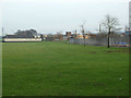
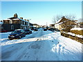
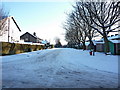
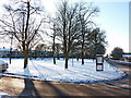
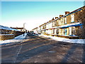
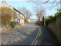
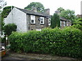
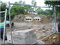
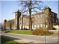
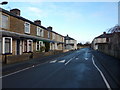
43 photos from this area
Area Information
Key information about the BB10 3HA including its size, population, and administrative classification.
- Area Type
- Postcode
- Area Size
- 1.1 hectares
- Population
- 1588
- Population Density
- 2382 people/km²
House Prices in BB10 3HA
34
Properties
£104,533
Average Sold Price
£35,500
Lowest Price
£163,000
Highest Price
Showing 34 properties
| Address | Type | Beds | Baths | Last Sale Price | Last Sale Date | |
|---|---|---|---|---|---|---|
| 9 Cromer Avenue, Burnley, BB10 3HA | house | 3 | 1 | £147,500 | Apr 2022 | |
| 15 Cromer Avenue, Burnley, BB10 3HA | house | - | - | £125,000 | Aug 2021 | |
| 11 Cromer Avenue, Burnley, BB10 3HA | house | - | - | £115,000 | Dec 2020 | |
| 39 Cromer Avenue, Burnley, BB10 3HA | Semi-detached | 3 | - | £113,500 | Aug 2017 | |
| 27 Cromer Avenue, Burnley, BB10 3HA | Semi-detached | 3 | 1 | £105,000 | Apr 2017 | |
| 12 Cromer Avenue, Burnley, BB10 3HA | Semi-detached | 4 | 1 | £126,000 | Feb 2016 | |
| 1 Cromer Avenue, Burnley, BB10 3HA | Semi-detached | 3 | - | £163,000 | Nov 2015 | |
| 37 Cromer Avenue, Burnley, BB10 3HA | Semi-detached | 3 | - | £95,000 | Apr 2015 | |
| 19 Cromer Avenue, Burnley, BB10 3HA | Semi-detached | 3 | - | £120,000 | Mar 2015 | |
| 25 Cromer Avenue, Burnley, BB10 3HA | Semi-detached | 3 | 1 | £59,950 | Sep 2003 |
Page 1 of 4
Energy Efficiency in BB10 3HA
Amenities
Schools
| Rank | School | Type | Entry gender | Ages |
|---|
Explore more schools in this area
Go to Schools tabDemographics
Household Size
Family (3-5 people)
most common
Accommodation Type
Houses
most common
Tenure
70
majority
Ethnic Group
White
most common
Religion
N/A
most common
Household Composition
N/A
most common
Age
47
median
Adults (30-64 years)
most common
Household Deprivation
N/A
with no deprivation
NS-SEC
24
in Lower managerial occupations
Explore more demographic insights in this area
Go to Demographics tabPlanning
Planning Constraints
- Flood RiskPremium
- Ramsar Wetland SitesPremium
- Area of Outstanding Natural BeautyPremium
- Protected Nature ReservePremium
- Protected WoodlandPremium