Area Overview for BB10 3ET
Photos of BB10 3ET
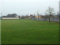
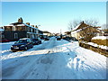
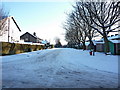
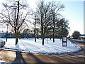
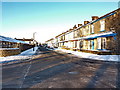
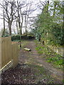
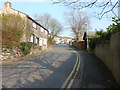
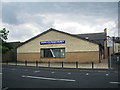
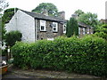
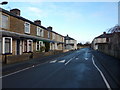
43 photos from this area
Area Information
Key information about the BB10 3ET including its size, population, and administrative classification.
- Area Type
- Postcode
- Area Size
- 3028 m²
- Population
- 1859
- Population Density
- 4803 people/km²
House Prices in BB10 3ET
11
Properties
£70,855
Average Sold Price
£28,000
Lowest Price
£127,500
Highest Price
Showing 11 properties
| Address | Type | Beds | Baths | Last Sale Price | Last Sale Date | |
|---|---|---|---|---|---|---|
| 20 Basnett Street, Burnley, BB10 3ET | Semi-detached | 2 | - | £127,500 | Jul 2025 | |
| 65 Basnett Street, Burnley, BB10 3ET | Terraced | 2 | 1 | £91,000 | Aug 2024 | |
| 18 Basnett Street, Burnley, BB10 3ET | Semi-detached | 2 | - | £115,000 | Aug 2022 | |
| 77 Basnett Street, Burnley, BB10 3ET | Retail | 2 | - | £79,950 | Aug 2022 | |
| 75 Basnett Street, Burnley, BB10 3ET | Terraced | 2 | 1 | £95,000 | Jul 2022 | |
| 63 Basnett Street, Burnley, BB10 3ET | house | 3 | 2 | £63,000 | Apr 2020 | |
| 67 Basnett Street, Burnley, BB10 3ET | Terraced | 2 | - | £56,000 | Jul 2015 | |
| 73 Basnett Street, Burnley, BB10 3ET | Terraced | 2 | 1 | £64,500 | Oct 2005 | |
| 79 Basnett Street, Burnley, BB10 3ET | Terraced | - | - | £29,950 | Sep 2002 | |
| 69 Basnett Street, Burnley, BB10 3ET | Terraced | - | - | £29,500 | Oct 2001 |
Page 1 of 2
Energy Efficiency in BB10 3ET
Amenities
Schools
| Rank | School | Type | Entry gender | Ages |
|---|
Explore more schools in this area
Go to Schools tabDemographics
Household Size
One person
most common
Accommodation Type
Houses
most common
Tenure
46
majority
Ethnic Group
White
most common
Religion
N/A
most common
Household Composition
N/A
most common
Age
47
median
Adults (30-64 years)
most common
Household Deprivation
N/A
with no deprivation
NS-SEC
16
in Lower managerial occupations
Explore more demographic insights in this area
Go to Demographics tabPlanning
Planning Constraints
- Flood RiskPremium
- Ramsar Wetland SitesPremium
- Area of Outstanding Natural BeautyPremium
- Protected Nature ReservePremium
- Protected WoodlandPremium