Area Overview for BB10 2TQ
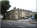
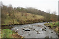
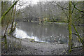
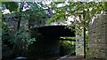
Photos of BB10 2TQ


Area Information
BB10 2TQ is a compact residential postcode in England, covering just 4.5 hectares and home to 1,588 residents. Its high population density of 35,628 people per square kilometre reflects a tightly knit community, typical of urban or semi-urban settings. The area’s proximity to Burnley and its surrounding infrastructure makes it a practical choice for those seeking a balance between convenience and space. While the ward’s historical context is tied to broader Lancashire developments, the modern character of BB10 2TQ is defined by its accessibility to essential services and transport links. Daily life here is shaped by proximity to retail hubs, rail networks, and a mix of primary and special schools. The area’s small size means residents are likely to know their neighbours, though the density also underscores the need for efficient planning. For buyers, BB10 2TQ offers a snapshot of a mature, established community with a focus on practical living, though its limited size means growth potential is constrained.
- Area Type
- Postcode
- Area Size
- 4.5 hectares
- Population
- 1588
- Population Density
- 2382 people/km²
The property market in BB10 2TQ is dominated by owner-occupied homes, with 70% of properties in private hands. This contrasts with areas where rental demand drives the market, suggesting a more settled demographic. The accommodation type is primarily houses, which, given the area’s small size, may indicate a mix of semi-detached or terraced housing. The high home ownership rate implies limited availability of rental properties, which could be a consideration for buyers seeking investment opportunities or flexibility. The compact nature of the postcode means the housing stock is likely concentrated within a small radius, potentially limiting options for those seeking larger properties or specific architectural styles. For buyers, the area’s established character and proximity to services may outweigh its limited size, though the market’s stability could make it a reliable choice for long-term residency.
House Prices in BB10 2TQ
No properties found in this postcode.
Energy Efficiency in BB10 2TQ
The lifestyle in BB10 2TQ is shaped by its proximity to retail and transport hubs. Residents can access major supermarkets such as Iceland Burnley, Lidl Browhead, and Tesco Reedley, ensuring convenience for shopping and daily essentials. The rail network, with stations like Burnley Central and Brierfield, connects the area to broader regional routes, facilitating commuting or leisure travel. While the data does not specify parks or leisure facilities, the presence of multiple retail and transport options suggests a focus on practicality over expansive recreational spaces. The compact nature of the postcode means amenities are within walking or short driving distance, contributing to a lifestyle that prioritises accessibility. For those valuing ease of access to services, BB10 2TQ offers a straightforward, functional environment.
Amenities
Schools
Residents of BB10 2TQ have access to a range of educational institutions, including primary and special schools. Burnley Walshaw High School and Sir John Thursby Community College cater to primary education, with the latter holding an Ofsted rating of ‘good’. Burnley Primrose Hill School and Ridgewood Community High School are special needs institutions, reflecting the area’s commitment to inclusive education. The Isaac Centre, classified as ‘other’, may offer additional learning or community services. This mix of school types ensures families can find options tailored to their children’s needs, whether mainstream or specialist. The presence of multiple schools within reach suggests the area is well-served for educational purposes, though the specific catchment areas and school performance data are not detailed in the provided information.
| Rank | School | Type | Entry gender | Ages |
|---|
Explore more schools in this area
Go to Schools tabDemographics
The population of BB10 2TQ has a median age of 47, with the majority of residents falling within the 30–64 age range. This suggests a community skewed towards adults, likely with families or long-term residents. Home ownership rates stand at 70%, indicating a strong presence of owner-occupied properties. The predominant accommodation type is houses, which aligns with the area’s residential character. The predominant ethnic group is White, reflecting broader demographic trends in the region. With no specific data on deprivation levels, it is difficult to assess socioeconomic diversity, but the high home ownership rate and mature age profile suggest a stable, established population. The absence of detailed diversity metrics means the community’s full composition remains partially opaque, though the data confirms a focus on family-oriented living.
Household Size
Accommodation Type
Tenure
Ethnic Group
Religion
Household Composition
Age
Household Deprivation
NS-SEC
Explore more demographic insights in this area
Go to Demographics tabPlanning
Planning Constraints
- Flood RiskPremium
- Ramsar Wetland SitesPremium
- Area of Outstanding Natural BeautyPremium
- Protected Nature ReservePremium
- Protected WoodlandPremium