Area Overview for BB10 2BD
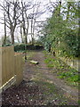
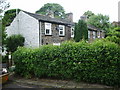
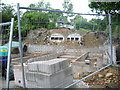
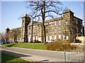
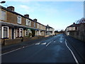
Photos of BB10 2BD
Area Information
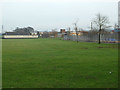
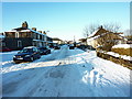
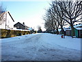
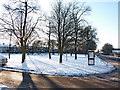
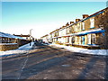
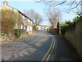
Living in BB10 2BD means being part of a small, tightly knit residential cluster in England, where the population of 1,588 residents contributes to a quiet, community-oriented atmosphere. The area is characterised by its modest scale, with homes predominantly in the form of houses rather than flats, reflecting a stable demographic. With a median age of 47 and a majority of residents aged between 30 and 64, the neighbourhood is home to a mature, established population. Daily life here is shaped by proximity to essential services, including retail outlets and rail connections, which provide both convenience and access to wider networks. While the area lacks large-scale amenities, its compact nature ensures that residents can reach key facilities within practical distances. BB10 2BD is not a place for those seeking urban sprawl, but it offers a simple, low-maintenance lifestyle for those prioritising security, stability, and a sense of local identity.
- Area Type
- Postcode
- Area Size
- Not available
- Population
- 1588
- Population Density
- 2382 people/km²
The property market in BB10 2BD is defined by its high home ownership rate of 70%, which indicates a community where most residents are long-term property owners rather than renters. The accommodation type is exclusively houses, which contrasts with areas where flats or apartments dominate. This suggests a housing stock that is likely older, with a focus on single-family homes. Given the area’s small size and limited development, the market is unlikely to be highly dynamic, with fewer opportunities for new builds or speculative investment. For buyers, this means a focus on existing properties, often with established gardens and private spaces. The compact nature of the area also means that property values may be influenced more by local amenities and transport links than by broader regional trends.
House Prices in BB10 2BD
No properties found in this postcode.
Energy Efficiency in BB10 2BD
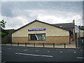
Residents of BB10 2BD have access to a modest but functional array of amenities within practical reach. Retail options include Tesco Reedley, Iceland Burnley, and Lidl Browhead, offering everyday shopping needs without requiring long journeys. The nearby rail stations — Burnley Central, Brierfield, and Burnley Barracks — provide regular services to surrounding areas, enhancing connectivity. While the area lacks large parks or leisure facilities, its compact size means that essential services are close at hand. The mix of retail and transport options supports a lifestyle that balances convenience with simplicity. For those prioritising ease of access over expansive amenities, BB10 2BD offers a straightforward, no-frills approach to daily living, with minimal need to venture beyond the immediate vicinity for basic needs.
Amenities
Schools
Residents of BB10 2BD have access to a range of educational institutions, including Burnley Walshaw High School, a primary school, and Burnley Primrose Hill School, which specialises in supporting students with specific needs. Sir John Thursby Community College is another primary school with an Ofsted rating of ‘good’, offering a reliable option for families. Ridgewood Community High School also caters to special educational needs, while The Isaac Centre provides additional services. This mix of primary, special needs, and other schools ensures that families have options tailored to different requirements. The presence of a ‘good’-rated primary school suggests a baseline of quality in local education, though no secondary schools are listed, which may require students to travel further for secondary education.
| Rank | School | Type | Entry gender | Ages |
|---|
Explore more schools in this area
Go to Schools tabDemographics
The community in BB10 2BD is predominantly composed of adults aged 30 to 64, with a median age of 47. This suggests a mature, settled population, likely with strong ties to the area. Home ownership is high, at 70%, indicating a stable housing market and long-term residency for many residents. The accommodation type is primarily houses, which aligns with the area’s small, residential character. The predominant ethnic group is White, though no specific data on diversity or deprivation is provided. The absence of detailed demographic breakdowns means that while the area’s age profile and ownership rates are clear, broader social or economic factors remain unquantified. This stability, however, is reflected in the low crime risk score of 79, suggesting a neighbourhood where residents are less likely to face safety concerns.
Household Size
Accommodation Type
Tenure
Ethnic Group
Religion
Household Composition
Age
Household Deprivation
NS-SEC
Explore more demographic insights in this area
Go to Demographics tabPlanning
Planning Constraints
- Flood RiskPremium
- Ramsar Wetland SitesPremium
- Area of Outstanding Natural BeautyPremium
- Protected Nature ReservePremium
- Protected WoodlandPremium