Area Overview for BB10 2AN
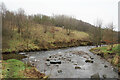
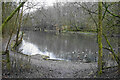
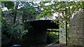
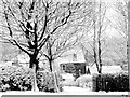
Photos of BB10 2AN


Area Information
BB10 2AN is a small residential postcode area in Burnley, Lancashire, covering 7,353 square metres and home to 1,859 residents. Its population density of 252,818 people per square kilometre reflects a tightly packed community, typical of urban clusters in the North West. The area sits within the Lanehead Ward, a district with historical ties to Burnley’s evolving electoral boundaries. Daily life here is shaped by its proximity to Burnley’s core infrastructure, with a focus on practical living over sprawling landscapes. The area’s compact size means residents are likely within walking or short driving distance of local amenities, though the high population density may influence the pace of life. With a median age of 47 and a majority of residents aged 30–64, the community leans towards mature adults, suggesting a stable demographic with established routines. This is not a young, transient area but one rooted in long-term residency, where familiarity with local services and networks is likely key to daily living.
- Area Type
- Postcode
- Area Size
- 7353 m²
- Population
- 1859
- Population Density
- 4803 people/km²
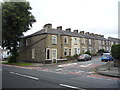
The property market in BB10 2AN is characterised by a 46% home ownership rate, indicating that nearly half of properties are owner-occupied, while the other 54% are likely rented. The accommodation type is predominantly houses, which contrasts with areas where flats or apartments dominate. This suggests a housing stock that may include semi-detached or terraced homes, typical of older urban developments. Given the area’s small size and high population density, the market is likely limited to a small number of properties, making it a niche area for buyers. The focus on houses may appeal to those seeking more space than a flat could offer, though the high density implies proximity to neighbours. For buyers, this means a limited inventory of homes, with potential competition among those seeking owner-occupied properties in a compact, established community. The lack of specific data on property prices or trends means the market’s dynamics remain opaque, but the emphasis on houses suggests a preference for traditional housing over modern developments.
House Prices in BB10 2AN
No properties found in this postcode.
Energy Efficiency in BB10 2AN
The lifestyle in BB10 2AN is shaped by its proximity to retail and transport hubs. Nearby amenities include five retail outlets, such as Lidl Browhead, Iceland Burnley, and Sainsburys Burnley, offering everyday shopping needs within reach. These stores cater to practical living, providing groceries and household essentials. The rail network, with stations like Burnley Central, connects residents to wider opportunities, whether for commuting, leisure, or socialising. While the area lacks detailed information on parks or leisure facilities, its compact nature suggests that local amenities are likely concentrated within a short walk or drive. The presence of multiple retail options and rail links indicates a community focused on convenience, where daily errands and travel are efficiently managed. However, the absence of specific data on green spaces or recreational areas means the area’s potential for outdoor activities remains unexplored in this context.
Amenities
Schools
The only school explicitly mentioned near BB10 2AN is Basnett Street Nursery School, a nursery providing early education for young children. No primary or secondary schools are listed in the data, which limits the range of educational options for families. The absence of higher-level schools may mean residents must travel to nearby areas for primary or secondary education, such as those in Burnley’s central district. The presence of a nursery indicates some local provision for early years education, but the lack of comprehensive school data means the area’s suitability for families with school-age children remains unclear. Parents seeking a full range of educational facilities would need to consider proximity to other schools outside BB10 2AN, as the data does not include further details on school types or Ofsted ratings.
| Rank | School | Type | Entry gender | Ages |
|---|
Explore more schools in this area
Go to Schools tabDemographics
The population of BB10 2AN is predominantly adults aged 30–64, with a median age of 47. This indicates a mature, established community with fewer young families or retirees compared to other areas. Home ownership stands at 46%, meaning just over half of residents own their homes, while the remaining 54% are likely renters. The accommodation type is primarily houses, suggesting a mix of semi-detached or terraced properties rather than flats. The predominant ethnic group is White, with no specific data on other demographics provided. This homogeneity may influence the social fabric of the area, though it is not uncommon in smaller urban postcode clusters. The absence of detailed diversity statistics means the community’s cultural makeup remains largely unexplored in this context. The age profile and home ownership rate together suggest a population that values stability, with many residents likely having lived in the area for years.
Household Size
Accommodation Type
Tenure
Ethnic Group
Religion
Household Composition
Age
Household Deprivation
NS-SEC
Explore more demographic insights in this area
Go to Demographics tabPlanning
Planning Constraints
- Flood RiskPremium
- Ramsar Wetland SitesPremium
- Area of Outstanding Natural BeautyPremium
- Protected Nature ReservePremium
- Protected WoodlandPremium