Area Overview for BB10 1ST
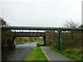
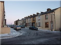
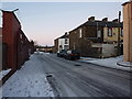
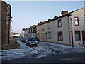
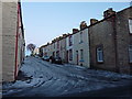
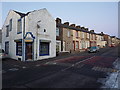
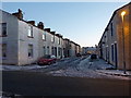
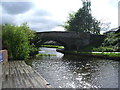
Photos of BB10 1ST
Area Information
Living in BB10 1ST means being part of a small, tightly knit residential cluster in Blackburn with Darwen, Lancashire. With a population of 1,839, this area reflects the historical industrial roots of Blackburn, shaped by its role as a manufacturing hub. The postcode is centred around Queensgate Ward, a community with a distinct character. Residents benefit from proximity to Queen’s Park, a historic green space opened in 1887, offering facilities like tennis courts, a lake, and a bandstand. The area’s compact size means amenities and services are within practical reach, while its location in North West England connects it to broader regional networks. Daily life here balances quiet residential living with access to nearby towns and transport links. The presence of both modern retail outlets and historic sites, such as the former Blackburn Workhouse, adds layers to the area’s identity. For those seeking a mix of practicality and local heritage, BB10 1ST offers a grounded, community-focused environment.
- Area Type
- Postcode
- Area Size
- Not available
- Population
- 1839
- Population Density
- 9850 people/km²
The property market in BB10 1ST is characterised by a 47% home ownership rate, with houses being the predominant type of accommodation. This suggests a focus on single-family homes rather than apartments or flats, which may appeal to families or those seeking more space. The relatively low home ownership percentage implies a significant portion of the housing stock is rented, though the exact balance between owner-occupied and rental properties is not specified. Given the area’s small size, the housing stock is likely limited, which could affect availability for buyers. The presence of houses may also mean properties are larger, potentially influencing price ranges. For buyers, this small postcode area offers a mix of residential options, but proximity to nearby towns like Burnley or Blackburn may be necessary for a broader selection. The market’s character is defined by its historical roots and practical, family-oriented housing.
House Prices in BB10 1ST
No properties found in this postcode.
Energy Efficiency in BB10 1ST
Residents of BB10 1ST enjoy a range of nearby amenities that support daily life. Retail options include Iceland Burnley, Lidl Browhead, and Tesco Reedley, offering convenience for grocery shopping. The area’s rail stations, such as Burnley Central and Brierfield, provide easy access to regional travel. For leisure, Queen’s Park is a focal point, featuring tennis courts, a lake, and a bandstand, offering recreational opportunities. The park’s history, including its origins as a former hospital site, adds a layer of local interest. The mix of practical retail, transport links, and green spaces creates a balanced lifestyle, blending convenience with outdoor activities. While the area’s small size means amenities are limited in scope, the proximity of essential services ensures residents can meet most needs without long journeys.
Amenities
Schools
Residents of BB10 1ST have access to a range of educational institutions, from nursery to sixth form. Barden Primary School, rated ‘good’ by Ofsted, provides a solid foundation for younger children, while St John’s RC Infant School serves the early years. Reedley Hallows Nursery School caters to younger children, and Thomas Whitham Sixth Form offers post-16 education. Holly Grove School, a special needs institution, ensures support for students with specific requirements. This diversity of school types means families can find options that align with their children’s needs, from early education to advanced studies. The presence of both state and faith-based schools reflects the area’s varied educational landscape. For parents, the proximity of multiple schools within practical reach reduces the need for long commutes, enhancing convenience for daily life.
| Rank | School | Type | Entry gender | Ages |
|---|
Explore more schools in this area
Go to Schools tabDemographics
The population of BB10 1ST has a median age of 47, with the majority of residents falling within the 30-64 age range. This suggests a mature, stable community with a focus on established households. Home ownership rates stand at 47%, indicating a mix of owner-occupied properties and rental units, though the exact proportion of rentals is not specified. The predominant accommodation type is houses, which may reflect a preference for family homes in this area. The dominant ethnic group is the Asian population, though specific proportions are not detailed. This demographic profile points to a community with a strong sense of continuity, where many residents have lived for extended periods. The absence of specific deprivation data means quality of life factors like access to services or employment opportunities are not quantified, but the presence of schools, retail, and transport links suggests reasonable infrastructure for daily needs.
Household Size
Accommodation Type
Tenure
Ethnic Group
Religion
Household Composition
Age
Household Deprivation
NS-SEC
Explore more demographic insights in this area
Go to Demographics tabPlanning
Planning Constraints
- Flood RiskPremium
- Ramsar Wetland SitesPremium
- Area of Outstanding Natural BeautyPremium
- Protected Nature ReservePremium
- Protected WoodlandPremium