Area Overview for BB10 1LY
Photos of BB10 1LY
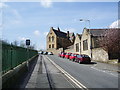
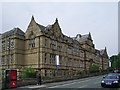
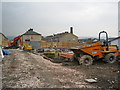
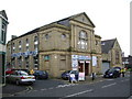
100 photos from this area
Area Information
Key information about the BB10 1LY including its size, population, and administrative classification.
- Area Type
- Postcode
- Area Size
- 2244 m²
- Population
- 1909
- Population Density
- 11236 people/km²
House Prices in BB10 1LY
24
Properties
£38,148
Average Sold Price
£5,250
Lowest Price
£90,000
Highest Price
Showing 24 properties
| Address | Type | Beds | Baths | Last Sale Price | Last Sale Date | |
|---|---|---|---|---|---|---|
| 15 Colville Street, Burnley, BB10 1LY | Terraced | 2 | 1 | £81,000 | Jul 2025 | |
| 17 Colville Street, Burnley, BB10 1LY | Terraced | 2 | 1 | £75,200 | Jul 2025 | |
| 30 Colville Street, Burnley, BB10 1LY | Terraced | 3 | 1 | £55,000 | Aug 2024 | |
| 20 Colville Street, Burnley, BB10 1LY | house | - | - | £52,500 | Oct 2022 | |
| 21 Colville Street, Burnley, BB10 1LY | house | - | - | £39,000 | May 2022 | |
| 24 Colville Street, Burnley, BB10 1LY | house | - | - | £35,000 | Apr 2020 | |
| 36 Colville Street, Burnley, BB10 1LY | Terraced | 2 | 1 | £46,000 | Nov 2018 | |
| 48 Colville Street, Burnley, BB10 1LY | house | - | - | £30,000 | Nov 2017 | |
| 28 Colville Street, Burnley, BB10 1LY | Unknown | - | - | £90,000 | Dec 2016 | |
| 22 Colville Street, Burnley, BB10 1LY | house | - | - | £30,000 | Dec 2015 |
Page 1 of 3
Energy Efficiency in BB10 1LY
Amenities
Schools
| Rank | School | Type | Entry gender | Ages |
|---|
Explore more schools in this area
Go to Schools tabDemographics
Household Size
Family (3-5 people)
most common
Accommodation Type
Houses
most common
Tenure
50
majority
Ethnic Group
asian_total
most common
Religion
N/A
most common
Household Composition
N/A
most common
Age
22
median
Adults (30-64 years)
most common
Household Deprivation
N/A
with no deprivation
NS-SEC
12
in Lower managerial occupations
Explore more demographic insights in this area
Go to Demographics tabPlanning
Planning Constraints
- Flood RiskPremium
- Ramsar Wetland SitesPremium
- Area of Outstanding Natural BeautyPremium
- Protected Nature ReservePremium
- Protected WoodlandPremium