Area Overview for BB1 9UB
Photos of BB1 9UB
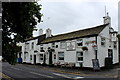
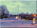
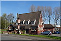
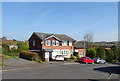
23 photos from this area
Area Information
Key information about the BB1 9UB including its size, population, and administrative classification.
- Area Type
- Postcode
- Area Size
- 1.2 hectares
- Population
- 1615
- Population Density
- 4346 people/km²
House Prices in BB1 9UB
32
Properties
£105,958
Average Sold Price
£44,500
Lowest Price
£175,000
Highest Price
Showing 32 properties
| Address | Type | Beds | Baths | Last Sale Price | Last Sale Date | |
|---|---|---|---|---|---|---|
| 75 Rosewood Avenue, Blackburn, BB1 9UB | Detached | 3 | 1 | £142,000 | Apr 2025 | |
| 53 Rosewood Avenue, Blackburn, BB1 9UB | house | - | - | £142,500 | Feb 2025 | |
| 77 Rosewood Avenue, Blackburn, BB1 9UB | Semi-detached | 3 | 1 | £160,000 | Jul 2024 | |
| 65 Rosewood Avenue, Blackburn, BB1 9UB | Semi-detached | 2 | 1 | £175,000 | Jun 2024 | |
| 67 Rosewood Avenue, Blackburn, BB1 9UB | Semi-detached | 3 | 2 | £125,000 | Jul 2022 | |
| 95 Rosewood Avenue, Blackburn, BB1 9UB | Bungalow | 3 | 1 | £95,000 | Oct 2021 | |
| 55 Rosewood Avenue, Blackburn, BB1 9UB | Semi-detached | 3 | - | £123,000 | Nov 2019 | |
| 101 Rosewood Avenue, Blackburn, BB1 9UB | Semi-detached | 3 | - | £116,000 | Jun 2018 | |
| 69 Rosewood Avenue, Blackburn, BB1 9UB | Semi-detached | 3 | - | £140,000 | Jul 2017 | |
| 89 Rosewood Avenue, Blackburn, BB1 9UB | Bungalow | 2 | 1 | £64,000 | Jul 2016 |
Page 1 of 4
Energy Efficiency in BB1 9UB
Amenities
Schools
| Rank | School | Type | Entry gender | Ages |
|---|
Explore more schools in this area
Go to Schools tabDemographics
Household Size
Family (3-5 people)
most common
Accommodation Type
Houses
most common
Tenure
74
majority
Ethnic Group
asian_total
most common
Religion
N/A
most common
Household Composition
N/A
most common
Age
47
median
Adults (30-64 years)
most common
Household Deprivation
N/A
with no deprivation
NS-SEC
31
in Lower managerial occupations
Explore more demographic insights in this area
Go to Demographics tabPlanning
Planning Constraints
- Flood RiskPremium
- Ramsar Wetland SitesPremium
- Area of Outstanding Natural BeautyPremium
- Protected Nature ReservePremium
- Protected WoodlandPremium