Area Overview for BB1 8DX
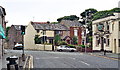
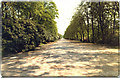
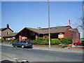
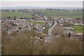
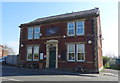
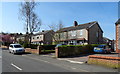
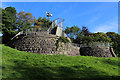
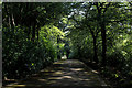
Photos of BB1 8DX
Area Information
Living in BB1 8DX means residing in a small, residential postcode area north of Blackburn town centre, with a population of 1,881. This area, part of the Roe Lee Ward, has a layered history rooted in the cotton industry, with former mills like Roe Lee Mills and Roe Lee New Mills shaping its industrial past. Today, it blends historical architecture with modern housing estates and green spaces such as Roe Lee Park, a 7-hectare urban park offering sports facilities, playgrounds, and open spaces. The area is compact, with most residents living within a short walk of local amenities, including retail outlets and rail stations. Its proximity to Blackburn—just 1.5 miles away—provides access to the town’s cultural and commercial hubs while retaining a distinct, community-focused character. The demographic profile suggests a settled population, with a median age of 47 and a strong presence of households aged 30–64. This makes BB1 8DX a place where families and long-term residents coexist, with a focus on stability and local connections.
- Area Type
- Postcode
- Area Size
- Not available
- Population
- 1881
- Population Density
- 3882 people/km²
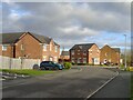
The property market in BB1 8DX is characterised by a high rate of home ownership—88%—and a predominance of houses rather than flats or apartments. This suggests a market skewed towards owner-occupied homes, with limited rental activity. The area’s compact size means the housing stock is concentrated, with properties likely to be family homes built during the mid-20th century or later. The lack of flats or high-density housing indicates a quieter, more suburban feel compared to urban centres. For buyers, this means a focus on individual properties rather than shared spaces, with potential for long-term value retention. However, the limited size of the postcode area may restrict the availability of new builds or developments, making it a niche market for those seeking established homes in a low-density setting. Proximity to Blackburn’s infrastructure could also make BB1 8DX an attractive option for commuters or those seeking a balance between suburban living and city access.
House Prices in BB1 8DX
No properties found in this postcode.
Energy Efficiency in BB1 8DX
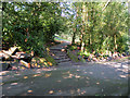
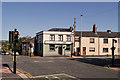
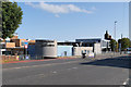
Residents of BB1 8DX have access to a range of local amenities, including retail outlets such as Spar, Tesco Blackburn, and M&S Blackburn, all within practical reach. These shops provide everyday convenience, from groceries to clothing, reducing the need for long trips to Blackburn. The area’s highlight is Roe Lee Park, a 7-hectare green space featuring tennis courts, bowling greens, and a children’s playground, offering recreational opportunities for all ages. The park’s Green Flag status underscores its quality as a public amenity. Historically, the area was shaped by cotton mills, though these are now demolished or repurposed. St Barnabas’ Church, though closed, remains a listed building, adding to the area’s architectural interest. The blend of retail, green space, and historical sites creates a lifestyle that balances practicality with a touch of heritage, appealing to those seeking a mix of convenience and community.
Amenities
Schools
The nearest school to BB1 8DX is St Mary’s College, a sixth-form institution. This suggests that the area does not host primary or secondary schools, meaning families with younger children would need to look beyond BB1 8DX for educational options. The absence of local schools may affect the appeal of the area for households prioritising proximity to education. However, the presence of a sixth-form college indicates that older students or those seeking post-16 education have access to facilities within the postcode. For families requiring primary or secondary schooling, nearby Blackburn or other parts of the Blackburn with Darwen borough would need to be considered. The lack of school data beyond St Mary’s College means the full educational landscape of the area remains unclear, though the existing institution serves a specific demographic.
| Rank | School | Type | Entry gender | Ages |
|---|
Explore more schools in this area
Go to Schools tabDemographics
The community in BB1 8DX is predominantly composed of adults aged 30–64, with a median age of 47. Home ownership is high, at 88%, indicating a strong presence of long-term residents and family homes. The accommodation type is primarily houses, which aligns with the area’s residential character. The predominant ethnic group is Asian, reflecting a cultural diversity that influences local traditions and community dynamics. There is no specific data on deprivation levels, but the high home ownership rate and stable age demographics suggest a relatively cohesive and economically resilient population. This profile implies a community with established roots, where residents are likely to have built careers and family networks over decades. The absence of significant youth or elderly populations may mean fewer schools or healthcare facilities tailored to those groups, though the area’s proximity to Blackburn mitigates this to some extent.
Household Size
Accommodation Type
Tenure
Ethnic Group
Religion
Household Composition
Age
Household Deprivation
NS-SEC
Explore more demographic insights in this area
Go to Demographics tabPlanning
Planning Constraints
- Flood RiskPremium
- Ramsar Wetland SitesPremium
- Area of Outstanding Natural BeautyPremium
- Protected Nature ReservePremium
- Protected WoodlandPremium