Area Overview for BB1 8BT
Photos of BB1 8BT
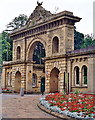
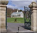
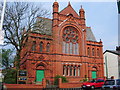
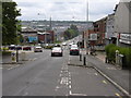
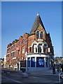
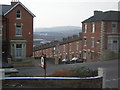
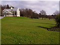
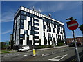
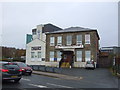
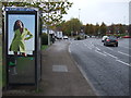
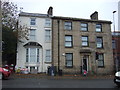
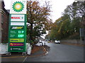
62 photos from this area
Area Information
Key information about the BB1 8BT including its size, population, and administrative classification.
- Area Type
- Postcode
- Area Size
- 7447 m²
- Population
- 1908
- Population Density
- 9775 people/km²
House Prices in BB1 8BT
53
Properties
£94,225
Average Sold Price
£20,000
Lowest Price
£175,000
Highest Price
Showing 53 properties
| Address | Type | Beds | Baths | Last Sale Price | Last Sale Date | |
|---|---|---|---|---|---|---|
| 2 Park Avenue, Blackburn, BB1 8BT | house | 5 | 2 | £90,000 | Mar 2022 | |
| 12 Park Avenue, Blackburn, BB1 8BT | house | - | - | £136,000 | Feb 2022 | |
| 11 Park Avenue, Blackburn, BB1 8BT | house | - | - | £157,000 | Dec 2021 | |
| 26 Park Avenue, Blackburn, BB1 8BT | house | - | - | £140,000 | Mar 2021 | |
| 19 Park Avenue, Blackburn, BB1 8BT | Terraced | 7 | - | £175,000 | Apr 2020 | |
| 10 Park Avenue, Blackburn, BB1 8BT | house | - | - | £90,000 | Mar 2020 | |
| 32 Park Avenue, Blackburn, BB1 8BT | Terraced | 4 | 2 | £155,000 | Sep 2018 | |
| 22 Park Avenue, Blackburn, BB1 8BT | Terraced | 4 | 2 | £138,000 | Jun 2017 | |
| 18 Park Avenue, Blackburn, BB1 8BT | Terraced | 4 | 2 | £150,000 | Sep 2016 | |
| 13 Park Avenue, Blackburn, BB1 8BT | house | - | - | £106,000 | May 2013 |
Page 1 of 6
Energy Efficiency in BB1 8BT
Amenities
Schools
| Rank | School | Type | Entry gender | Ages |
|---|
Explore more schools in this area
Go to Schools tabDemographics
Household Size
Family (3-5 people)
most common
Accommodation Type
Houses
most common
Tenure
64
majority
Ethnic Group
asian_total
most common
Religion
N/A
most common
Household Composition
N/A
most common
Age
47
median
Adults (30-64 years)
most common
Household Deprivation
N/A
with no deprivation
NS-SEC
20
in Lower managerial occupations
Explore more demographic insights in this area
Go to Demographics tabPlanning
Planning Constraints
- Flood RiskPremium
- Ramsar Wetland SitesPremium
- Area of Outstanding Natural BeautyPremium
- Protected Nature ReservePremium
- Protected WoodlandPremium