Area Overview for BB1 6EE
Photos of BB1 6EE

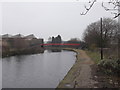
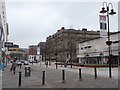
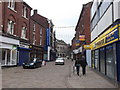
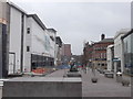
100 photos from this area
Area Information
Key information about the BB1 6EE including its size, population, and administrative classification.
- Area Type
- Postcode
- Area Size
- 4979 m²
- Population
- 2206
- Population Density
- 11342 people/km²
House Prices in BB1 6EE
26
Properties
£52,167
Average Sold Price
£15,000
Lowest Price
£100,000
Highest Price
Showing 26 properties
| Address | Type | Beds | Baths | Last Sale Price | Last Sale Date | |
|---|---|---|---|---|---|---|
| 137 Whalley Range, Blackburn, BB1 6EE | Terraced | 6 | 3 | £80,000 | Oct 2023 | |
| 147 Whalley Range, Blackburn, BB1 6EE | Terraced | 4 | 1 | £100,000 | May 2022 | |
| 151 Whalley Range, Blackburn, BB1 6EE | house | - | - | £40,000 | Sep 2013 | |
| 127 Whalley Range, Blackburn, BB1 6EE | Terraced | 2 | 1 | £60,000 | May 2005 | |
| 117 Whalley Range, Blackburn, BB1 6EE | house | - | - | £18,000 | Mar 2001 | |
| 149 Whalley Range, Blackburn, BB1 6EE | Terraced | - | - | £15,000 | Aug 2000 | |
| 123-125 Whalley Range, Blackburn, BB1 6EE | Terraced | 4 | - | - | - | |
| 125 Whalley Range, Blackburn, BB1 6EE | Terraced | - | - | - | - | |
| Flat At, 107-109 Whalley Range, Blackburn, BB1 6EE | Flat | - | - | - | - | |
| Imran Barbers, 107 Whalley Range, Blackburn, BB1 6EE | shop | - | - | - | - |
Page 1 of 3
Energy Efficiency in BB1 6EE
Amenities
Schools
| Rank | School | Type | Entry gender | Ages |
|---|
Explore more schools in this area
Go to Schools tabDemographics
Household Size
Family (3-5 people)
most common
Accommodation Type
Houses
most common
Tenure
68
majority
Ethnic Group
asian_total
most common
Religion
N/A
most common
Household Composition
N/A
most common
Age
47
median
Adults (30-64 years)
most common
Household Deprivation
N/A
with no deprivation
NS-SEC
13
in Lower managerial occupations
Explore more demographic insights in this area
Go to Demographics tabPlanning
Planning Constraints
- Flood RiskPremium
- Ramsar Wetland SitesPremium
- Area of Outstanding Natural BeautyPremium
- Protected Nature ReservePremium
- Protected WoodlandPremium