Area Overview for BB1 6AF
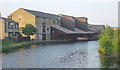
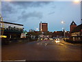
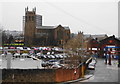
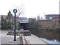
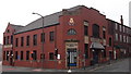
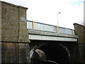
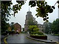
Photos of BB1 6AF

Area Information
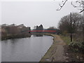
Living in BB1 6AF means residing within a very specific postcode area that covers a small residential cluster of just one hectare. This tightly defined location sits in the core of Blackburn, Lancashire, placing you within a population of 1,653 residents. You are centred around coordinates 53.749199, -2.482185, which places you near the town's historic heart. The ward includes distinct streets such as Alexandra Road, Corporation Park, and Linden Avenue, giving you immediate access to the administrative centre of the Blackburn with Darwen borough. Your daily life is shaped by location. Blackburn sits on the southern edge of the Ribble Valley, approximately 8 miles east of Preston and 21 miles north-northwest of Manchester. The M65 motorway passes to the south, with junctions 3 to 6 nearby, linking you directly to Preston and Colne. You can also travel via the A677 towards Preston or utilise the A6078 as a town centre orbital route. This connectivity ensures you are well positioned for commuting while remaining embedded in a compact community where residence is defined by specific streets rather than broad neighbourhoods.
- Area Type
- Postcode
- Area Size
- 1.0 hectares
- Population
- 1653
- Population Density
- 3299 people/km²
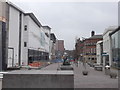
The property market in BB1 6AF is characterised by a specific housing stock and ownership dynamic. You are entering an area where houses dominate the accommodation type, providing the traditional family home structure common in this census ward. The data shows that 40% of residents are homeowners, indicating that a substantial minority of the 1,653 population have secured their own property within this one-hectare cluster. This suggests the area functions as a mix of owner-occupied and potential rental sectors. The predominance of houses over flats aligns with the preferences of the adult demographic, which skews towards the 30 to 64 years age range. Buyers looking at this small postcode area will find a market defined by residential integrity. The fact that specific streets like Bingham and Ar Bank Road fall under this area means you are acquiring a home with defined local boundaries. The market here lacks the density of a high-rise urban block, focusing instead on houses within Blackburn Central.
House Prices in BB1 6AF
No properties found in this postcode.
Energy Efficiency in BB1 6AF
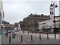
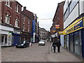
Daily life in BB1 6AF benefits from a cluster of amenities within practical reach of your home. You have five notable retail locations close by, including Morrisons Blackburn, M&S Blackburn, and Spar. These supermarkets and high street stores provide you with everything from groceries to fashion without the need for long journeys. The area serves the core needs of the 1,653 residents living within this hectare. Transport links further enhance your lifestyle, with five railway stations nearby including Blackburn and Mill Hill Railway Station. These stations connect you to the M65 motorway network, which passes to the south and links you to Preston and Colne. While specific leisure parks or dining venues outside the station areas are not detailed in the immediate data, the presence of major retailers and transport hubs creates a functional lifestyle. You can combine your commute, shopping, and travel in a highly concentrated area. This density means you can manage most daily tasks without venturing far beyond your immediate surroundings.
Amenities
Schools
Families considering homes in BB1 6AF have several educational options nearby, primarily focused on primary education. St Michael With St John CofE Primary School operates in the area as a state-funded institution with a good Ofsted rating. You also have access to St Alban's Roman Catholic Primary School Blackburn, which similarly holds a good Ofsted rating. These two schools provide a solid state education foundation for children within the ward. For those seeking private education, the Blackburn Raza Muslim Girls School is an independent option available to residents. The mix of state primary schools with good ratings and one independent school offers a varied educational pathway. While secondary school data is not included in the immediate vicinity, the presence of two well-rated primaries ensures early childhood education is accessible. The school types range from Church of England denominations to Roman Catholic and independent institutions, giving you choices that align with different faiths or educational philosophies.
| Rank | School | Type | Entry gender | Ages |
|---|
Explore more schools in this area
Go to Schools tabDemographics
The community in BB1 6AF is defined by its age profile and household structure. The median age stands at 47 years, with adults aged between 30 and 64 forming the most common age range. This demographic skew indicates an area populated largely by those in the maturity of their working lives and families requiring stability. You will find that 40% of residents own their homes, a significant portion of the population securing equity in this specific postcode area. The majority of accommodation consists of houses, offering the structural stability many in this age group prefer. The area also reflects a diverse cultural landscape, as the predominant ethnic group is Asian. These specific figures paint a picture of a settled community where long-term residents have established a home. While specific deprivation data is absent from the available statistics, the concentration of adults in the 30-64 bracket and the rate of home ownership suggest a neighbourhood focused on established living arrangements rather than transient population turnover.
Household Size
Accommodation Type
Tenure
Ethnic Group
Religion
Household Composition
Age
Household Deprivation
NS-SEC
Explore more demographic insights in this area
Go to Demographics tabPlanning
Planning Constraints
- Flood RiskPremium
- Ramsar Wetland SitesPremium
- Area of Outstanding Natural BeautyPremium
- Protected Nature ReservePremium
- Protected WoodlandPremium