Area Overview for BB1 5TN
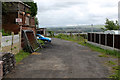
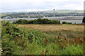
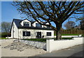
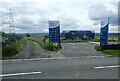
Photos of BB1 5TN
Area Information
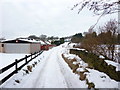
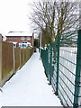
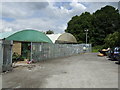
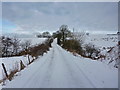
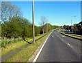
Living in BB1 5TN means being part of a small, tightly knit residential cluster in the heart of Blackburn with Darwen, Lancashire. With a population of 1,602 and a density of 954 people per square kilometre, this area blends compact living with proximity to historical and industrial landmarks. Situated approximately 2 miles northeast of Blackburn town centre, it sits within the Little Harwood & Whitebirk Ward, a district shaped by its 19th-century coal-mining past and Saxon-era roots. Daily life here is characterised by a mix of open land, industrial units, and mixed housing, with notable features like the Little Harwood Clock Tower, a war memorial from 1923. The area’s transport links are practical, with rail stations like Blackburn and Ramsgreave offering connections to major cities. For residents, the balance of local amenities, historical significance, and modern connectivity makes BB1 5TN a place where tradition meets convenience.
- Area Type
- Postcode
- Area Size
- Not available
- Population
- 1602
- Population Density
- 954 people/km²
The property market in BB1 5TN is dominated by owner-occupied homes, with 70% of residents owning their properties. This high home ownership rate indicates a stable, long-term community with limited rental demand. The area’s accommodation is primarily houses, which are more common than flats, suggesting a preference for standalone homes in a residential setting. Given the small size of the postcode and its integration with surrounding suburbs like Little Harwood and Whitebirk, buyers should consider the limited availability of properties and the potential for competition among local residents. The presence of industrial units and open land nearby may also influence property values, with homes potentially benefiting from proximity to both urban and semi-rural environments. For buyers, this area offers a mix of traditional housing stock and practical living conditions, though the small size of the postcode means opportunities are limited to a specific geographic cluster.
House Prices in BB1 5TN
No properties found in this postcode.
Energy Efficiency in BB1 5TN
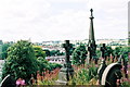
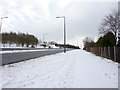
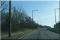
Residents of BB1 5TN have access to a range of local amenities within practical reach. Retail options include Aldi Shadsworth, Iceland Hyndburn, and Tesco Blackburn, providing everyday shopping convenience. The area’s rail network, with stations like Ramsgreave & Wilpshire and Blackburn, connects to broader regional services, enhancing accessibility for work, leisure, and travel. Historically, the area was shaped by industries like coal mining and tramway depots, but today, its character is defined by landmarks such as the Little Harwood Clock Tower and Blackburn Cemetery. The mix of open land, industrial units, and residential housing creates a varied landscape, while the presence of multiple places of worship reflects a diverse community. For daily life, the balance of local shops, transport links, and historical sites offers both practicality and a connection to the area’s past.
Amenities
Schools
| Rank | A + A* % | School | Type | Entry gender | Ages |
|---|
Explore more schools in this area
Go to Schools tabDemographics
The community in BB1 5TN is predominantly composed of adults aged 30–64, with a median age of 47. This suggests a mature, stable population, likely with established careers and families. Home ownership is high at 70%, indicating a strong presence of long-term residents. The area’s accommodation is largely houses, reflecting a preference for single-family dwellings over flats. The predominant ethnic group is White, though the presence of multiple mosques and churches hints at a multicultural character. The population density of 954 people per square kilometre means the area is neither overly crowded nor sparse, offering a sense of community without urban congestion. This demographic profile suggests a neighbourhood where local amenities and services are tailored to the needs of middle-aged residents, with a focus on stability and family-oriented living.
Household Size
Accommodation Type
Tenure
Ethnic Group
Religion
Household Composition
Age
Household Deprivation
NS-SEC
Explore more demographic insights in this area
Go to Demographics tabPlanning
Planning Constraints
- Flood RiskLocked
- Ramsar Wetland SitesLocked
- Area of Outstanding Natural BeautyLocked
- Protected Nature ReserveLocked
- Protected WoodlandLocked
- Crime RiskLocked