Area Overview for BB1 5TL
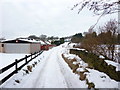
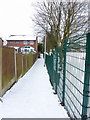
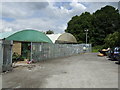
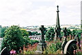
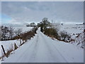
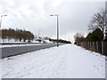
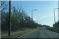
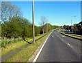
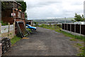
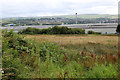
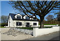
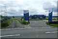
Photos of BB1 5TL
Area Information
BB1 5TL is a small residential cluster in Blackburn with Darwen, Lancashire, encompassing the suburbs of Little Harwood and Whitebirk. Situated approximately 2 miles northeast of Blackburn town centre, the area has a population of 1,602 people, with a density of 954 residents per square kilometre. This compact postcode reflects a blend of historical and modern elements: Little Harwood, once a moorland township, now features a mix of housing, industrial units, and open land, while Whitebirk’s Saxon roots are echoed in its name, meaning “white or silver birch trees.” The area’s character is shaped by its proximity to Blackburn’s urban core, with easy access to rail links and retail hubs. Daily life here is defined by a mature community, with a median age of 47 and a strong presence of adults aged 30–64. The area’s history of coal mining and tramway infrastructure has left a legacy of mixed-use development, offering a quiet alternative to the town’s busier districts. With 70% of homes owner-occupied, BB1 5TL is a stable, family-oriented postcode where residents benefit from both local amenities and connections to broader regional networks.
- Area Type
- Postcode
- Area Size
- Not available
- Population
- 1602
- Population Density
- 954 people/km²
The property market in BB1 5TL is dominated by owner-occupied homes, with 70% of properties in private hands. This high ownership rate suggests a community of long-term residents rather than a rental-heavy market. The accommodation type is primarily houses, which is unusual for urban areas and may indicate a preference for family homes or larger properties. As a small postcode area, the housing stock is limited, but its proximity to Blackburn offers buyers access to a broader range of properties in the surrounding suburbs. The mix of housing types, including industrial units and open land, reflects the area’s historical use as a blend of residential and light industrial zones. Buyers should consider the area’s compact nature, which may limit availability but also contribute to a sense of community. Those seeking a quieter, family-friendly environment with access to town amenities may find BB1 5TL appealing.
House Prices in BB1 5TL
No properties found in this postcode.
Energy Efficiency in BB1 5TL
Living in BB1 5TL offers access to a range of nearby amenities within practical reach. Retail options include Aldi Shadsworth, Iceland Hyndburn, and Tesco Blackburn, providing everyday shopping convenience. The area’s rail network, with stations like Blackburn and Rishton, connects residents to broader regional services and employment opportunities. Historically, the area was linked to the Leeds Liverpool Canal and early tramway systems, though modern life is shaped by its proximity to Blackburn’s urban amenities. The mix of housing, industrial units, and open land creates a varied landscape, with notable features like the Little Harwood Clock Tower, a war memorial with hourly chimes. While the data does not specify parks or leisure facilities, the area’s transport links and retail options suggest a lifestyle that balances local convenience with access to larger town amenities.
Amenities
Schools
| Rank | School | Type | Entry gender | Ages |
|---|
Explore more schools in this area
Go to Schools tabDemographics
The population of BB1 5TL is predominantly adults aged 30–64, with a median age of 47. This suggests a community with a strong working-age demographic, likely supporting local services and businesses. Home ownership is high, at 70%, indicating a stable residential base with long-term residents. The accommodation type is primarily houses, reflecting a more traditional housing stock compared to flats or apartments. The predominant ethnic group is White, which aligns with broader trends in the region. While specific data on diversity is not provided, the presence of multiple mosques and churches in the area suggests a multicultural character. The age profile and ownership rates imply a community focused on stability and family life, with fewer transient populations. The absence of detailed deprivation data means quality of life is inferred from the area’s amenities, transport links, and safety profile.
Household Size
Accommodation Type
Tenure
Ethnic Group
Religion
Household Composition
Age
Household Deprivation
NS-SEC
Explore more demographic insights in this area
Go to Demographics tabPlanning
Planning Constraints
- Flood RiskPremium
- Ramsar Wetland SitesPremium
- Area of Outstanding Natural BeautyPremium
- Protected Nature ReservePremium
- Protected WoodlandPremium